Property Record
611 E Douglas Rd, Mishawaka, IN 46545
NEARBY LISTINGS FOR SALE OR LEASE
Property Detail
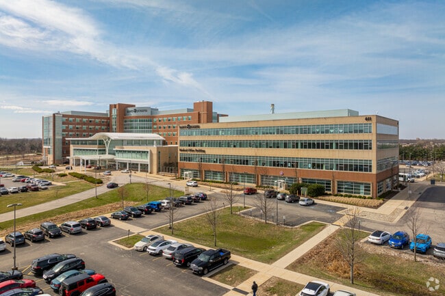
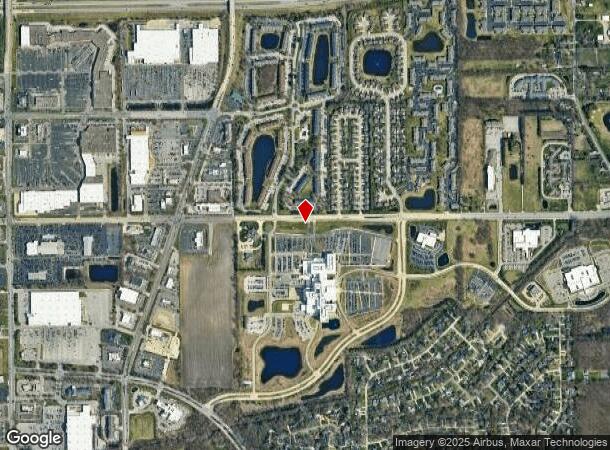
611 E Douglas Rd
71-04-34-101-006.000-022
St Joseph Medical Edison Lakes Sub
Medicalbuilding
BUILDING ON LEASED GROUND (BEING LOT 1 ST JOSEPH MEDICAL EDISON LAKES SUB) PER QC #1211 2-25-10
X
St Joseph
18141C0204D
Indiana
2023
1
2024
Mishawaka
011505
South Bend/Mishawaka
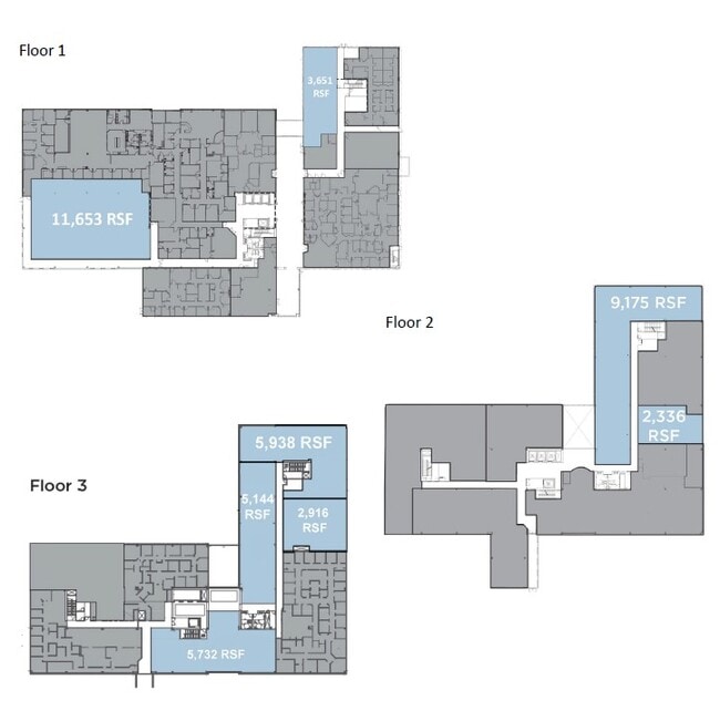
262,392 SF
South Bend-Mishawaka, IN-MI
DEMOGRAPHICS near 611 E Douglas Rd
1 Mile
3 Mile
5 Mile
2024 Total Population
5,703
60,100
153,475
2029 Population
5,661
59,838
153,272
Pop Growth 2024-2029
(0.74%)
(0.44%)
(0.13%)
Average Age
39
38
38
2024 Total Households
2,769
24,605
60,753
HH Growth 2024-2029
(0.61%)
(0.35%)
(0.08%)
Median Household Inc
$59,100
$58,764
$61,606
Avg Household Size
2.00
2.20
2.30
2024 Avg HH Vehicles
2.00
2.00
2.00
Median Home Value
$226,791
$180,219
$172,229
Median Year Built
1988
1975
1970
Nearby Places
Map Layers
Map Styles
 Street
 Aerial
- Restaurants
- Banks
- Shops
- Fitness
- Groceries
PUBLIC TRANSPORTATION
COMMUTER RAIL
South Bend Amtrak Station (Capitol Limited - Amtrak, Lake Shore Limited - Amtrak)
DRIVE
WALK
Distance
South Bend Amtrak Station (Capitol Limited - Amtrak, Lake Shore Limited - Amtrak)
17 min
7.1 mi
South Bend Airport Station (South Shore Line - Northern Indiana Commuter Transportation District (South Shore Line))
DRIVE
WALK
Distance
South Bend Airport Station (South Shore Line - Northern Indiana Commuter Transportation District (South Shore Line))
19 min
8.8 mi
AIRPORT
South Bend International
DRIVE
WALK
Distance
South Bend International
29 min
11.0 mi
Freight Ports
Port Milwaukee
DRIVE
WALK
Distance
Port Milwaukee
224 min
182.3 mi
SALE & LEASE HISTORY
LISTING DATE
SALE/LEASE

Sep 25, 2016
For Lease
Nearby Properties
Address
Land Use
TOTAL SIZE
Lot Size
Zoning
Address
Land Use
TOTAL SIZE
Lot Size
Zoning
560,184 SF
0.01 AC
Address
Land Use
TOTAL SIZE
Lot Size
Zoning
808,463 SF
30.51 AC
Address
Land Use
TOTAL SIZE
Lot Size
Zoning
966,201 SF
0.01 AC
Address
Land Use
TOTAL SIZE
Lot Size
Zoning
168,997 SF
9.62 AC
Address
Land Use
TOTAL SIZE
Lot Size
Zoning
529,154 SF
131 SF
Address
Land Use
TOTAL SIZE
Lot Size
Zoning
275,670 SF
44 SF
Address
Land Use
TOTAL SIZE
Lot Size
Zoning
599,502 SF
39.10 AC
Address
Land Use
TOTAL SIZE
Lot Size
Zoning
394,459 SF
44 SF
Address
Land Use
TOTAL SIZE
Lot Size
Zoning
66,297 SF
131 SF
Address
Land Use
TOTAL SIZE
Lot Size
Zoning
239,419 SF
44 SF
Address
Land Use
TOTAL SIZE
Lot Size
Zoning
770,407 SF
0.01 AC
Address
Land Use
TOTAL SIZE
Lot Size
Zoning
220,913 SF
29.14 AC
Address
Land Use
TOTAL SIZE
Lot Size
Zoning
18,028 SF
80.67 AC
Address
Land Use
TOTAL SIZE
Lot Size
Zoning
186,131 SF
87 SF
Address
Land Use
TOTAL SIZE
Lot Size
Zoning
799,664 SF
0.01 AC
Address
Land Use
TOTAL SIZE
Lot Size
Zoning
331,913 SF
30 AC
Address
Land Use
TOTAL SIZE
Lot Size
Zoning
327,618 SF
39.65 AC
Address
Land Use
TOTAL SIZE
Lot Size
Zoning
118,884 SF
44 SF
Address
Land Use
TOTAL SIZE
Lot Size
Zoning
138,405 SF
87 SF
Address
Land Use
TOTAL SIZE
Lot Size
Zoning
65,986 SF
174 SF
Address
Land Use
TOTAL SIZE
Lot Size
Zoning
107,258 SF
1.61 AC
Address
Land Use
TOTAL SIZE
Lot Size
Zoning
192,770 SF
12.21 AC
Address
Land Use
TOTAL SIZE
Lot Size
Zoning
124,260 SF
44 SF
Address
Land Use
TOTAL SIZE
Lot Size
Zoning
2,368,321 SF
32.52 AC
Address
Land Use
TOTAL SIZE
Lot Size
Zoning
151,852 SF
0.86 AC
Address
Land Use
TOTAL SIZE
Lot Size
Zoning
140,994 SF
13.58 AC
Address
Land Use
TOTAL SIZE
Lot Size
Zoning
360,056 SF
19.59 AC
Address
Land Use
TOTAL SIZE
Lot Size
Zoning
97,681 SF
44 SF
Address
Land Use
TOTAL SIZE
Lot Size
Zoning
92,030 SF
44 SF
The World's #1 Commercial Real Estate Marketplace
Connect with us
© 2026 CoStar Group
The information above has been obtained from sources believed reliable. While we do not doubt its accuracy we have not verified it and make no guarantee, warranty or representation about it. It is your responsibility to independently confirm its accuracy and completeness. Any projections, opinions, assumptions, or estimates used are for example only and do not represent the current or future performance of the property. The value of this transaction to you depends on tax and other factors which should be evaluated by your tax, financial, and legal advisors. You and your advisors should conduct a careful, independent investigation of the property to determine to your satisfaction the suitability of the property for your needs.