Property Record
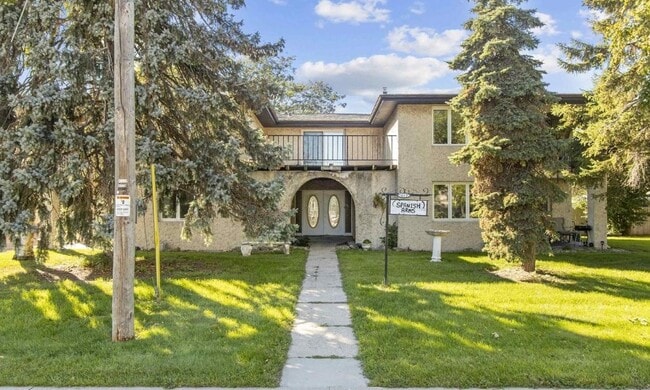
611 N Kensington Dr, Appleton, WI 54915


Property Detail
611 N Kensington Dr
31-4-5106-00
COLONY OAKS WEST LOT 3 LESS N38FT AND N50FT OF LOT 4 BLK 2
Commercialnec
OUTAGAMIE
R3
Wisconsin
B and X Area of moderate flood hazard, usually the area between the limits of the 100-year and 500-year floods.
3
2024
0.32 AC
2024
Colony Oaks
010601
Green Bay
7,923 SF
Appleton, WI
NEARBY LISTINGS FOR SALE OR LEASE
DEMOGRAPHICS near 611 N Kensington Dr
1 mile
3 mile
5 mile
2025 Total Population
6,482
84,019
164,261
2030 Population
6,628
85,963
167,840
Pop Growth 2025-2030
+ 2.25%
+ 2.31%
+ 2.18%
Average Age
41
40
40
2025 Total Households
2,762
34,470
67,151
HH Growth 2025-2030
+ 2.28%
+ 2.49%
+ 2.25%
Median Household Inc
$68,719
$76,238
$80,894
Avg Household Size
2.30
2.30
2.40
2025 Avg HH Vehicles
2.00
2.00
2.00
Median Home Value
$231,387
$241,147
$256,687
Median Year Built
1974
1974
1979
Nearby Places
Map Layers
Map Styles
 Street
 Aerial
Layers
 Traffic
 Biking
Places
Listings with unknown addresses are not visible on the map
- Restaurants
- Banks
- Shops
- Fitness
- Groceries
PUBLIC TRANSPORTATION
AIRPORT
Appleton International
Drive
Walk
Distance
Appleton International
19 min
9.6 mi
Green Bay/Austin Straubel International
Drive
Walk
Distance
Green Bay/Austin Straubel International
35 min
24.3 mi
SALE & LEASE HISTORY
LISTING DATE
SALE/LEASE

Oct 21, 2022
For Sale
Nearby Properties
Address
Land Use
TOTAL SIZE
Lot Size
Zoning
Address
Land Use
TOTAL SIZE
Lot Size
Zoning
154,889 SF
1 AC
C2
Address
Land Use
TOTAL SIZE
Lot Size
Zoning
211,780 SF
23.01 AC
PDR3
Address
Land Use
TOTAL SIZE
Lot Size
Zoning
33.54 AC
Address
Land Use
TOTAL SIZE
Lot Size
Zoning
3.42 AC
PDC2
Address
Land Use
TOTAL SIZE
Lot Size
Zoning
309,785 SF
20.13 AC
R3
Address
Land Use
TOTAL SIZE
Lot Size
Zoning
84,620 SF
92.18 AC
C2
Address
Land Use
TOTAL SIZE
Lot Size
Zoning
20.37 AC
PDC2
Address
Land Use
TOTAL SIZE
Lot Size
Zoning
31.46 AC
Address
Land Use
TOTAL SIZE
Lot Size
Zoning
249,600 SF
11.88 AC
M1
Address
Land Use
TOTAL SIZE
Lot Size
Zoning
100,105 SF
12.62 AC
C2
Address
Land Use
TOTAL SIZE
Lot Size
Zoning
70,136 SF
6.34 AC
C2
Address
Land Use
TOTAL SIZE
Lot Size
Zoning
17.51 AC
Address
Land Use
TOTAL SIZE
Lot Size
Zoning
65,818 SF
8.01 AC
C2
Address
Land Use
TOTAL SIZE
Lot Size
Zoning
16.63 AC
Address
Land Use
TOTAL SIZE
Lot Size
Zoning
6.59 AC
M1
Address
Land Use
TOTAL SIZE
Lot Size
Zoning
29,742 SF
5.95 AC
R3
Address
Land Use
TOTAL SIZE
Lot Size
Zoning
6.02 AC
Address
Land Use
TOTAL SIZE
Lot Size
Zoning
218,400 SF
12.39 AC
M1
Address
Land Use
TOTAL SIZE
Lot Size
Zoning
Address
Land Use
TOTAL SIZE
Lot Size
Zoning
247,520 SF
13.68 AC
M1
Address
Land Use
TOTAL SIZE
Lot Size
Zoning
37,430 SF
7.32 AC
M1
Address
Land Use
TOTAL SIZE
Lot Size
Zoning
12.49 AC
Address
Land Use
TOTAL SIZE
Lot Size
Zoning
Address
Land Use
TOTAL SIZE
Lot Size
Zoning
53,321 SF
2.51 AC
CBD
Address
Land Use
TOTAL SIZE
Lot Size
Zoning
200,880 SF
14.60 AC
M1
Address
Land Use
TOTAL SIZE
Lot Size
Zoning
209,059 SF
18.40 AC
PDC2
Address
Land Use
TOTAL SIZE
Lot Size
Zoning
44,164 SF
0.62 AC
CBD
Address
Land Use
TOTAL SIZE
Lot Size
Zoning
17.43 AC
M2
Address
Land Use
TOTAL SIZE
Lot Size
Zoning
40,560 SF
6.67 AC
R3
Address
Land Use
TOTAL SIZE
Lot Size
Zoning
107,202 SF
39.98 AC
C2
The World's #1 Commercial Real Estate Marketplace
Connect with us
© 2026 CoStar Group
The information above has been obtained from sources believed reliable. While we do not doubt its accuracy we have not verified it and make no guarantee, warranty or representation about it. It is your responsibility to independently confirm its accuracy and completeness. Any projections, opinions, assumptions, or estimates used are for example only and do not represent the current or future performance of the property. The value of this transaction to you depends on tax and other factors which should be evaluated by your tax, financial, and legal advisors. You and your advisors should conduct a careful, independent investigation of the property to determine to your satisfaction the suitability of the property for your needs.