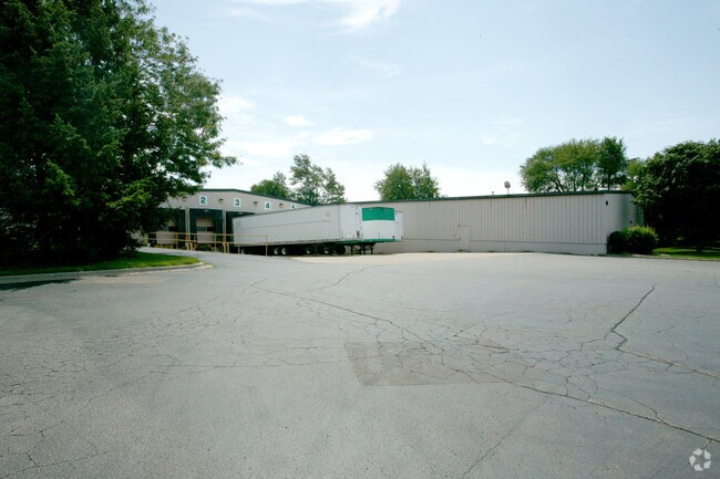
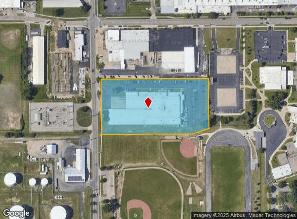
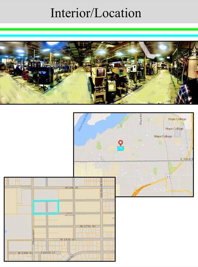
Property Record
611 Ottawa Ave, Holland, MI 49423

NEARBY LISTINGS FOR SALE OR LEASE
Property Detail
611 Ottawa Ave
70-16-31-401-008
S 1/2 OF NW 1/4 OF NW 1/4 OF SE 1/4 EXC W 33 FT FOR STREET ALSO EXC THAT PT OF VAC 26TH ST WHICH IS DESC AS COM 33023 FT S OF
Lightindustrial
Ottawa
X
Michigan
26005C0020G
4.72 AC
2025
Holland West
2025
West Michigan
025700
Grand Rapids-Wyoming, MI
72,618 SF
DEMOGRAPHICS near 611 Ottawa Ave
1 Mile
3 Mile
5 Mile
2024 Total Population
10,948
47,282
89,711
2029 Population
11,362
49,217
93,674
Pop Growth 2024-2029
+ 3.78%
+ 4.09%
+ 4.42%
Average Age
37
39
39
2024 Total Households
4,098
17,757
33,778
HH Growth 2024-2029
+ 3.76%
+ 4.21%
+ 4.57%
Median Household Inc
$65,996
$70,022
$73,478
Avg Household Size
2.60
2.50
2.50
2024 Avg HH Vehicles
2.00
2.00
2.00
Median Home Value
$194,456
$228,970
$245,201
Median Year Built
1951
1971
1982
Nearby Places
Map Layers
Map Styles
 Street
 Aerial
- Restaurants
- Banks
- Shops
- Fitness
- Groceries
PUBLIC TRANSPORTATION
COMMUTER RAIL
Holland Amtrak Station (Pere Marquette - Amtrak)
DRIVE
WALK
Distance
Holland Amtrak Station (Pere Marquette - Amtrak)
7 min
2.8 mi
Freight Ports
Port Milwaukee
DRIVE
WALK
Distance
Port Milwaukee
276 min
234.7 mi
SALE & LEASE HISTORY
LISTING DATE
SALE/LEASE

May 11, 2021
For Lease
Mar 11, 2021
For Lease
Aug 14, 2020
For Sale
Nearby Properties
Address
Land Use
TOTAL SIZE
Lot Size
Zoning
Address
Land Use
TOTAL SIZE
Lot Size
Zoning
572,832 SF
10.89 AC
PUD
Address
Land Use
TOTAL SIZE
Lot Size
Zoning
1,788,352 SF
173.33 AC
Address
Land Use
TOTAL SIZE
Lot Size
Zoning
682,378 SF
99.60 AC
NA
Address
Land Use
TOTAL SIZE
Lot Size
Zoning
198,712 SF
Address
Land Use
TOTAL SIZE
Lot Size
Zoning
556,819 SF
85.45 AC
Address
Land Use
TOTAL SIZE
Lot Size
Zoning
660,002 SF
32.13 AC
I-2
Address
Land Use
TOTAL SIZE
Lot Size
Zoning
329,784 SF
38.51 AC
I-2
Address
Land Use
TOTAL SIZE
Lot Size
Zoning
674,052 SF
79.30 AC
Address
Land Use
TOTAL SIZE
Lot Size
Zoning
154,107 SF
Address
Land Use
TOTAL SIZE
Lot Size
Zoning
239,465 SF
Address
Land Use
TOTAL SIZE
Lot Size
Zoning
589,649 SF
92.65 AC
Address
Land Use
TOTAL SIZE
Lot Size
Zoning
94,790 SF
1.74 AC
C-2
Address
Land Use
TOTAL SIZE
Lot Size
Zoning
58,710 SF
6.96 AC
C-2
Address
Land Use
TOTAL SIZE
Lot Size
Zoning
209,455 SF
17 AC
C-2
Address
Land Use
TOTAL SIZE
Lot Size
Zoning
177,800 SF
12.34 AC
I-2
Address
Land Use
TOTAL SIZE
Lot Size
Zoning
114,088 SF
10.79 AC
PRD
Address
Land Use
TOTAL SIZE
Lot Size
Zoning
134,490 SF
15.76 AC
C-2
Address
Land Use
TOTAL SIZE
Lot Size
Zoning
181,754 SF
13.44 AC
R3
Address
Land Use
TOTAL SIZE
Lot Size
Zoning
65.75 AC
PUD
Address
Land Use
TOTAL SIZE
Lot Size
Zoning
228,876 SF
49.31 AC
GMU
Address
Land Use
TOTAL SIZE
Lot Size
Zoning
372,017 SF
17.60 AC
R-2
Address
Land Use
TOTAL SIZE
Lot Size
Zoning
73,700 SF
Address
Land Use
TOTAL SIZE
Lot Size
Zoning
397,258 SF
36.66 AC
I2
Address
Land Use
TOTAL SIZE
Lot Size
Zoning
158,661 SF
17.28 AC
Address
Land Use
TOTAL SIZE
Lot Size
Zoning
122,026 SF
15.03 AC
R3
Address
Land Use
TOTAL SIZE
Lot Size
Zoning
146,357 SF
20.04 AC
Address
Land Use
TOTAL SIZE
Lot Size
Zoning
22,344 SF
8.16 AC
R-3
Address
Land Use
TOTAL SIZE
Lot Size
Zoning
73,663 SF
4.66 AC
Address
Land Use
TOTAL SIZE
Lot Size
Zoning
152,926 SF
8.83 AC
I-2
Address
Land Use
TOTAL SIZE
Lot Size
Zoning
386,644 SF
22.74 AC
I
The World's #1 Commercial Real Estate Marketplace
Connect with us
© 2026 CoStar Group
The information above has been obtained from sources believed reliable. While we do not doubt its accuracy we have not verified it and make no guarantee, warranty or representation about it. It is your responsibility to independently confirm its accuracy and completeness. Any projections, opinions, assumptions, or estimates used are for example only and do not represent the current or future performance of the property. The value of this transaction to you depends on tax and other factors which should be evaluated by your tax, financial, and legal advisors. You and your advisors should conduct a careful, independent investigation of the property to determine to your satisfaction the suitability of the property for your needs.