Property Record
611 S Tyler St, Covington, LA 70433
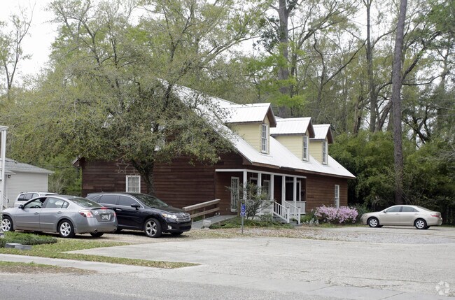


Property Detail
611 S Tyler St
Slidell-Mandeville-Covington, LA
PARCEL MEASURES 115 X 150 IN SQ 1507 DIVISION OF NEW COVINGTON CB 942 120 CB 1351 30 33
19876
Saint Tammany
Commercialnec
Louisiana
2025
1 AC
2025
Mandeville/Covington
040402
New Orleans/Metairie/Kenner
3,180 SF
NEARBY LISTINGS FOR SALE OR LEASE
DEMOGRAPHICS near 611 S Tyler St
1 mile
3 mile
5 mile
2025 Total Population
5,600
33,053
71,093
2030 Population
5,791
34,468
73,629
Pop Growth 2025-2030
+ 3.41%
+ 4.28%
+ 3.57%
Average Age
43
42
41
2025 Total Households
2,389
13,382
28,181
HH Growth 2025-2030
+ 3.47%
+ 4.30%
+ 3.60%
Median Household Inc
$73,628
$78,142
$80,607
Avg Household Size
2.30
2.40
2.50
2025 Avg HH Vehicles
2.00
2.00
2.00
Median Home Value
$371,253
$352,299
$330,996
Median Year Built
1983
2000
1998
Nearby Places
Map Layers
Map Styles
 Street
 Aerial
Layers
 Traffic
 Biking
Places
Listings with unknown addresses are not visible on the map
- Restaurants
- Banks
- Shops
- Fitness
- Groceries
PUBLIC TRANSPORTATION
AIRPORT
Louis Armstrong New Orleans International
Drive
Walk
Distance
Louis Armstrong New Orleans International
58 min
43.0 mi
Freight Ports
Port of New Orleans
Drive
Walk
Distance
Port of New Orleans
62 min
43.9 mi
Nearby Properties
Address
Land Use
TOTAL SIZE
Lot Size
Zoning
Address
Land Use
TOTAL SIZE
Lot Size
Zoning
515,547 SF
20.54 AC
Address
Land Use
TOTAL SIZE
Lot Size
Zoning
179,934 SF
20.43 AC
Address
Land Use
TOTAL SIZE
Lot Size
Zoning
200,000 SF
0.28 AC
Address
Land Use
TOTAL SIZE
Lot Size
Zoning
277,159 SF
55.34 AC
Address
Land Use
TOTAL SIZE
Lot Size
Zoning
Address
Land Use
TOTAL SIZE
Lot Size
Zoning
0.92 AC
Address
Land Use
TOTAL SIZE
Lot Size
Zoning
11.91 AC
Address
Land Use
TOTAL SIZE
Lot Size
Zoning
Address
Land Use
TOTAL SIZE
Lot Size
Zoning
246,559 SF
42.43 AC
Address
Land Use
TOTAL SIZE
Lot Size
Zoning
105,000 SF
9.37 AC
Address
Land Use
TOTAL SIZE
Lot Size
Zoning
96,067 SF
10.71 AC
Address
Land Use
TOTAL SIZE
Lot Size
Zoning
86,167 SF
0.71 AC
Address
Land Use
TOTAL SIZE
Lot Size
Zoning
99,157 SF
12 AC
Address
Land Use
TOTAL SIZE
Lot Size
Zoning
201,095 SF
Address
Land Use
TOTAL SIZE
Lot Size
Zoning
171,138 SF
13.02 AC
Address
Land Use
TOTAL SIZE
Lot Size
Zoning
66,500 SF
4.35 AC
Address
Land Use
TOTAL SIZE
Lot Size
Zoning
77,245 SF
5.58 AC
Address
Land Use
TOTAL SIZE
Lot Size
Zoning
77,994 SF
5.29 AC
Address
Land Use
TOTAL SIZE
Lot Size
Zoning
102,470 SF
10.50 AC
Address
Land Use
TOTAL SIZE
Lot Size
Zoning
205,612 SF
23.60 AC
Address
Land Use
TOTAL SIZE
Lot Size
Zoning
147,611 SF
22 AC
Address
Land Use
TOTAL SIZE
Lot Size
Zoning
38,976 SF
6.80 AC
Address
Land Use
TOTAL SIZE
Lot Size
Zoning
82,796 SF
19.47 AC
Address
Land Use
TOTAL SIZE
Lot Size
Zoning
92,535 SF
2.80 AC
Address
Land Use
TOTAL SIZE
Lot Size
Zoning
Address
Land Use
TOTAL SIZE
Lot Size
Zoning
62,800 SF
15 AC
Address
Land Use
TOTAL SIZE
Lot Size
Zoning
114,823 SF
4.57 AC
Address
Land Use
TOTAL SIZE
Lot Size
Zoning
124,002 SF
20.55 AC
Address
Land Use
TOTAL SIZE
Lot Size
Zoning
139,485 SF
16.60 AC
Address
Land Use
TOTAL SIZE
Lot Size
Zoning
130,535 SF
9.63 AC
The World's #1 Commercial Real Estate Marketplace
Connect with us
© 2026 CoStar Group
The information above has been obtained from sources believed reliable. While we do not doubt its accuracy we have not verified it and make no guarantee, warranty or representation about it. It is your responsibility to independently confirm its accuracy and completeness. Any projections, opinions, assumptions, or estimates used are for example only and do not represent the current or future performance of the property. The value of this transaction to you depends on tax and other factors which should be evaluated by your tax, financial, and legal advisors. You and your advisors should conduct a careful, independent investigation of the property to determine to your satisfaction the suitability of the property for your needs.