Property Record
611 W Grant Line Rd, Tracy, CA 95376
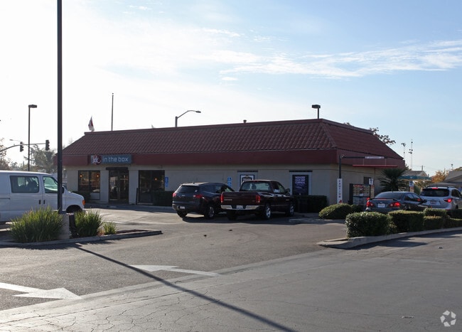


Property Detail
611 W Grant Line Rd
Stockton-Lodi, CA
MAP 14 PG 189
214-200-56
San Joaquin
Restaurantdrivein
California
B and X Area of moderate flood hazard, usually the area between the limits of the 100-year and 500-year floods.
a
2025
0.57 AC
2025
Tracy/Manteca
005312
Stockton/Modesto
2,304 SF
NEARBY LISTINGS FOR SALE OR LEASE
DEMOGRAPHICS near 611 W Grant Line Rd
1 mile
3 mile
5 mile
2025 Total Population
22,940
79,572
104,262
2030 Population
23,785
82,781
108,981
Pop Growth 2025-2030
+ 3.68%
+ 4.03%
+ 4.53%
Average Age
37
38
38
2025 Total Households
7,253
24,059
31,177
HH Growth 2025-2030
+ 3.85%
+ 4.11%
+ 4.58%
Median Household Inc
$92,143
$113,400
$120,341
Avg Household Size
3.10
3.20
3.30
2025 Avg HH Vehicles
2.00
3.00
3.00
Median Home Value
$613,873
$705,055
$732,216
Median Year Built
1976
1991
1994
Nearby Places
Map Layers
Map Styles
 Street
 Aerial
Layers
 Traffic
 Biking
Places
Listings with unknown addresses are not visible on the map
- Restaurants
- Banks
- Shops
- Fitness
- Groceries
PUBLIC TRANSPORTATION
COMMUTER RAIL
Drive
Walk
Distance
8 min
4.2 mi
AIRPORT
Stockton Metro
Drive
Walk
Distance
Stockton Metro
26 min
18.7 mi
Freight Ports
Port of Stockton
Drive
Walk
Distance
Port of Stockton
28 min
22.2 mi
Nearby Properties
Address
Land Use
TOTAL SIZE
Lot Size
Zoning
Address
Land Use
TOTAL SIZE
Lot Size
Zoning
3,485,402 SF
86.48 AC
Address
Land Use
TOTAL SIZE
Lot Size
Zoning
610,914 SF
28.11 AC
M1
Address
Land Use
TOTAL SIZE
Lot Size
Zoning
8.90 AC
Address
Land Use
TOTAL SIZE
Lot Size
Zoning
925,475 SF
42.09 AC
Address
Land Use
TOTAL SIZE
Lot Size
Zoning
1,601 SF
17.08 AC
PUD1
Address
Land Use
TOTAL SIZE
Lot Size
Zoning
657,600 SF
44.03 AC
Address
Land Use
TOTAL SIZE
Lot Size
Zoning
3.77 AC
Address
Land Use
TOTAL SIZE
Lot Size
Zoning
1,124,201 SF
53.72 AC
Address
Land Use
TOTAL SIZE
Lot Size
Zoning
795,732 SF
36.67 AC
IG
Address
Land Use
TOTAL SIZE
Lot Size
Zoning
749,840 SF
37.96 AC
Address
Land Use
TOTAL SIZE
Lot Size
Zoning
10.15 AC
PUD1
Address
Land Use
TOTAL SIZE
Lot Size
Zoning
24.07 AC
Address
Land Use
TOTAL SIZE
Lot Size
Zoning
567,870 SF
36.41 AC
M1
Address
Land Use
TOTAL SIZE
Lot Size
Zoning
461,810 SF
23.23 AC
PUD3
Address
Land Use
TOTAL SIZE
Lot Size
Zoning
827,280 SF
36.18 AC
Address
Land Use
TOTAL SIZE
Lot Size
Zoning
9,327 SF
12.06 AC
Address
Land Use
TOTAL SIZE
Lot Size
Zoning
381,600 SF
19.46 AC
Address
Land Use
TOTAL SIZE
Lot Size
Zoning
22,726 SF
8.96 AC
PUD1
Address
Land Use
TOTAL SIZE
Lot Size
Zoning
309,108 SF
19.39 AC
Address
Land Use
TOTAL SIZE
Lot Size
Zoning
442,350 SF
27.01 AC
CN
Address
Land Use
TOTAL SIZE
Lot Size
Zoning
575,167 SF
46.44 AC
Address
Land Use
TOTAL SIZE
Lot Size
Zoning
532,500 SF
25.15 AC
Address
Land Use
TOTAL SIZE
Lot Size
Zoning
265,868 SF
11.99 AC
Address
Land Use
TOTAL SIZE
Lot Size
Zoning
265,000 SF
10.83 AC
Address
Land Use
TOTAL SIZE
Lot Size
Zoning
49,264 SF
9 AC
Address
Land Use
TOTAL SIZE
Lot Size
Zoning
148,663 SF
16.37 AC
Address
Land Use
TOTAL SIZE
Lot Size
Zoning
225,000 SF
11.13 AC
M
The World's #1 Commercial Real Estate Marketplace
Connect with us
© 2026 CoStar Group
The information above has been obtained from sources believed reliable. While we do not doubt its accuracy we have not verified it and make no guarantee, warranty or representation about it. It is your responsibility to independently confirm its accuracy and completeness. Any projections, opinions, assumptions, or estimates used are for example only and do not represent the current or future performance of the property. The value of this transaction to you depends on tax and other factors which should be evaluated by your tax, financial, and legal advisors. You and your advisors should conduct a careful, independent investigation of the property to determine to your satisfaction the suitability of the property for your needs.