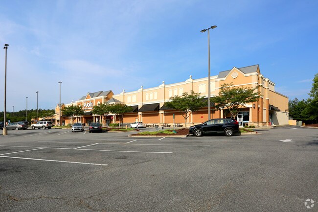
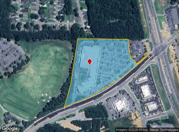
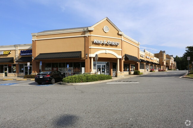
Property Record
6110 Cedarcrest Rd Nw, Acworth, GA 30101
NEARBY LISTINGS FOR SALE OR LEASE
Property Detail
6110 Cedarcrest Rd Nw
20-0040-0-029-0
20Th District 2Nd Section
Regionalshoppingcenterormallwithanchorstore
Cobb
X
Georgia
13223C0055D
1
2025
8.52 AC
2025
Kennesaw/NW Cobb
030109
Atlanta
69,376 SF
Atlanta-Sandy Springs-Roswell, GA
DEMOGRAPHICS near 6110 Cedarcrest Rd Nw
1 Mile
3 Mile
5 Mile
2024 Total Population
2,274
21,130
82,254
2029 Population
2,387
23,032
88,676
Pop Growth 2024-2029
+ 4.97%
+ 9.00%
+ 7.81%
Average Age
39
40
39
2024 Total Households
779
7,394
28,346
HH Growth 2024-2029
+ 4.75%
+ 8.52%
+ 7.45%
Median Household Inc
$101,326
$101,253
$96,842
Avg Household Size
2.90
2.80
2.90
2024 Avg HH Vehicles
2.00
2.00
2.00
Median Home Value
$356,410
$347,089
$319,281
Median Year Built
1996
1999
1999
Nearby Places
Map Layers
Map Styles
 Street
 Aerial
- Restaurants
- Banks
- Shops
- Fitness
- Groceries
SALE & LEASE HISTORY
LISTING DATE
SALE/LEASE

Sep 24, 2016
For Lease
Oct 17, 2024
For Lease
May 31, 2017
For Lease
Feb 14, 2023
For Lease
Nearby Properties
Address
Land Use
TOTAL SIZE
Lot Size
Zoning
Address
Land Use
TOTAL SIZE
Lot Size
Zoning
90.96 AC
Address
Land Use
TOTAL SIZE
Lot Size
Zoning
147,079 SF
16.90 AC
C2/R-7
Address
Land Use
TOTAL SIZE
Lot Size
Zoning
173,600 SF
42.94 AC
Address
Land Use
TOTAL SIZE
Lot Size
Zoning
11.60 AC
IN
Address
Land Use
TOTAL SIZE
Lot Size
Zoning
71,175 SF
30.37 AC
Address
Land Use
TOTAL SIZE
Lot Size
Zoning
192,215 SF
20.60 AC
C2
Address
Land Use
TOTAL SIZE
Lot Size
Zoning
172,170 SF
14.67 AC
C2/R-7
Address
Land Use
TOTAL SIZE
Lot Size
Zoning
1,186 SF
3.74 AC
Address
Land Use
TOTAL SIZE
Lot Size
Zoning
85,172 SF
21.79 AC
C2
Address
Land Use
TOTAL SIZE
Lot Size
Zoning
3.76 AC
IN
Address
Land Use
TOTAL SIZE
Lot Size
Zoning
109,347 SF
4.69 AC
C2
Address
Land Use
TOTAL SIZE
Lot Size
Zoning
8.61 AC
C-2
Address
Land Use
TOTAL SIZE
Lot Size
Zoning
47,728 SF
5.45 AC
GC/WS
Address
Land Use
TOTAL SIZE
Lot Size
Zoning
30,804 SF
2.29 AC
B2
Address
Land Use
TOTAL SIZE
Lot Size
Zoning
44,928 SF
5.06 AC
C2/R-7
Address
Land Use
TOTAL SIZE
Lot Size
Zoning
31.69 AC
Address
Land Use
TOTAL SIZE
Lot Size
Zoning
27,350 SF
4.93 AC
GC
Address
Land Use
TOTAL SIZE
Lot Size
Zoning
61,857 SF
15.38 AC
C2
Address
Land Use
TOTAL SIZE
Lot Size
Zoning
133,517 SF
9.65 AC
R4
Address
Land Use
TOTAL SIZE
Lot Size
Zoning
33,355 SF
4.30 AC
NRC
Address
Land Use
TOTAL SIZE
Lot Size
Zoning
70,010 SF
2.63 AC
C1
Address
Land Use
TOTAL SIZE
Lot Size
Zoning
Address
Land Use
TOTAL SIZE
Lot Size
Zoning
18,376 SF
5 AC
GC
Address
Land Use
TOTAL SIZE
Lot Size
Zoning
13,546 SF
1.49 AC
NB
Address
Land Use
TOTAL SIZE
Lot Size
Zoning
672 SF
52.57 AC
Address
Land Use
TOTAL SIZE
Lot Size
Zoning
2,968 SF
24.61 AC
A1
Address
Land Use
TOTAL SIZE
Lot Size
Zoning
15,061 SF
16.55 AC
GC
Address
Land Use
TOTAL SIZE
Lot Size
Zoning
11,544 SF
2.42 AC
C2
Address
Land Use
TOTAL SIZE
Lot Size
Zoning
14,490 SF
1.65 AC
GC/WS
The World's #1 Commercial Real Estate Marketplace
Connect with us
© 2025 CoStar Group
The information above has been obtained from sources believed reliable. While we do not doubt its accuracy we have not verified it and make no guarantee, warranty or representation about it. It is your responsibility to independently confirm its accuracy and completeness. Any projections, opinions, assumptions, or estimates used are for example only and do not represent the current or future performance of the property. The value of this transaction to you depends on tax and other factors which should be evaluated by your tax, financial, and legal advisors. You and your advisors should conduct a careful, independent investigation of the property to determine to your satisfaction the suitability of the property for your needs.