Property Record
6110 Firestone Blvd, Firestone, CO 80504
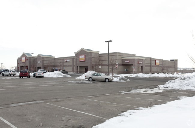


Property Detail
6110 Firestone Blvd
Greeley, CO
FIR HPM L8 HIGH PLAINS MARKETPLACE
R2718804
Weld
Commercialnec
Colorado
B and X Area of moderate flood hazard, usually the area between the limits of the 100-year and 500-year floods.
8
2024
7.62 AC
2025
Greeley
002020
Denver
92,749 SF
NEARBY LISTINGS FOR SALE OR LEASE
DEMOGRAPHICS near 6110 Firestone Blvd
1 mile
3 mile
5 mile
2025 Total Population
8,958
24,983
42,221
2030 Population
9,743
27,392
46,525
Pop Growth 2025-2030
+ 8.76%
+ 9.64%
+ 10.19%
Average Age
36
37
38
2025 Total Households
2,928
8,374
14,469
HH Growth 2025-2030
+ 9.08%
+ 10.01%
+ 10.55%
Median Household Inc
$126,673
$125,305
$119,590
Avg Household Size
3.00
3.00
2.90
2025 Avg HH Vehicles
3.00
2.00
2.00
Median Home Value
$603,872
$640,713
$630,329
Median Year Built
2006
2007
2006
Nearby Places
Map Layers
Map Styles
 Street
 Aerial
Layers
 Traffic
 Biking
Places
Listings with unknown addresses are not visible on the map
- Restaurants
- Banks
- Shops
- Fitness
- Groceries
PUBLIC TRANSPORTATION
AIRPORT
Denver International
Drive
Walk
Distance
Denver International
47 min
39.2 mi
SALE & LEASE HISTORY
LISTING DATE
SALE/LEASE

Jun 01, 2020
For Sale
Jan 18, 2022
For Lease
Aug 11, 2022
For Lease
Nearby Properties
Address
Land Use
TOTAL SIZE
Lot Size
Zoning
Address
Land Use
TOTAL SIZE
Lot Size
Zoning
537,643 SF
40.16 AC
Address
Land Use
TOTAL SIZE
Lot Size
Zoning
123,729 SF
27 AC
Address
Land Use
TOTAL SIZE
Lot Size
Zoning
227,793 SF
12.47 AC
Address
Land Use
TOTAL SIZE
Lot Size
Zoning
429,053 SF
19.92 AC
Address
Land Use
TOTAL SIZE
Lot Size
Zoning
189,849 SF
13.10 AC
Address
Land Use
TOTAL SIZE
Lot Size
Zoning
47,531 SF
5.99 AC
Address
Land Use
TOTAL SIZE
Lot Size
Zoning
129,681 SF
12.96 AC
Address
Land Use
TOTAL SIZE
Lot Size
Zoning
125,978 SF
118.07 AC
Address
Land Use
TOTAL SIZE
Lot Size
Zoning
107,268 SF
10.89 AC
Address
Land Use
TOTAL SIZE
Lot Size
Zoning
29,185 SF
6.67 AC
Address
Land Use
TOTAL SIZE
Lot Size
Zoning
42,765 SF
23.90 AC
Address
Land Use
TOTAL SIZE
Lot Size
Zoning
87,231 SF
5.55 AC
Address
Land Use
TOTAL SIZE
Lot Size
Zoning
48,515 SF
9.18 AC
Address
Land Use
TOTAL SIZE
Lot Size
Zoning
40,322 SF
5.07 AC
Address
Land Use
TOTAL SIZE
Lot Size
Zoning
105,027 SF
86.37 AC
Address
Land Use
TOTAL SIZE
Lot Size
Zoning
55,134 SF
4 AC
Address
Land Use
TOTAL SIZE
Lot Size
Zoning
4,799 SF
133.29 AC
Address
Land Use
TOTAL SIZE
Lot Size
Zoning
175,961 SF
7.41 AC
Address
Land Use
TOTAL SIZE
Lot Size
Zoning
47,438 SF
10 AC
Address
Land Use
TOTAL SIZE
Lot Size
Zoning
52,625 SF
3.73 AC
Address
Land Use
TOTAL SIZE
Lot Size
Zoning
83,796 SF
4.54 AC
Address
Land Use
TOTAL SIZE
Lot Size
Zoning
86,375 SF
6.24 AC
Address
Land Use
TOTAL SIZE
Lot Size
Zoning
35,448 SF
6.07 AC
Address
Land Use
TOTAL SIZE
Lot Size
Zoning
56,766 SF
5.94 AC
Address
Land Use
TOTAL SIZE
Lot Size
Zoning
57,488 SF
4.36 AC
Address
Land Use
TOTAL SIZE
Lot Size
Zoning
77,208 SF
11.10 AC
Address
Land Use
TOTAL SIZE
Lot Size
Zoning
33,726 SF
6.90 AC
Address
Land Use
TOTAL SIZE
Lot Size
Zoning
58,266 SF
3.99 AC
Address
Land Use
TOTAL SIZE
Lot Size
Zoning
147,598 SF
9.04 AC
The World's #1 Commercial Real Estate Marketplace
Connect with us
© 2026 CoStar Group
The information above has been obtained from sources believed reliable. While we do not doubt its accuracy we have not verified it and make no guarantee, warranty or representation about it. It is your responsibility to independently confirm its accuracy and completeness. Any projections, opinions, assumptions, or estimates used are for example only and do not represent the current or future performance of the property. The value of this transaction to you depends on tax and other factors which should be evaluated by your tax, financial, and legal advisors. You and your advisors should conduct a careful, independent investigation of the property to determine to your satisfaction the suitability of the property for your needs.