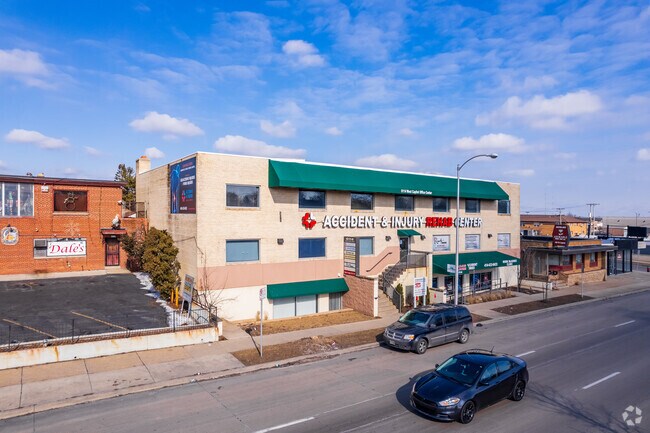
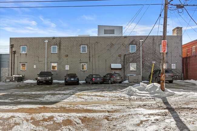
Property Record
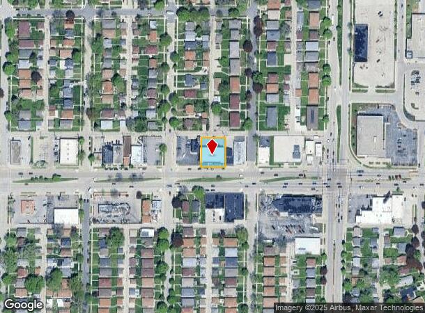
6114 W Capitol Dr, Milwaukee, WI 53216

NEARBY LISTINGS FOR SALE OR LEASE
Property Detail
6114 W Capitol Dr
Milwaukee-Waukesha-West Allis, WI
Capitol View No 2
250-0319-000-8
CAPITOL VIEW NO 2 IN SE 1/4 SEC 3-7-21 BLOCK 6 LOT 14 & LANDS 60 BY 120 ADJ ON E
Officebuilding
Milwaukee
X
Wisconsin
55079C0100E
14
2024
0.28 AC
2024
Milwaukee NW
003600
Milwaukee/Madison
17,226 SF
DEMOGRAPHICS near 6114 W Capitol Dr
1 Mile
3 Mile
5 Mile
2024 Total Population
20,923
197,567
397,506
2029 Population
20,512
194,686
391,899
Pop Growth 2024-2029
(1.96%)
(1.46%)
(1.41%)
Average Age
38
36
36
2024 Total Households
8,351
78,016
162,169
HH Growth 2024-2029
(2.06%)
(1.60%)
(1.49%)
Median Household Inc
$41,876
$45,320
$48,020
Avg Household Size
2.40
2.40
2.30
2024 Avg HH Vehicles
1.00
1.00
1.00
Median Home Value
$132,230
$150,229
$176,825
Median Year Built
1953
1950
1952
Nearby Places
Map Layers
Map Styles
 Street
 Aerial
- Restaurants
- Banks
- Shops
- Fitness
- Groceries
PUBLIC TRANSPORTATION
COMMUTER RAIL
DRIVE
WALK
Distance
15 min
7.2 mi
AIRPORT
General Mitchell International
DRIVE
WALK
Distance
General Mitchell International
27 min
13.9 mi
Freight Ports
Port Milwaukee
DRIVE
WALK
Distance
Port Milwaukee
19 min
9.7 mi
SALE & LEASE HISTORY
LISTING DATE
SALE/LEASE

Sep 05, 2022
For Lease
Mar 16, 2018
For Sale
Jun 27, 2024
For Lease
Jun 11, 2023
For Lease
Jan 13, 2017
For Lease
Feb 01, 2022
For Sale
Nearby Properties
Address
Land Use
TOTAL SIZE
Lot Size
Zoning
Address
Land Use
TOTAL SIZE
Lot Size
Zoning
0.71 AC
RM2
Address
Land Use
TOTAL SIZE
Lot Size
Zoning
8.03 AC
RM1
Address
Land Use
TOTAL SIZE
Lot Size
Zoning
0.71 AC
RM2
Address
Land Use
TOTAL SIZE
Lot Size
Zoning
1.76 AC
LB2
Address
Land Use
TOTAL SIZE
Lot Size
Zoning
0.36 AC
Address
Land Use
TOTAL SIZE
Lot Size
Zoning
12.49 AC
TL
Address
Land Use
TOTAL SIZE
Lot Size
Zoning
17.84 AC
TL
Address
Land Use
TOTAL SIZE
Lot Size
Zoning
169,550 SF
12.04 AC
RB2
Address
Land Use
TOTAL SIZE
Lot Size
Zoning
18.54 AC
RS6
Address
Land Use
TOTAL SIZE
Lot Size
Zoning
0.51 AC
RT2
Address
Land Use
TOTAL SIZE
Lot Size
Zoning
7.38 AC
TL
Address
Land Use
TOTAL SIZE
Lot Size
Zoning
6.66 AC
RT3
Address
Land Use
TOTAL SIZE
Lot Size
Zoning
28.12 AC
RM1
Address
Land Use
TOTAL SIZE
Lot Size
Zoning
11.45 AC
RS6
Address
Land Use
TOTAL SIZE
Lot Size
Zoning
163,539 SF
7.17 AC
PUD
Address
Land Use
TOTAL SIZE
Lot Size
Zoning
65,274 SF
3.91 AC
C2
Address
Land Use
TOTAL SIZE
Lot Size
Zoning
1.40 AC
RM1
Address
Land Use
TOTAL SIZE
Lot Size
Zoning
90,360 SF
6.52 AC
LB1
Address
Land Use
TOTAL SIZE
Lot Size
Zoning
63,201 SF
5.69 AC
PD
Address
Land Use
TOTAL SIZE
Lot Size
Zoning
Address
Land Use
TOTAL SIZE
Lot Size
Zoning
267,589 SF
7.65 AC
TL
Address
Land Use
TOTAL SIZE
Lot Size
Zoning
344,223 SF
26.39 AC
IL1
Address
Land Use
TOTAL SIZE
Lot Size
Zoning
64,440 SF
12.28 AC
CS
Address
Land Use
TOTAL SIZE
Lot Size
Zoning
265,000 SF
14.70 AC
RS5
Address
Land Use
TOTAL SIZE
Lot Size
Zoning
197,684 SF
10.67 AC
RM1
Address
Land Use
TOTAL SIZE
Lot Size
Zoning
44,000 SF
0.63 AC
CS
Address
Land Use
TOTAL SIZE
Lot Size
Zoning
42,489 SF
3.95 AC
IO2
Address
Land Use
TOTAL SIZE
Lot Size
Zoning
3.52 AC
RM5
Address
Land Use
TOTAL SIZE
Lot Size
Zoning
13.44 AC
CS
Address
Land Use
TOTAL SIZE
Lot Size
Zoning
9.50 AC
RS5
The World's #1 Commercial Real Estate Marketplace
Connect with us
© 2025 CoStar Group
The information above has been obtained from sources believed reliable. While we do not doubt its accuracy we have not verified it and make no guarantee, warranty or representation about it. It is your responsibility to independently confirm its accuracy and completeness. Any projections, opinions, assumptions, or estimates used are for example only and do not represent the current or future performance of the property. The value of this transaction to you depends on tax and other factors which should be evaluated by your tax, financial, and legal advisors. You and your advisors should conduct a careful, independent investigation of the property to determine to your satisfaction the suitability of the property for your needs.