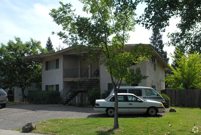
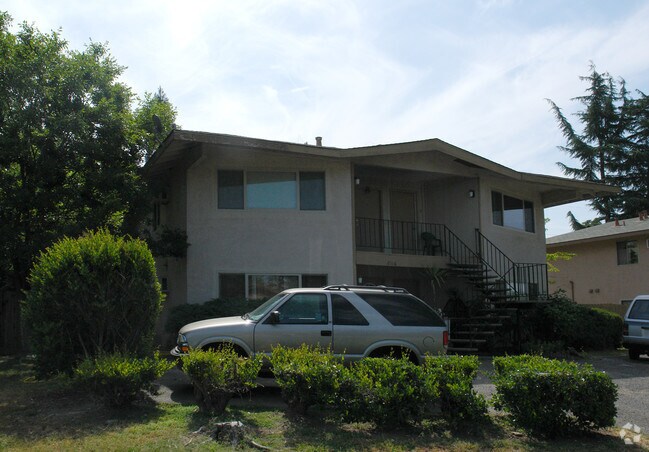
Property Record
6116 Terrell Dr, Citrus Heights, CA 95621
NEARBY LISTINGS FOR SALE OR LEASE
Property Detail
6116 Terrell Dr
Sacramento-Roseville-Folsom, CA
Cambridge Park 01
243-0292-005
CAMBRIDGE PARK 01, LOT 7
Quadruplex
Sacramento
X
California
06067C0091J
7
2024
0.19 AC
2025
Outer Carmichael/Citrus Heights
008119
Sacramento
3,480 SF
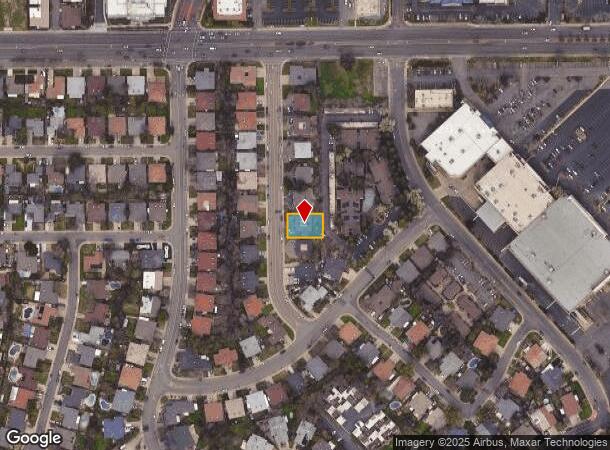
DEMOGRAPHICS near 6116 Terrell Dr
1 mile
3 mile
5 mile
2024 Total Population
20,231
161,163
385,424
2029 Population
20,325
161,913
388,952
Pop Growth 2024-2029
+ 0.46%
+ 0.47%
+ 0.92%
Average Age
41
41
40
2024 Total Households
8,424
63,561
144,849
HH Growth 2024-2029
+ 0.40%
+ 0.44%
+ 0.91%
Median Household Inc
$67,848
$76,797
$78,222
Avg Household Size
2.40
2.50
2.60
2024 Avg HH Vehicles
2.00
2.00
2.00
Median Home Value
$409,332
$434,833
$447,878
Median Year Built
1975
1974
1976
Nearby Places
Map Layers
Map Styles
 Street
 Aerial
Transit
 Traffic
 Biking
Places
Listings with unknown addresses are not visible on the map
- Restaurants
- Banks
- Shops
- Fitness
- Groceries
PUBLIC TRANSPORTATION
COMMUTER RAIL
Drive
Walk
Distance
14 min
6.1 mi
Drive
Walk
Distance
16 min
9.4 mi
AIRPORT
Sacramento International
Drive
Walk
Distance
Sacramento International
31 min
21.6 mi
Nearby Properties
Address
Land Use
TOTAL SIZE
Lot Size
Zoning
Address
Land Use
TOTAL SIZE
Lot Size
Zoning
17,642 SF
26.44 AC
RD30
Address
Land Use
TOTAL SIZE
Lot Size
Zoning
187,369 SF
15.24 AC
RD20
Address
Land Use
TOTAL SIZE
Lot Size
Zoning
251,225 SF
23.54 AC
SC
Address
Land Use
TOTAL SIZE
Lot Size
Zoning
180,595 SF
10.74 AC
RD-30
Address
Land Use
TOTAL SIZE
Lot Size
Zoning
130.97 AC
MH
Address
Land Use
TOTAL SIZE
Lot Size
Zoning
212,037 SF
17.20 AC
BP
Address
Land Use
TOTAL SIZE
Lot Size
Zoning
199,580 SF
10.29 AC
RD20
Address
Land Use
TOTAL SIZE
Lot Size
Zoning
145,334 SF
8.84 AC
RD-20
Address
Land Use
TOTAL SIZE
Lot Size
Zoning
78,730 SF
8.03 AC
RD20 BP
Address
Land Use
TOTAL SIZE
Lot Size
Zoning
128,480 SF
7.95 AC
RD30 BP
Address
Land Use
TOTAL SIZE
Lot Size
Zoning
58.14 AC
RD-2
Address
Land Use
TOTAL SIZE
Lot Size
Zoning
75,700 SF
4.02 AC
RD-40
Address
Land Use
TOTAL SIZE
Lot Size
Zoning
4.40 AC
RD20
Address
Land Use
TOTAL SIZE
Lot Size
Zoning
21,890 SF
0.50 AC
SC
Address
Land Use
TOTAL SIZE
Lot Size
Zoning
99,408 SF
3.53 AC
BP
Address
Land Use
TOTAL SIZE
Lot Size
Zoning
217,550 SF
21.31 AC
SPA
Address
Land Use
TOTAL SIZE
Lot Size
Zoning
4.90 AC
RD30
Address
Land Use
TOTAL SIZE
Lot Size
Zoning
12,548 SF
14.36 AC
RD-30
Address
Land Use
TOTAL SIZE
Lot Size
Zoning
4.02 AC
RD20
Address
Land Use
TOTAL SIZE
Lot Size
Zoning
156,365 SF
12.81 AC
SC
Address
Land Use
TOTAL SIZE
Lot Size
Zoning
84,387 SF
3.52 AC
LC
Address
Land Use
TOTAL SIZE
Lot Size
Zoning
166,268 SF
9.50 AC
RD30
Address
Land Use
TOTAL SIZE
Lot Size
Zoning
99,568 SF
10.92 AC
RD-5
Address
Land Use
TOTAL SIZE
Lot Size
Zoning
148,663 SF
13.19 AC
SPA
Address
Land Use
TOTAL SIZE
Lot Size
Zoning
98,508 SF
5.33 AC
RD20
Address
Land Use
TOTAL SIZE
Lot Size
Zoning
140,102 SF
3.30 AC
RD-20
Address
Land Use
TOTAL SIZE
Lot Size
Zoning
137,732 SF
12.87 AC
SC
Address
Land Use
TOTAL SIZE
Lot Size
Zoning
112,065 SF
8.52 AC
RD20
Address
Land Use
TOTAL SIZE
Lot Size
Zoning
0.16 AC
RD-5
Address
Land Use
TOTAL SIZE
Lot Size
Zoning
78,379 SF
4.91 AC
RD20
The World's #1 Commercial Real Estate Marketplace
Connect with us
© 2026 CoStar Group
The information above has been obtained from sources believed reliable. While we do not doubt its accuracy we have not verified it and make no guarantee, warranty or representation about it. It is your responsibility to independently confirm its accuracy and completeness. Any projections, opinions, assumptions, or estimates used are for example only and do not represent the current or future performance of the property. The value of this transaction to you depends on tax and other factors which should be evaluated by your tax, financial, and legal advisors. You and your advisors should conduct a careful, independent investigation of the property to determine to your satisfaction the suitability of the property for your needs.