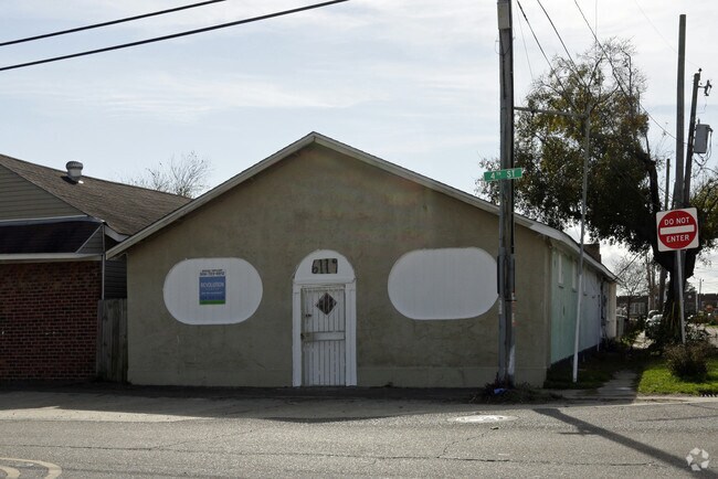
Property Record
6119 4Th St, Marrero, LA 70072


NEARBY LISTINGS FOR SALE OR LEASE
Property Detail
6119 4Th St
New Orleans-Metairie, LA
Pitre-Thalheim Sub
0420001290
LOT 3 BLK B 10032075 PITRE-THALHEIM 9955408
Realpropertynec
Jefferson
X
Louisiana
22051C0215F
3
2024
0.10 AC
2024
Outer Jefferson Parish
026800
New Orleans/Metairie/Kenner
DEMOGRAPHICS near 6119 4Th St
1 Mile
3 Mile
5 Mile
2024 Total Population
7,861
105,321
257,191
2029 Population
7,565
101,569
248,622
Pop Growth 2024-2029
(3.77%)
(3.56%)
(3.33%)
Average Age
42
41
40
2024 Total Households
3,226
44,119
108,483
HH Growth 2024-2029
(3.91%)
(3.76%)
(3.28%)
Median Household Inc
$37,816
$59,295
$53,173
Avg Household Size
2.30
2.20
2.20
2024 Avg HH Vehicles
2.00
1.00
1.00
Median Home Value
$133,288
$258,940
$236,220
Median Year Built
1965
1959
1963
Nearby Places
Map Layers
Map Styles
 Street
 Aerial
- Restaurants
- Banks
- Shops
- Fitness
- Groceries
PUBLIC TRANSPORTATION
COMMUTER RAIL
DRIVE
WALK
Distance
14 min
9.3 mi
AIRPORT
Louis Armstrong New Orleans International
DRIVE
WALK
Distance
Louis Armstrong New Orleans International
30 min
17.7 mi
Freight Ports
Plaquemines Port
DRIVE
WALK
Distance
Plaquemines Port
16 min
9.7 mi
Nearby Properties
Address
Land Use
TOTAL SIZE
Lot Size
Zoning
Address
Land Use
TOTAL SIZE
Lot Size
Zoning
80.92 AC
EC
Address
Land Use
TOTAL SIZE
Lot Size
Zoning
468,704 SF
7.58 AC
MC
Address
Land Use
TOTAL SIZE
Lot Size
Zoning
3.66 AC
MC
Address
Land Use
TOTAL SIZE
Lot Size
Zoning
197,182 SF
0.01 AC
OS-R
Address
Land Use
TOTAL SIZE
Lot Size
Zoning
Address
Land Use
TOTAL SIZE
Lot Size
Zoning
609,449 SF
2 AC
EC
Address
Land Use
TOTAL SIZE
Lot Size
Zoning
10.42 AC
Address
Land Use
TOTAL SIZE
Lot Size
Zoning
3.36 AC
EC
Address
Land Use
TOTAL SIZE
Lot Size
Zoning
4.12 AC
Address
Land Use
TOTAL SIZE
Lot Size
Zoning
315,570 SF
4.42 AC
HU-RM2
Address
Land Use
TOTAL SIZE
Lot Size
Zoning
11.29 AC
HU-RD1
Address
Land Use
TOTAL SIZE
Lot Size
Zoning
20.13 AC
EC
Address
Land Use
TOTAL SIZE
Lot Size
Zoning
151,320 SF
27.55 AC
Address
Land Use
TOTAL SIZE
Lot Size
Zoning
1.15 AC
Address
Land Use
TOTAL SIZE
Lot Size
Zoning
9.02 AC
HU-RD2
Address
Land Use
TOTAL SIZE
Lot Size
Zoning
7,468 SF
8.13 AC
HU-RD2
Address
Land Use
TOTAL SIZE
Lot Size
Zoning
1.27 AC
HU-RM1
Address
Land Use
TOTAL SIZE
Lot Size
Zoning
0.17 AC
Address
Land Use
TOTAL SIZE
Lot Size
Zoning
4.12 AC
HU-MU
Address
Land Use
TOTAL SIZE
Lot Size
Zoning
2.09 AC
HU-RD2
Address
Land Use
TOTAL SIZE
Lot Size
Zoning
3.46 AC
HU-RD2
Address
Land Use
TOTAL SIZE
Lot Size
Zoning
Address
Land Use
TOTAL SIZE
Lot Size
Zoning
298,450 SF
17.22 AC
MC
Address
Land Use
TOTAL SIZE
Lot Size
Zoning
3.55 AC
Address
Land Use
TOTAL SIZE
Lot Size
Zoning
12.79 AC
Address
Land Use
TOTAL SIZE
Lot Size
Zoning
14.69 AC
Address
Land Use
TOTAL SIZE
Lot Size
Zoning
0.12 AC
Address
Land Use
TOTAL SIZE
Lot Size
Zoning
0.14 AC
Address
Land Use
TOTAL SIZE
Lot Size
Zoning
5.06 AC
HU-RS
Address
Land Use
TOTAL SIZE
Lot Size
Zoning
96,477 SF
1.73 AC
HU-RD2
The World's #1 Commercial Real Estate Marketplace
Connect with us
© 2026 CoStar Group
The information above has been obtained from sources believed reliable. While we do not doubt its accuracy we have not verified it and make no guarantee, warranty or representation about it. It is your responsibility to independently confirm its accuracy and completeness. Any projections, opinions, assumptions, or estimates used are for example only and do not represent the current or future performance of the property. The value of this transaction to you depends on tax and other factors which should be evaluated by your tax, financial, and legal advisors. You and your advisors should conduct a careful, independent investigation of the property to determine to your satisfaction the suitability of the property for your needs.