Property Record
612 11Th Ave Nw, Rochester, MN 55901


NEARBY LISTINGS FOR SALE OR LEASE
Property Detail
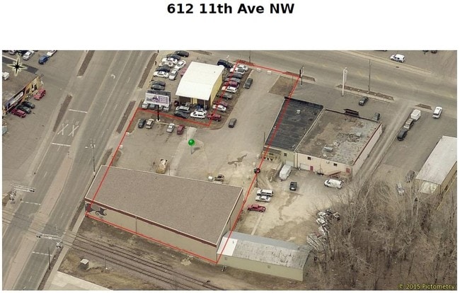
612 11Th Ave Nw
74.35.23.081981
Logans Run Condo Cic 360-Torrens
Industrialgeneral
SECT-35 TWP-107 RANGE-014 LOGANS RUN CONDO CIC 360-TORRENS LOGANS RUN CONDO UNIT 1 TOGETHER WITH AN UND 20.10% INT IN ALL COM
X
Olmsted
27109C0163F
Minnesota
2025
0.91 AC
2024
Rochester
000600
Other Market Areas
4,134 SF
Rochester, MN
DEMOGRAPHICS near 612 11Th Ave Nw
1 Mile
3 Mile
5 Mile
2024 Total Population
13,382
82,582
125,720
2029 Population
13,806
84,787
128,922
Pop Growth 2024-2029
+ 3.17%
+ 2.67%
+ 2.55%
Average Age
41
40
39
2024 Total Households
6,724
35,642
51,551
HH Growth 2024-2029
+ 3.32%
+ 2.72%
+ 2.56%
Median Household Inc
$61,819
$70,942
$81,896
Avg Household Size
1.90
2.20
2.30
2024 Avg HH Vehicles
1.00
2.00
2.00
Median Home Value
$251,053
$260,080
$277,625
Median Year Built
1970
1978
1986
Nearby Places
Map Layers
Map Styles
 Street
 Aerial
- Restaurants
- Banks
- Shops
- Fitness
- Groceries
PUBLIC TRANSPORTATION
AIRPORT
Rochester International
DRIVE
WALK
Distance
Rochester International
15 min
10.3 mi
Freight Ports
Port Milwaukee
DRIVE
WALK
Distance
Port Milwaukee
308 min
279.7 mi
SALE & LEASE HISTORY
LISTING DATE
SALE/LEASE

Feb 07, 2017
For Lease
Feb 07, 2017
For Sale
Dec 17, 2018
For Lease
Nearby Properties
Address
Land Use
TOTAL SIZE
Lot Size
Zoning
Address
Land Use
TOTAL SIZE
Lot Size
Zoning
Address
Land Use
TOTAL SIZE
Lot Size
Zoning
2,238,362 SF
2.06 AC
Address
Land Use
TOTAL SIZE
Lot Size
Zoning
1,232,028 SF
2.03 AC
Address
Land Use
TOTAL SIZE
Lot Size
Zoning
2.77 AC
Address
Land Use
TOTAL SIZE
Lot Size
Zoning
791,669 SF
2.15 AC
Address
Land Use
TOTAL SIZE
Lot Size
Zoning
37,242 SF
1.06 AC
Address
Land Use
TOTAL SIZE
Lot Size
Zoning
454,243 SF
3.92 AC
Address
Land Use
TOTAL SIZE
Lot Size
Zoning
443,223 SF
4.44 AC
Address
Land Use
TOTAL SIZE
Lot Size
Zoning
448,296 SF
1.21 AC
Address
Land Use
TOTAL SIZE
Lot Size
Zoning
4,612 SF
21.16 AC
Address
Land Use
TOTAL SIZE
Lot Size
Zoning
960 SF
38.12 AC
Address
Land Use
TOTAL SIZE
Lot Size
Zoning
45.84 AC
Address
Land Use
TOTAL SIZE
Lot Size
Zoning
1,836 SF
80.90 AC
Address
Land Use
TOTAL SIZE
Lot Size
Zoning
339,724 SF
0.56 AC
Address
Land Use
TOTAL SIZE
Lot Size
Zoning
7,202 SF
52.44 AC
Address
Land Use
TOTAL SIZE
Lot Size
Zoning
0.88 AC
Address
Land Use
TOTAL SIZE
Lot Size
Zoning
13,946 SF
34.10 AC
Address
Land Use
TOTAL SIZE
Lot Size
Zoning
576 SF
48.26 AC
Address
Land Use
TOTAL SIZE
Lot Size
Zoning
309,127 SF
0.67 AC
Address
Land Use
TOTAL SIZE
Lot Size
Zoning
175,078 SF
1.98 AC
Address
Land Use
TOTAL SIZE
Lot Size
Zoning
98,878 SF
0.89 AC
Address
Land Use
TOTAL SIZE
Lot Size
Zoning
180,031 SF
2.96 AC
Address
Land Use
TOTAL SIZE
Lot Size
Zoning
159,238 SF
0.65 AC
Address
Land Use
TOTAL SIZE
Lot Size
Zoning
423,328 SF
1.89 AC
Address
Land Use
TOTAL SIZE
Lot Size
Zoning
192,929 SF
1.12 AC
Address
Land Use
TOTAL SIZE
Lot Size
Zoning
Address
Land Use
TOTAL SIZE
Lot Size
Zoning
210,691 SF
34.19 AC
Address
Land Use
TOTAL SIZE
Lot Size
Zoning
61,632 SF
53.25 AC
Address
Land Use
TOTAL SIZE
Lot Size
Zoning
53.73 AC
Address
Land Use
TOTAL SIZE
Lot Size
Zoning
167.09 AC
The World's #1 Commercial Real Estate Marketplace
Connect with us
© 2025 CoStar Group
The information above has been obtained from sources believed reliable. While we do not doubt its accuracy we have not verified it and make no guarantee, warranty or representation about it. It is your responsibility to independently confirm its accuracy and completeness. Any projections, opinions, assumptions, or estimates used are for example only and do not represent the current or future performance of the property. The value of this transaction to you depends on tax and other factors which should be evaluated by your tax, financial, and legal advisors. You and your advisors should conduct a careful, independent investigation of the property to determine to your satisfaction the suitability of the property for your needs.