Property Record
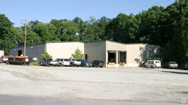
612 Hendrix St, High Point, NC 27260

Property Detail
612 Hendrix St
0182234
B PB78-30 3.73AC PL:78-30
Industrialgeneral
GUILFORD
LI
North Carolina
B and X Area of moderate flood hazard, usually the area between the limits of the 100-year and 500-year floods.
5
2024
3.73 AC
2025
High Point/SW Guilford Cty
013900
Greensboro/Winston-Salem
13,800 SF
Greensboro-High Point, NC
NEARBY LISTINGS FOR SALE OR LEASE
DEMOGRAPHICS near 612 Hendrix St
1 mile
3 mile
5 mile
2025 Total Population
7,092
49,711
120,835
2030 Population
7,353
51,682
124,943
Pop Growth 2025-2030
+ 3.68%
+ 3.96%
+ 3.40%
Average Age
39
38
40
2025 Total Households
2,729
17,901
47,628
HH Growth 2025-2030
+ 3.85%
+ 4.40%
+ 3.61%
Median Household Inc
$64,935
$47,946
$59,687
Avg Household Size
2.60
2.40
2.40
2025 Avg HH Vehicles
2.00
2.00
2.00
Median Home Value
$164,449
$174,133
$234,785
Median Year Built
1980
1975
1981
Nearby Places
Map Layers
Map Styles
 Street
 Aerial
Transit
 Traffic
 Biking
Places
Listings with unknown addresses are not visible on the map
- Restaurants
- Banks
- Shops
- Fitness
- Groceries
PUBLIC TRANSPORTATION
COMMUTER RAIL
High Point Station (Piedmont - North Carolina by Train (NC Train))
Drive
Walk
Distance
High Point Station (Piedmont - North Carolina by Train (NC Train))
9 min
4.0 mi
AIRPORT
Piedmont Triad International
Drive
Walk
Distance
Piedmont Triad International
27 min
16.0 mi
Nearby Properties
Address
Land Use
TOTAL SIZE
Lot Size
Zoning
Address
Land Use
TOTAL SIZE
Lot Size
Zoning
264,860 SF
62.75 AC
PI
Address
Land Use
TOTAL SIZE
Lot Size
Zoning
1,277,656 SF
2.47 AC
CB
Address
Land Use
TOTAL SIZE
Lot Size
Zoning
464,134 SF
11.28 AC
PI
Address
Land Use
TOTAL SIZE
Lot Size
Zoning
236,597 SF
13.83 AC
CU-PI
Address
Land Use
TOTAL SIZE
Lot Size
Zoning
484,289 SF
6.41 AC
CB
Address
Land Use
TOTAL SIZE
Lot Size
Zoning
419,281 SF
25.12 AC
CIV
Address
Land Use
TOTAL SIZE
Lot Size
Zoning
802,214 SF
0.01 AC
CB
Address
Land Use
TOTAL SIZE
Lot Size
Zoning
805,958 SF
61.42 AC
LI
Address
Land Use
TOTAL SIZE
Lot Size
Zoning
1,259,149 SF
46.12 AC
HB
Address
Land Use
TOTAL SIZE
Lot Size
Zoning
136,202 SF
30.02 AC
CZ-I
Address
Land Use
TOTAL SIZE
Lot Size
Zoning
457,534 SF
2.13 AC
CB
Address
Land Use
TOTAL SIZE
Lot Size
Zoning
30,322 SF
964.25 AC
PNR
Address
Land Use
TOTAL SIZE
Lot Size
Zoning
142,800 SF
1.04 AC
CB
Address
Land Use
TOTAL SIZE
Lot Size
Zoning
285,094 SF
3.23 AC
CB
Address
Land Use
TOTAL SIZE
Lot Size
Zoning
299,349 SF
21.76 AC
RM-16
Address
Land Use
TOTAL SIZE
Lot Size
Zoning
403,590 SF
72.06 AC
CIV
Address
Land Use
TOTAL SIZE
Lot Size
Zoning
185,320 SF
15.08 AC
PI
Address
Land Use
TOTAL SIZE
Lot Size
Zoning
90,060 SF
3.15 AC
CZ-I
Address
Land Use
TOTAL SIZE
Lot Size
Zoning
297,676 SF
0.48 AC
CB
Address
Land Use
TOTAL SIZE
Lot Size
Zoning
319,603 SF
1.34 AC
CB
Address
Land Use
TOTAL SIZE
Lot Size
Zoning
250,573 SF
48.53 AC
R-5
Address
Land Use
TOTAL SIZE
Lot Size
Zoning
369,312 SF
0.75 AC
CB
Address
Land Use
TOTAL SIZE
Lot Size
Zoning
324,986 SF
24.19 AC
LI
Address
Land Use
TOTAL SIZE
Lot Size
Zoning
473,040 SF
63.60 AC
AG
Address
Land Use
TOTAL SIZE
Lot Size
Zoning
181,106 SF
16.23 AC
RM-16
Address
Land Use
TOTAL SIZE
Lot Size
Zoning
174,529 SF
2.87 AC
CB
Address
Land Use
TOTAL SIZE
Lot Size
Zoning
81,450 SF
1.38 AC
CB
Address
Land Use
TOTAL SIZE
Lot Size
Zoning
233,398 SF
0.48 AC
CB
Address
Land Use
TOTAL SIZE
Lot Size
Zoning
200,288 SF
2.58 AC
CB
Address
Land Use
TOTAL SIZE
Lot Size
Zoning
286,940 SF
1.97 AC
CB
The World's #1 Commercial Real Estate Marketplace
Connect with us
© 2026 CoStar Group
The information above has been obtained from sources believed reliable. While we do not doubt its accuracy we have not verified it and make no guarantee, warranty or representation about it. It is your responsibility to independently confirm its accuracy and completeness. Any projections, opinions, assumptions, or estimates used are for example only and do not represent the current or future performance of the property. The value of this transaction to you depends on tax and other factors which should be evaluated by your tax, financial, and legal advisors. You and your advisors should conduct a careful, independent investigation of the property to determine to your satisfaction the suitability of the property for your needs.