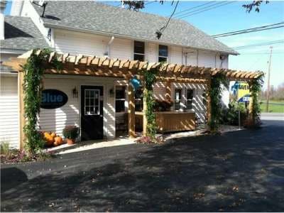
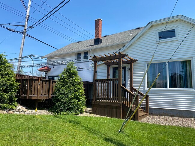
Property Record
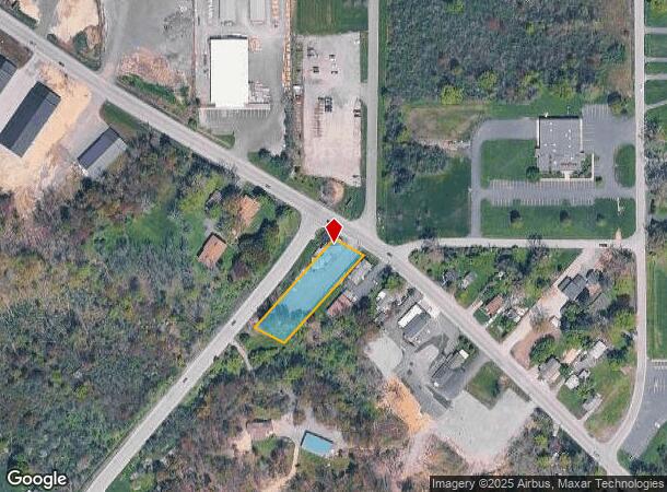
6120 Seneca St, Elma, NY 14059
NEARBY LISTINGS FOR SALE OR LEASE
-
-
View all Elma listings for lease on LoopNet.com
Property Detail
6120 Seneca St
144200-145-030-0002-003-000
Buffalo Creek Reservation
Restaurantbuilding
Erie
X
New York
36029C0358H
3.000
2025
1.04 AC
2024
Outlying Erie County
014102
Buffalo/Niagara Falls
3,198 SF
Buffalo-Cheektowaga-Niagara Falls, NY
DEMOGRAPHICS near 6120 Seneca St
1 Mile
3 Mile
5 Mile
2024 Total Population
1,274
19,812
95,524
2029 Population
1,265
19,753
95,297
Pop Growth 2024-2029
(0.71%)
(0.30%)
(0.24%)
Average Age
46
45
44
2024 Total Households
529
8,253
40,803
HH Growth 2024-2029
(0.95%)
(0.34%)
(0.27%)
Median Household Inc
$65,104
$82,827
$77,631
Avg Household Size
2.40
2.40
2.30
2024 Avg HH Vehicles
2.00
2.00
2.00
Median Home Value
$289,505
$262,633
$234,740
Median Year Built
1960
1974
1972
Nearby Places
- Restaurants
- Banks
- Shops
- Fitness
- Groceries
PUBLIC TRANSPORTATION
COMMUTER RAIL
DRIVE
WALK
Distance
15 min
7.7 mi
DRIVE
WALK
Distance
16 min
8.2 mi
AIRPORT
Buffalo Niagara International
DRIVE
WALK
Distance
Buffalo Niagara International
21 min
10.7 mi
Niagara Falls International
DRIVE
WALK
Distance
Niagara Falls International
46 min
29.7 mi
SALE & LEASE HISTORY
LISTING DATE
SALE/LEASE

Mar 16, 2021
For Lease
Jun 28, 2019
For Sale
Nearby Properties
Address
Land Use
TOTAL SIZE
Lot Size
Zoning
Address
Land Use
TOTAL SIZE
Lot Size
Zoning
13,152 SF
496 AC
08 - GOVER
Address
Land Use
TOTAL SIZE
Lot Size
Zoning
145,881 SF
29.40 AC
10
Address
Land Use
TOTAL SIZE
Lot Size
Zoning
161,077 SF
31 AC
10
Address
Land Use
TOTAL SIZE
Lot Size
Zoning
64,283 SF
18.67 AC
10
Address
Land Use
TOTAL SIZE
Lot Size
Zoning
9,952 SF
8.70 AC
10
Address
Land Use
TOTAL SIZE
Lot Size
Zoning
10,771 SF
13.10 AC
B2
Address
Land Use
TOTAL SIZE
Lot Size
Zoning
211,282 SF
20.43 AC
13
Address
Land Use
TOTAL SIZE
Lot Size
Zoning
27,340 SF
21.18 AC
B2
Address
Land Use
TOTAL SIZE
Lot Size
Zoning
89,576 SF
10.26 AC
11
Address
Land Use
TOTAL SIZE
Lot Size
Zoning
176,610 SF
7.90 AC
12
Address
Land Use
TOTAL SIZE
Lot Size
Zoning
159,069 SF
19.11 AC
13
Address
Land Use
TOTAL SIZE
Lot Size
Zoning
263,348 SF
12 AC
13
Address
Land Use
TOTAL SIZE
Lot Size
Zoning
136,200 SF
13.34 AC
13
Address
Land Use
TOTAL SIZE
Lot Size
Zoning
39,504 SF
4.13 AC
SR
Address
Land Use
TOTAL SIZE
Lot Size
Zoning
7,740 SF
6.70 AC
10
Address
Land Use
TOTAL SIZE
Lot Size
Zoning
4,511 SF
157.64 AC
R
Address
Land Use
TOTAL SIZE
Lot Size
Zoning
7,872 SF
4.20 AC
10
Address
Land Use
TOTAL SIZE
Lot Size
Zoning
12,478 SF
1.12 AC
Address
Land Use
TOTAL SIZE
Lot Size
Zoning
556 SF
2.17 AC
12
Address
Land Use
TOTAL SIZE
Lot Size
Zoning
263,348 SF
5.93 AC
13
Address
Land Use
TOTAL SIZE
Lot Size
Zoning
12,500 SF
4.20 AC
10
Address
Land Use
TOTAL SIZE
Lot Size
Zoning
3.70 AC
10
Address
Land Use
TOTAL SIZE
Lot Size
Zoning
65,388 SF
7.08 AC
SR
Address
Land Use
TOTAL SIZE
Lot Size
Zoning
7,558 SF
4.50 AC
11
Address
Land Use
TOTAL SIZE
Lot Size
Zoning
49,402 SF
3 AC
10
Address
Land Use
TOTAL SIZE
Lot Size
Zoning
26,237 SF
5.10 AC
10
Address
Land Use
TOTAL SIZE
Lot Size
Zoning
11,264 SF
2.10 AC
10
Address
Land Use
TOTAL SIZE
Lot Size
Zoning
8,264 SF
5.70 AC
10
Address
Land Use
TOTAL SIZE
Lot Size
Zoning
35,928 SF
5.50 AC
12
Address
Land Use
TOTAL SIZE
Lot Size
Zoning
15,000 SF
10.30 AC
10
The World's #1 Commercial Real Estate Marketplace
Connect with us
© 2025 CoStar Group
The information above has been obtained from sources believed reliable. While we do not doubt its accuracy we have not verified it and make no guarantee, warranty or representation about it. It is your responsibility to independently confirm its accuracy and completeness. Any projections, opinions, assumptions, or estimates used are for example only and do not represent the current or future performance of the property. The value of this transaction to you depends on tax and other factors which should be evaluated by your tax, financial, and legal advisors. You and your advisors should conduct a careful, independent investigation of the property to determine to your satisfaction the suitability of the property for your needs.