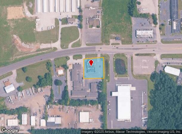
Property Record
6121 Us Highway 20, Portage, IN 46368

NEARBY LISTINGS FOR SALE OR LEASE
Property Detail
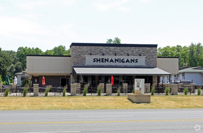
6121 Us Highway 20
64-05-01-302-004.000-016
N203 E190 S OF RD 20 NW SW 1-36-7 .87 AC
Restaurantbuilding
Porter
X
Indiana
18127C0106E
0.87 AC
2023
Porter County
2024
Chicago
050407
Chicago-Naperville-Elgin, IL-IN-WI
6,449 SF
DEMOGRAPHICS near 6121 Us Highway 20
1 Mile
3 Mile
5 Mile
2024 Total Population
3,405
36,390
75,562
2029 Population
3,492
37,312
77,038
Pop Growth 2024-2029
+ 2.56%
+ 2.53%
+ 1.95%
Average Age
41
40
40
2024 Total Households
1,358
14,068
29,895
HH Growth 2024-2029
+ 2.58%
+ 2.59%
+ 2.02%
Median Household Inc
$75,057
$72,212
$61,869
Avg Household Size
2.40
2.50
2.50
2024 Avg HH Vehicles
2.00
2.00
2.00
Median Home Value
$181,194
$203,463
$178,158
Median Year Built
1977
1975
1974
Nearby Places
Map Layers
Map Styles
 Street
 Aerial
- Restaurants
- Banks
- Shops
- Fitness
- Groceries
PUBLIC TRANSPORTATION
COMMUTER RAIL
Ogden Dunes (Portage) Station (South Shore Line - Northern Indiana Commuter Transportation District (South Shore Line))
DRIVE
WALK
Distance
Ogden Dunes (Portage) Station (South Shore Line - Northern Indiana Commuter Transportation District (South Shore Line))
5 min
2.5 mi
Miller (Gary) Station (South Shore Line - Northern Indiana Commuter Transportation District (South Shore Line))
DRIVE
WALK
Distance
Miller (Gary) Station (South Shore Line - Northern Indiana Commuter Transportation District (South Shore Line))
9 min
5.0 mi
Freight Ports
Port Milwaukee
DRIVE
WALK
Distance
Port Milwaukee
157 min
124.5 mi
SALE & LEASE HISTORY
LISTING DATE
SALE/LEASE

Sep 24, 2016
For Sale
Dec 01, 2016
For Sale
Nearby Properties
Address
Land Use
TOTAL SIZE
Lot Size
Zoning
Address
Land Use
TOTAL SIZE
Lot Size
Zoning
511,056 SF
131 SF
Address
Land Use
TOTAL SIZE
Lot Size
Zoning
2,305,884 SF
0.03 AC
Address
Land Use
TOTAL SIZE
Lot Size
Zoning
567,109 SF
131 SF
Address
Land Use
TOTAL SIZE
Lot Size
Zoning
400,440 SF
87 SF
Address
Land Use
TOTAL SIZE
Lot Size
Zoning
533,172 SF
Address
Land Use
TOTAL SIZE
Lot Size
Zoning
199,296 SF
87 SF
Address
Land Use
TOTAL SIZE
Lot Size
Zoning
140,434 SF
15.26 AC
Address
Land Use
TOTAL SIZE
Lot Size
Zoning
204,400 SF
Address
Land Use
TOTAL SIZE
Lot Size
Zoning
243,963 SF
Address
Land Use
TOTAL SIZE
Lot Size
Zoning
78,620 SF
87 SF
Address
Land Use
TOTAL SIZE
Lot Size
Zoning
233,491 SF
174 SF
Address
Land Use
TOTAL SIZE
Lot Size
Zoning
73,376 SF
44 SF
Address
Land Use
TOTAL SIZE
Lot Size
Zoning
116,310 SF
131 SF
Address
Land Use
TOTAL SIZE
Lot Size
Zoning
67,925 SF
2.97 AC
Address
Land Use
TOTAL SIZE
Lot Size
Zoning
124,160 SF
87 SF
Address
Land Use
TOTAL SIZE
Lot Size
Zoning
37,351 SF
13.74 AC
Address
Land Use
TOTAL SIZE
Lot Size
Zoning
70,454 SF
1.14 AC
Address
Land Use
TOTAL SIZE
Lot Size
Zoning
70,454 SF
1.20 AC
Address
Land Use
TOTAL SIZE
Lot Size
Zoning
147,024 SF
44 SF
Address
Land Use
TOTAL SIZE
Lot Size
Zoning
61,561 SF
3.71 AC
Address
Land Use
TOTAL SIZE
Lot Size
Zoning
216,590 SF
Address
Land Use
TOTAL SIZE
Lot Size
Zoning
247,594 SF
15.35 AC
Address
Land Use
TOTAL SIZE
Lot Size
Zoning
157,920 SF
44 SF
Address
Land Use
TOTAL SIZE
Lot Size
Zoning
164,640 SF
44 SF
Address
Land Use
TOTAL SIZE
Lot Size
Zoning
174,960 SF
Address
Land Use
TOTAL SIZE
Lot Size
Zoning
73,528 SF
44 SF
Address
Land Use
TOTAL SIZE
Lot Size
Zoning
122,175 SF
44 SF
Address
Land Use
TOTAL SIZE
Lot Size
Zoning
35,750 SF
44 SF
Address
Land Use
TOTAL SIZE
Lot Size
Zoning
230,260 SF
44 SF
Address
Land Use
TOTAL SIZE
Lot Size
Zoning
53,164 SF
44 SF
The World's #1 Commercial Real Estate Marketplace
Connect with us
© 2025 CoStar Group
The information above has been obtained from sources believed reliable. While we do not doubt its accuracy we have not verified it and make no guarantee, warranty or representation about it. It is your responsibility to independently confirm its accuracy and completeness. Any projections, opinions, assumptions, or estimates used are for example only and do not represent the current or future performance of the property. The value of this transaction to you depends on tax and other factors which should be evaluated by your tax, financial, and legal advisors. You and your advisors should conduct a careful, independent investigation of the property to determine to your satisfaction the suitability of the property for your needs.