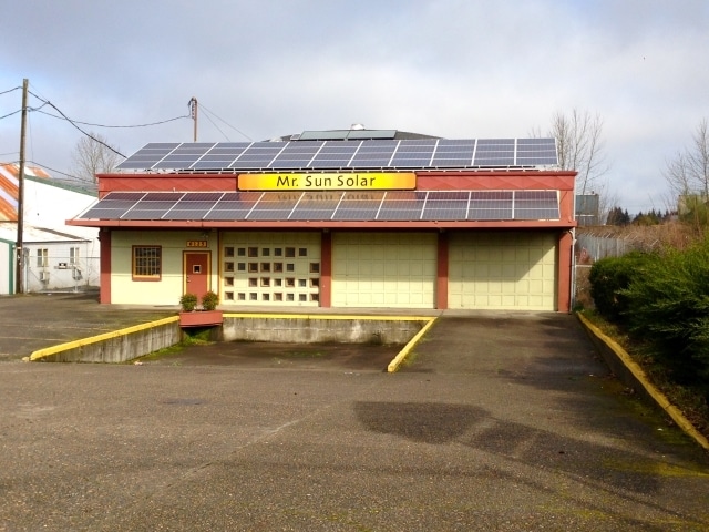
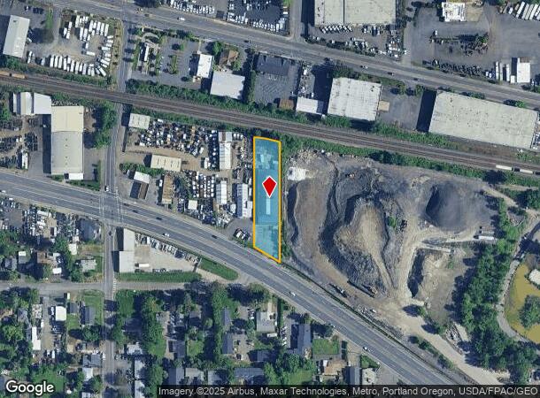
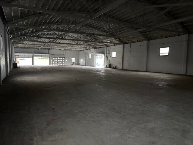
Property Record
6125 Ne Lombard St, Portland, OR 97218

Current Lease Availabilities
NEARBY LISTINGS FOR SALE OR LEASE
Property Detail
6125 Ne Lombard St
Portland-Vancouver-Hillsboro, OR-WA
Killingsworth Gardens
R197554
KILLINGSWORTH GARDENS, BLOCK 1, NLY OF HWY E 35 OF LOT 6, W 45.10 OF LOT 7 EXC PT IN HWY
Industrialgeneral
Multnomah
ARE
Oregon
53011C0525D
6,7
2025
0.66 AC
2025
Gateway
007400
Portland
10,080 SF
DEMOGRAPHICS near 6125 Ne Lombard St
1 Mile
3 Mile
5 Mile
2024 Total Population
10,876
98,985
363,745
2029 Population
10,617
96,283
362,775
Pop Growth 2024-2029
(2.38%)
(2.73%)
(0.27%)
Average Age
39
41
41
2024 Total Households
3,970
40,283
160,476
HH Growth 2024-2029
(2.77%)
(3.06%)
(0.40%)
Median Household Inc
$73,258
$94,262
$81,177
Avg Household Size
2.40
2.30
2.10
2024 Avg HH Vehicles
2.00
2.00
2.00
Median Home Value
$465,139
$609,381
$540,409
Median Year Built
1962
1948
1962
Nearby Places
- Restaurants
- Banks
- Shops
- Fitness
- Groceries
PUBLIC TRANSPORTATION
COMMUTER RAIL
DRIVE
WALK
Distance
15 min
8.1 mi
DRIVE
WALK
Distance
17 min
8.6 mi
AIRPORT
Portland International
DRIVE
WALK
Distance
Portland International
8 min
3.3 mi
Nearby Properties
Address
Land Use
TOTAL SIZE
Lot Size
Zoning
Address
Land Use
TOTAL SIZE
Lot Size
Zoning
1,405,000 SF
16.51 AC
IG2
Address
Land Use
TOTAL SIZE
Lot Size
Zoning
15,473 SF
192.67 AC
IG2
Address
Land Use
TOTAL SIZE
Lot Size
Zoning
273,811 SF
6.39 AC
NULL
Address
Land Use
TOTAL SIZE
Lot Size
Zoning
178,785 SF
10.20 AC
R5
Address
Land Use
TOTAL SIZE
Lot Size
Zoning
197,027 SF
28.54 AC
R7H
Address
Land Use
TOTAL SIZE
Lot Size
Zoning
817,845 SF
22.54 AC
IG2
Address
Land Use
TOTAL SIZE
Lot Size
Zoning
296,039 SF
11.70 AC
R5
Address
Land Use
TOTAL SIZE
Lot Size
Zoning
183,664 SF
8.96 AC
R5
Address
Land Use
TOTAL SIZE
Lot Size
Zoning
23.95 AC
IG2
Address
Land Use
TOTAL SIZE
Lot Size
Zoning
126.43 AC
IG2
Address
Land Use
TOTAL SIZE
Lot Size
Zoning
356,805 SF
27.10 AC
EG2
Address
Land Use
TOTAL SIZE
Lot Size
Zoning
126.40 AC
IG2
Address
Land Use
TOTAL SIZE
Lot Size
Zoning
105.72 AC
IG2
Address
Land Use
TOTAL SIZE
Lot Size
Zoning
107,958 SF
2.48 AC
IG2
Address
Land Use
TOTAL SIZE
Lot Size
Zoning
152,575 SF
5.32 AC
EG1
Address
Land Use
TOTAL SIZE
Lot Size
Zoning
133.11 AC
IG2
Address
Land Use
TOTAL SIZE
Lot Size
Zoning
64,673 SF
NULL
Address
Land Use
TOTAL SIZE
Lot Size
Zoning
1,256 SF
103.58 AC
IG2
Address
Land Use
TOTAL SIZE
Lot Size
Zoning
47.70 AC
IG2
Address
Land Use
TOTAL SIZE
Lot Size
Zoning
258,082 SF
2.80 AC
CS
Address
Land Use
TOTAL SIZE
Lot Size
Zoning
257,560 SF
NULL
Address
Land Use
TOTAL SIZE
Lot Size
Zoning
205,034 SF
0.38 AC
RM1
Address
Land Use
TOTAL SIZE
Lot Size
Zoning
184,000 SF
18.88 AC
EG2
Address
Land Use
TOTAL SIZE
Lot Size
Zoning
141,560 SF
8.12 AC
R5
Address
Land Use
TOTAL SIZE
Lot Size
Zoning
58,843 SF
4.53 AC
EG2
Address
Land Use
TOTAL SIZE
Lot Size
Zoning
361,241 SF
1.80 AC
CI2
Address
Land Use
TOTAL SIZE
Lot Size
Zoning
101,812 SF
3.14 AC
R5
Address
Land Use
TOTAL SIZE
Lot Size
Zoning
53.15 AC
IG2
Address
Land Use
TOTAL SIZE
Lot Size
Zoning
185,799 SF
15.44 AC
CG
Address
Land Use
TOTAL SIZE
Lot Size
Zoning
67.55 AC
IG2
The World's #1 Commercial Real Estate Marketplace
Connect with us
© 2025 CoStar Group
The information above has been obtained from sources believed reliable. While we do not doubt its accuracy we have not verified it and make no guarantee, warranty or representation about it. It is your responsibility to independently confirm its accuracy and completeness. Any projections, opinions, assumptions, or estimates used are for example only and do not represent the current or future performance of the property. The value of this transaction to you depends on tax and other factors which should be evaluated by your tax, financial, and legal advisors. You and your advisors should conduct a careful, independent investigation of the property to determine to your satisfaction the suitability of the property for your needs.