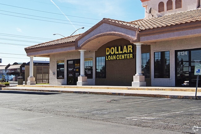
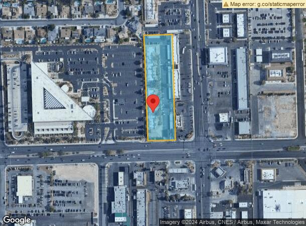
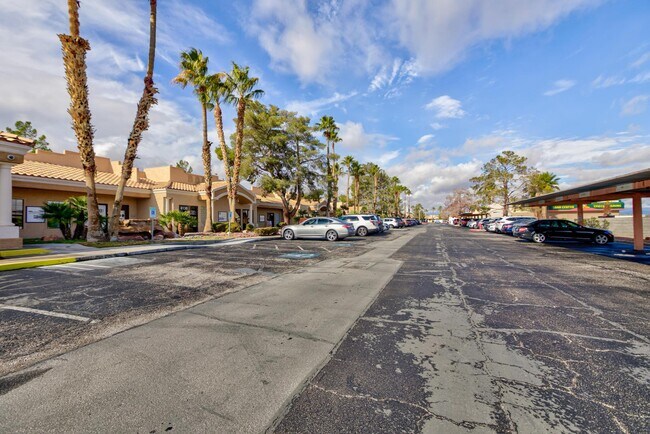
Property Record
6154 W Sahara Ave, Las Vegas, NV 89146
Current Lease Availabilities
NEARBY LISTINGS FOR SALE OR LEASE
Property Detail
6154 W Sahara Ave
163-02-802-004
PT SE4 SE4 SEC 02 21 60
Commercialnec
Clark
X
Nevada
32003C2165D
2.63 AC
2025
West Las Vegas
2025
Las Vegas
002905
Las Vegas-Henderson-Paradise, NV
35,005 SF
DEMOGRAPHICS near 6154 W Sahara Ave
1 Mile
3 Mile
5 Mile
2024 Total Population
9,859
194,157
471,702
2029 Population
10,560
208,400
507,514
Pop Growth 2024-2029
+ 7.11%
+ 7.34%
+ 7.59%
Average Age
42
40
40
2024 Total Households
3,701
74,933
190,417
HH Growth 2024-2029
+ 7.08%
+ 7.31%
+ 7.63%
Median Household Inc
$53,000
$45,929
$49,978
Avg Household Size
2.50
2.50
2.40
2024 Avg HH Vehicles
2.00
2.00
2.00
Median Home Value
$430,570
$289,333
$332,969
Median Year Built
1982
1983
1989
Nearby Places
- Restaurants
- Banks
- Shops
- Fitness
- Groceries
PUBLIC TRANSPORTATION
AIRPORT
Harry Reid International
DRIVE
WALK
Distance
Harry Reid International
17 min
8.9 mi
Boulder City Municipal
DRIVE
WALK
Distance
Boulder City Municipal
42 min
29.5 mi
Freight Ports
Port of Long Beach
DRIVE
WALK
Distance
Port of Long Beach
319 min
284.0 mi
Nearby Properties
Address
Land Use
TOTAL SIZE
Lot Size
Zoning
Address
Land Use
TOTAL SIZE
Lot Size
Zoning
754,711 SF
24.79 AC
H1
Address
Land Use
TOTAL SIZE
Lot Size
Zoning
1,345,377 SF
88.53 AC
H1
Address
Land Use
TOTAL SIZE
Lot Size
Zoning
115,059 SF
30.12 AC
Address
Land Use
TOTAL SIZE
Lot Size
Zoning
80.45 AC
CV
Address
Land Use
TOTAL SIZE
Lot Size
Zoning
109,306 SF
25.79 AC
H1
Address
Land Use
TOTAL SIZE
Lot Size
Zoning
40 AC
PF
Address
Land Use
TOTAL SIZE
Lot Size
Zoning
Address
Land Use
TOTAL SIZE
Lot Size
Zoning
6,310 SF
3.68 AC
Address
Land Use
TOTAL SIZE
Lot Size
Zoning
22,018 SF
6.91 AC
Address
Land Use
TOTAL SIZE
Lot Size
Zoning
8,523 SF
6.06 AC
Address
Land Use
TOTAL SIZE
Lot Size
Zoning
12.23 AC
PF
Address
Land Use
TOTAL SIZE
Lot Size
Zoning
28,956 SF
75.82 AC
CV
Address
Land Use
TOTAL SIZE
Lot Size
Zoning
4,872 SF
18.22 AC
R3
Address
Land Use
TOTAL SIZE
Lot Size
Zoning
8,261 SF
9.36 AC
Address
Land Use
TOTAL SIZE
Lot Size
Zoning
271,484 SF
7.04 AC
C2
Address
Land Use
TOTAL SIZE
Lot Size
Zoning
322,005 SF
29.37 AC
C1
Address
Land Use
TOTAL SIZE
Lot Size
Zoning
6,558 SF
23.36 AC
R3
Address
Land Use
TOTAL SIZE
Lot Size
Zoning
52,058 SF
6.44 AC
C1
Address
Land Use
TOTAL SIZE
Lot Size
Zoning
66.57 AC
CV
Address
Land Use
TOTAL SIZE
Lot Size
Zoning
12,212 SF
8.29 AC
C1
Address
Land Use
TOTAL SIZE
Lot Size
Zoning
285,929 SF
5.06 AC
C1
Address
Land Use
TOTAL SIZE
Lot Size
Zoning
4,729 SF
19.05 AC
R4
Address
Land Use
TOTAL SIZE
Lot Size
Zoning
6,280 SF
8.72 AC
RPD18
Address
Land Use
TOTAL SIZE
Lot Size
Zoning
5,818 SF
14.55 AC
R4
Address
Land Use
TOTAL SIZE
Lot Size
Zoning
2,650 SF
1.05 AC
Address
Land Use
TOTAL SIZE
Lot Size
Zoning
6,037 SF
15.12 AC
R3
Address
Land Use
TOTAL SIZE
Lot Size
Zoning
4,721 SF
18.14 AC
R4
Address
Land Use
TOTAL SIZE
Lot Size
Zoning
The World's #1 Commercial Real Estate Marketplace
Connect with us
© 2025 CoStar Group
The information above has been obtained from sources believed reliable. While we do not doubt its accuracy we have not verified it and make no guarantee, warranty or representation about it. It is your responsibility to independently confirm its accuracy and completeness. Any projections, opinions, assumptions, or estimates used are for example only and do not represent the current or future performance of the property. The value of this transaction to you depends on tax and other factors which should be evaluated by your tax, financial, and legal advisors. You and your advisors should conduct a careful, independent investigation of the property to determine to your satisfaction the suitability of the property for your needs.