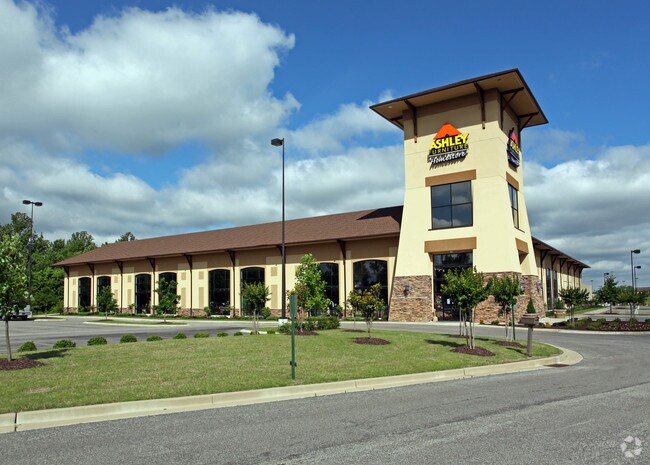
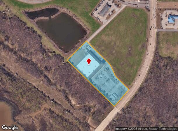
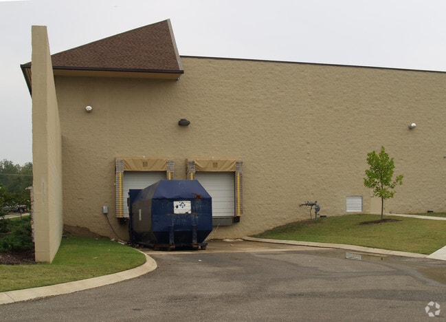
Property Record
6129 Airways Blvd, Southaven, MS 38671
NEARBY LISTINGS FOR SALE OR LEASE
Property Detail
6129 Airways Blvd
Memphis, TN-MS-AR
Southaven Towne Center 1St Rev Div Of Lo
1087361000001100
SOUTHAVEN TOWNE CENTER DIV OF LOT 11 LOT 11A
Realpropertynec
DeSoto
AE
Mississippi
28033C0078H
11
2024
4.58 AC
2024
Southaven-Horn Lake
070610
Memphis
51,874 SF
DEMOGRAPHICS near 6129 Airways Blvd
1 Mile
3 Mile
5 Mile
2024 Total Population
3,870
47,626
104,112
2029 Population
4,229
52,340
112,394
Pop Growth 2024-2029
+ 9.28%
+ 9.90%
+ 7.95%
Average Age
36
38
38
2024 Total Households
1,659
18,630
38,918
HH Growth 2024-2029
+ 9.40%
+ 10.02%
+ 8.03%
Median Household Inc
$42,897
$52,049
$58,574
Avg Household Size
2.30
2.50
2.60
2024 Avg HH Vehicles
2.00
2.00
2.00
Median Home Value
$163,959
$169,397
$190,671
Median Year Built
1991
1992
1992
Nearby Places
- Restaurants
- Banks
- Shops
- Fitness
- Groceries
PUBLIC TRANSPORTATION
AIRPORT
Memphis International
DRIVE
WALK
Distance
Memphis International
14 min
8.3 mi
Freight Ports
Port of Shreveport
DRIVE
WALK
Distance
Port of Shreveport
417 min
383.0 mi
Nearby Properties
Address
Land Use
TOTAL SIZE
Lot Size
Zoning
Address
Land Use
TOTAL SIZE
Lot Size
Zoning
1,040,736 SF
57.67 AC
M-1
Address
Land Use
TOTAL SIZE
Lot Size
Zoning
1,197,601 SF
59.47 AC
PBP
Address
Land Use
TOTAL SIZE
Lot Size
Zoning
73.05 AC
PBP
Address
Land Use
TOTAL SIZE
Lot Size
Zoning
868,060 SF
51.02 AC
PBP
Address
Land Use
TOTAL SIZE
Lot Size
Zoning
948,020 SF
62.60 AC
PBP
Address
Land Use
TOTAL SIZE
Lot Size
Zoning
23,183 SF
33.02 AC
PUD
Address
Land Use
TOTAL SIZE
Lot Size
Zoning
843,202 SF
51 AC
PBP
Address
Land Use
TOTAL SIZE
Lot Size
Zoning
39.98 AC
PUD
Address
Land Use
TOTAL SIZE
Lot Size
Zoning
741,634 SF
34.89 AC
PBP
Address
Land Use
TOTAL SIZE
Lot Size
Zoning
62,561 SF
33.01 AC
PUD
Address
Land Use
TOTAL SIZE
Lot Size
Zoning
864,768 SF
44.14 AC
PBP
Address
Land Use
TOTAL SIZE
Lot Size
Zoning
56.29 AC
PBP
Address
Land Use
TOTAL SIZE
Lot Size
Zoning
18,830 SF
25.45 AC
PUD
Address
Land Use
TOTAL SIZE
Lot Size
Zoning
586,092 SF
51.64 AC
PBP
Address
Land Use
TOTAL SIZE
Lot Size
Zoning
15,472 SF
25.97 AC
PUD
Address
Land Use
TOTAL SIZE
Lot Size
Zoning
611,307 SF
29.51 AC
PBP
Address
Land Use
TOTAL SIZE
Lot Size
Zoning
703,642 SF
37.11 AC
PBP
Address
Land Use
TOTAL SIZE
Lot Size
Zoning
618,927 SF
28.71 AC
PBP
Address
Land Use
TOTAL SIZE
Lot Size
Zoning
14,122 SF
24 AC
PUD
Address
Land Use
TOTAL SIZE
Lot Size
Zoning
554,932 SF
24.57 AC
PBP
Address
Land Use
TOTAL SIZE
Lot Size
Zoning
519,762 SF
29.67 AC
PBP
Address
Land Use
TOTAL SIZE
Lot Size
Zoning
552,590 SF
36.77 AC
PBP
Address
Land Use
TOTAL SIZE
Lot Size
Zoning
397,766 SF
37.80 AC
PBP
Address
Land Use
TOTAL SIZE
Lot Size
Zoning
515,317 SF
35.91 AC
PBP
Address
Land Use
TOTAL SIZE
Lot Size
Zoning
468,106 SF
22.28 AC
PBP
Address
Land Use
TOTAL SIZE
Lot Size
Zoning
34,358 SF
26.89 AC
C-4
Address
Land Use
TOTAL SIZE
Lot Size
Zoning
332,605 SF
25.85 AC
PBP
Address
Land Use
TOTAL SIZE
Lot Size
Zoning
10,341 SF
13.94 AC
RM-6
Address
Land Use
TOTAL SIZE
Lot Size
Zoning
430,984 SF
21.84 AC
PBP
Address
Land Use
TOTAL SIZE
Lot Size
Zoning
410,494 SF
19.25 AC
PBP
The World's #1 Commercial Real Estate Marketplace
Connect with us
© 2025 CoStar Group
The information above has been obtained from sources believed reliable. While we do not doubt its accuracy we have not verified it and make no guarantee, warranty or representation about it. It is your responsibility to independently confirm its accuracy and completeness. Any projections, opinions, assumptions, or estimates used are for example only and do not represent the current or future performance of the property. The value of this transaction to you depends on tax and other factors which should be evaluated by your tax, financial, and legal advisors. You and your advisors should conduct a careful, independent investigation of the property to determine to your satisfaction the suitability of the property for your needs.