Property Record
613 Derby Dr, Plano, IL 60545
Save to a Folder
{{folder.Name}}
{{folder.ListingIds.length}} Properties
{{folder.ListingIds.length}} Property
Create a New Folder
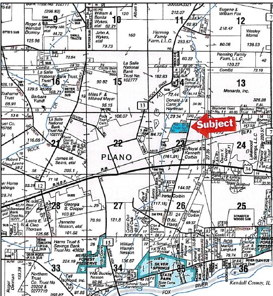
Property Detail
613 Derby Dr
Chicago-Naperville-Elgin, IL-IN
LOT 17 CHURCHILL FARMS UNIT 2 CITY OF PLANO
01-23-150-009
Kendall
Vacantlandnec
Illinois
B and X Area of moderate flood hazard, usually the area between the limits of the 100-year and 500-year floods.
17
2024
0.28 AC
2025
Western East/West Corr
890501
Chicago
NEARBY LISTINGS FOR SALE OR LEASE
DEMOGRAPHICS near 613 Derby Dr
1 mile
3 mile
5 mile
2025 Total Population
3,570
16,587
35,674
2030 Population
3,801
17,729
38,133
Pop Growth 2025-2030
+ 6.47%
+ 6.88%
+ 6.89%
Average Age
37
37
38
2025 Total Households
1,215
5,460
12,354
HH Growth 2025-2030
+ 6.34%
+ 6.83%
+ 6.75%
Median Household Inc
$85,697
$92,292
$97,464
Avg Household Size
2.90
2.90
2.80
2025 Avg HH Vehicles
2.00
2.00
2.00
Median Home Value
$231,545
$245,367
$275,252
Median Year Built
1974
2000
1999
Nearby Places
Map Layers
Map Styles
 Street
 Aerial
Layers
 Traffic
 Biking
Places
Listings with unknown addresses are not visible on the map
- Restaurants
- Banks
- Shops
- Fitness
- Groceries
PUBLIC TRANSPORTATION
COMMUTER RAIL
Plano Amtrak Station (Carl Sandburg - Amtrak, Illinois Zephyr - Amtrak)
Drive
Walk
Distance
Plano Amtrak Station (Carl Sandburg - Amtrak, Illinois Zephyr - Amtrak)
5 min
1.8 mi
Freight Ports
Port Milwaukee
Drive
Walk
Distance
Port Milwaukee
158 min
124.9 mi
SALE & LEASE HISTORY
LISTING DATE
SALE/LEASE

Sep 24, 2016
For Sale
Nearby Properties
Address
Land Use
TOTAL SIZE
Lot Size
Zoning
Address
Land Use
TOTAL SIZE
Lot Size
Zoning
1,703,170 SF
266.50 AC
Address
Land Use
TOTAL SIZE
Lot Size
Zoning
178,669 SF
21.48 AC
Address
Land Use
TOTAL SIZE
Lot Size
Zoning
34,047 SF
7.36 AC
Address
Land Use
TOTAL SIZE
Lot Size
Zoning
177,481 SF
14.11 AC
Address
Land Use
TOTAL SIZE
Lot Size
Zoning
62,548 SF
3.06 AC
Address
Land Use
TOTAL SIZE
Lot Size
Zoning
90,533 SF
7.18 AC
Address
Land Use
TOTAL SIZE
Lot Size
Zoning
21,800 SF
2.79 AC
Address
Land Use
TOTAL SIZE
Lot Size
Zoning
20,654 SF
2.38 AC
Address
Land Use
TOTAL SIZE
Lot Size
Zoning
15,632 SF
2.83 AC
Address
Land Use
TOTAL SIZE
Lot Size
Zoning
34,347 SF
2.82 AC
Address
Land Use
TOTAL SIZE
Lot Size
Zoning
9.03 AC
Address
Land Use
TOTAL SIZE
Lot Size
Zoning
16,296 SF
1.17 AC
Address
Land Use
TOTAL SIZE
Lot Size
Zoning
52,672 SF
6.43 AC
Address
Land Use
TOTAL SIZE
Lot Size
Zoning
4,231 SF
1.46 AC
Address
Land Use
TOTAL SIZE
Lot Size
Zoning
18,712 SF
1.38 AC
Address
Land Use
TOTAL SIZE
Lot Size
Zoning
12,570 SF
1.28 AC
Address
Land Use
TOTAL SIZE
Lot Size
Zoning
133,396 SF
8.51 AC
Address
Land Use
TOTAL SIZE
Lot Size
Zoning
70,912 SF
7.15 AC
Address
Land Use
TOTAL SIZE
Lot Size
Zoning
14,292 SF
15.48 AC
Address
Land Use
TOTAL SIZE
Lot Size
Zoning
17,608 SF
1.94 AC
Address
Land Use
TOTAL SIZE
Lot Size
Zoning
10,048 SF
1.31 AC
Address
Land Use
TOTAL SIZE
Lot Size
Zoning
5,027 SF
1.37 AC
Address
Land Use
TOTAL SIZE
Lot Size
Zoning
3,956 SF
1 AC
Address
Land Use
TOTAL SIZE
Lot Size
Zoning
7,194 SF
0.21 AC
Address
Land Use
TOTAL SIZE
Lot Size
Zoning
6,960 SF
0.67 AC
Address
Land Use
TOTAL SIZE
Lot Size
Zoning
60,350 SF
40.44 AC
Address
Land Use
TOTAL SIZE
Lot Size
Zoning
37,000 SF
6.63 AC
Address
Land Use
TOTAL SIZE
Lot Size
Zoning
6,600 SF
1.15 AC
Address
Land Use
TOTAL SIZE
Lot Size
Zoning
3.33 AC
Address
Land Use
TOTAL SIZE
Lot Size
Zoning
3.42 AC
The World's #1 Commercial Real Estate Marketplace
Connect with us
© 2026 CoStar Group
The information above has been obtained from sources believed reliable. While we do not doubt its accuracy we have not verified it and make no guarantee, warranty or representation about it. It is your responsibility to independently confirm its accuracy and completeness. Any projections, opinions, assumptions, or estimates used are for example only and do not represent the current or future performance of the property. The value of this transaction to you depends on tax and other factors which should be evaluated by your tax, financial, and legal advisors. You and your advisors should conduct a careful, independent investigation of the property to determine to your satisfaction the suitability of the property for your needs.