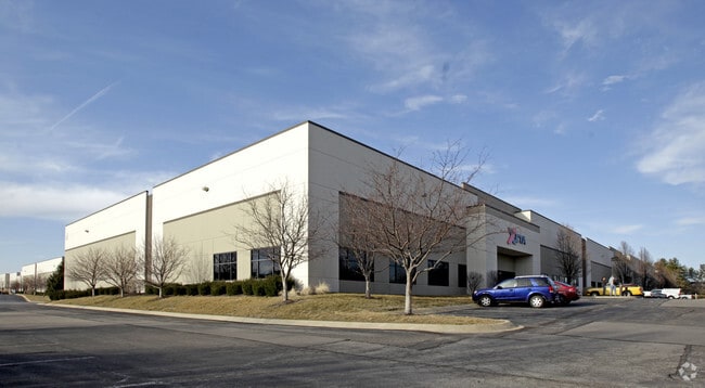
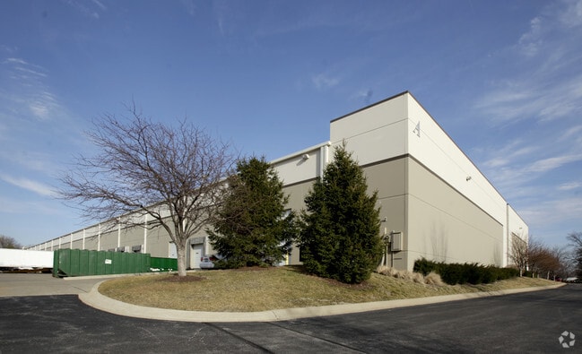
Property Record
613 Lambert Pointe Dr, Hazelwood, MO 63042


Current Lease Availabilities
Property Detail
613 Lambert Pointe Dr
St. Louis, MO-IL
LAMBERT POINTE BUSINESS CENTRE LOT PT A
09L-21-0535
Saint Louis
Warehouse
Missouri
80H
a
B and X Area of moderate flood hazard, usually the area between the limits of the 100-year and 500-year floods.
3.06 AC
2024
Airport
2025
St. Louis
211402
NEARBY LISTINGS FOR SALE OR LEASE
DEMOGRAPHICS near 613 Lambert Pointe Dr
1 mile
3 mile
5 mile
2025 Total Population
4,142
54,638
170,421
2030 Population
4,086
54,251
169,415
Pop Growth 2025-2030
(1.35%)
(0.71%)
(0.59%)
Average Age
39
39
39
2025 Total Households
1,944
23,076
69,466
HH Growth 2025-2030
(1.44%)
(0.76%)
(0.63%)
Median Household Inc
$52,094
$58,198
$62,413
Avg Household Size
2.10
2.30
2.40
2025 Avg HH Vehicles
2.00
2.00
2.00
Median Home Value
$146,358
$153,058
$149,817
Median Year Built
1967
1965
1962
Nearby Places
Map Layers
Map Styles
 Street
 Aerial
Layers
 Traffic
 Biking
Places
Listings with unknown addresses are not visible on the map
- Restaurants
- Banks
- Shops
- Fitness
- Groceries
PUBLIC TRANSPORTATION
COMMUTER RAIL
Lambert Airport East Terminal (Lambert Airport Shiloh-Scott - St. Louis MetroLink (MetroLink))
Drive
Walk
Distance
Lambert Airport East Terminal (Lambert Airport Shiloh-Scott - St. Louis MetroLink (MetroLink))
10 min
5.8 mi
Lambert Airport Main Terminal (Lambert Airport Shiloh-Scott - St. Louis MetroLink (MetroLink))
Drive
Walk
Distance
Lambert Airport Main Terminal (Lambert Airport Shiloh-Scott - St. Louis MetroLink (MetroLink))
12 min
6.3 mi
AIRPORT
St Louis Lambert International
Drive
Walk
Distance
St Louis Lambert International
7 min
3.0 mi
Freight Ports
Port Milwaukee
Drive
Walk
Distance
Port Milwaukee
429 min
376.2 mi
Nearby Properties
Address
Land Use
TOTAL SIZE
Lot Size
Zoning
Address
Land Use
TOTAL SIZE
Lot Size
Zoning
1,770,455 SF
1,090.47 AC
NU
Address
Land Use
TOTAL SIZE
Lot Size
Zoning
1,817,830 SF
75.99 AC
M1
Address
Land Use
TOTAL SIZE
Lot Size
Zoning
2,640,818 SF
159.97 AC
7M-1
Address
Land Use
TOTAL SIZE
Lot Size
Zoning
4,416 SF
54.81 AC
80B
Address
Land Use
TOTAL SIZE
Lot Size
Zoning
378,915 SF
12.16 AC
73C
Address
Land Use
TOTAL SIZE
Lot Size
Zoning
893,188 SF
71.88 AC
G
Address
Land Use
TOTAL SIZE
Lot Size
Zoning
815,658 SF
28.70 AC
M1
Address
Land Use
TOTAL SIZE
Lot Size
Zoning
816,783 SF
37.97 AC
7M-1
Address
Land Use
TOTAL SIZE
Lot Size
Zoning
528,000 SF
21.10 AC
80I
Address
Land Use
TOTAL SIZE
Lot Size
Zoning
339,604 SF
35.30 AC
M1
Address
Land Use
TOTAL SIZE
Lot Size
Zoning
491,800 SF
18.69 AC
80AG
Address
Land Use
TOTAL SIZE
Lot Size
Zoning
136,258 SF
263.16 AC
7M-1
Address
Land Use
TOTAL SIZE
Lot Size
Zoning
277,926 SF
12.61 AC
67C-2
Address
Land Use
TOTAL SIZE
Lot Size
Zoning
406,000 SF
18.82 AC
80CA
Address
Land Use
TOTAL SIZE
Lot Size
Zoning
245,474 SF
6.52 AC
10B-3
Address
Land Use
TOTAL SIZE
Lot Size
Zoning
445,715 SF
28.16 AC
80I
Address
Land Use
TOTAL SIZE
Lot Size
Zoning
343,900 SF
19.62 AC
80AG
Address
Land Use
TOTAL SIZE
Lot Size
Zoning
335,294 SF
33.83 AC
24MFD
Address
Land Use
TOTAL SIZE
Lot Size
Zoning
6.88 AC
H
Address
Land Use
TOTAL SIZE
Lot Size
Zoning
1,428 SF
131.27 AC
C
Address
Land Use
TOTAL SIZE
Lot Size
Zoning
110,500 SF
11.06 AC
72C3
Address
Land Use
TOTAL SIZE
Lot Size
Zoning
206,787 SF
37.07 AC
72R1
Address
Land Use
TOTAL SIZE
Lot Size
Zoning
293,622 SF
28.06 AC
H
Address
Land Use
TOTAL SIZE
Lot Size
Zoning
659,138 SF
1,142.84 AC
M1
Address
Land Use
TOTAL SIZE
Lot Size
Zoning
262,938 SF
11.32 AC
80H
Address
Land Use
TOTAL SIZE
Lot Size
Zoning
161,536 SF
7.91 AC
R5
Address
Land Use
TOTAL SIZE
Lot Size
Zoning
28,570 SF
20.89 AC
10B-2
Address
Land Use
TOTAL SIZE
Lot Size
Zoning
269,258 SF
89.80 AC
80F
Address
Land Use
TOTAL SIZE
Lot Size
Zoning
216,000 SF
16.42 AC
80AG
Address
Land Use
TOTAL SIZE
Lot Size
Zoning
214,280 SF
22.39 AC
NU
The World's #1 Commercial Real Estate Marketplace
Connect with us
© 2026 CoStar Group
The information above has been obtained from sources believed reliable. While we do not doubt its accuracy we have not verified it and make no guarantee, warranty or representation about it. It is your responsibility to independently confirm its accuracy and completeness. Any projections, opinions, assumptions, or estimates used are for example only and do not represent the current or future performance of the property. The value of this transaction to you depends on tax and other factors which should be evaluated by your tax, financial, and legal advisors. You and your advisors should conduct a careful, independent investigation of the property to determine to your satisfaction the suitability of the property for your needs.