Property Record
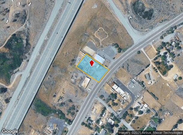
613 Us Highway 395 S, Washoe Valley, NV 89704


NEARBY LISTINGS FOR SALE OR LEASE
-
-
-
-
-
No Photo
-
-
View all Washoe Valley listings for sale on LoopNet.com
Property Detail
613 Us Highway 395 S
Reno, NV
_Unspecified
046-070-19
PM 1349 LT 2
Commercialacreage
Washoe
X
Nevada
32031C3350G
2
0
1 AC
2026
S Outlying Washoe County
003207
Reno/Sparks
DEMOGRAPHICS near 613 Us Highway 395 S
1 Mile
3 Mile
5 Mile
2024 Total Population
446
4,559
11,410
2029 Population
468
4,890
12,140
Pop Growth 2024-2029
+ 4.93%
+ 7.26%
+ 6.40%
Average Age
49
49
48
2024 Total Households
185
1,829
4,463
HH Growth 2024-2029
+ 5.41%
+ 7.33%
+ 6.50%
Median Household Inc
$91,776
$105,653
$123,356
Avg Household Size
2.40
2.50
2.50
2024 Avg HH Vehicles
3.00
3.00
3.00
Median Home Value
$661,458
$859,818
$802,450
Median Year Built
1978
1994
1993
Nearby Places
Map Layers
Map Styles
 Street
 Aerial
- Restaurants
- Banks
- Shops
- Fitness
- Groceries
PUBLIC TRANSPORTATION
AIRPORT
Reno/Tahoe International
DRIVE
WALK
Distance
Reno/Tahoe International
40 min
21.2 mi
Freight Ports
Port of Stockton
DRIVE
WALK
Distance
Port of Stockton
232 min
200.4 mi
Nearby Properties
Address
Land Use
TOTAL SIZE
Lot Size
Zoning
Address
Land Use
TOTAL SIZE
Lot Size
Zoning
30,500 SF
17.53 AC
LDS
Address
Land Use
TOTAL SIZE
Lot Size
Zoning
183.38 AC
LDS
Address
Land Use
TOTAL SIZE
Lot Size
Zoning
27,360 SF
3.76 AC
GC
Address
Land Use
TOTAL SIZE
Lot Size
Zoning
175.21 AC
LDS 65% /
Address
Land Use
TOTAL SIZE
Lot Size
Zoning
73,440 SF
10 AC
GC
Address
Land Use
TOTAL SIZE
Lot Size
Zoning
2,929.44 AC
PR 22%/WB
Address
Land Use
TOTAL SIZE
Lot Size
Zoning
34,376 SF
5.60 AC
PSP 90% /
Address
Land Use
TOTAL SIZE
Lot Size
Zoning
8,318 SF
67.68 AC
TC 5% / PR
Address
Land Use
TOTAL SIZE
Lot Size
Zoning
85.32 AC
LDS
Address
Land Use
TOTAL SIZE
Lot Size
Zoning
85.82 AC
LDS
Address
Land Use
TOTAL SIZE
Lot Size
Zoning
2.01 AC
OS
Address
Land Use
TOTAL SIZE
Lot Size
Zoning
43.18 AC
LDS
Address
Land Use
TOTAL SIZE
Lot Size
Zoning
34.25 AC
MS
Address
Land Use
TOTAL SIZE
Lot Size
Zoning
6,315 SF
5.61 AC
GC
Address
Land Use
TOTAL SIZE
Lot Size
Zoning
20,670 SF
52.58 AC
PSP
Address
Land Use
TOTAL SIZE
Lot Size
Zoning
7,504 SF
49.52 AC
PR
Address
Land Use
TOTAL SIZE
Lot Size
Zoning
415.54 AC
OS
Address
Land Use
TOTAL SIZE
Lot Size
Zoning
14,800 SF
1.76 AC
GC
Address
Land Use
TOTAL SIZE
Lot Size
Zoning
57.02 AC
LDS 79% /
Address
Land Use
TOTAL SIZE
Lot Size
Zoning
7,632 SF
2.02 AC
GC
Address
Land Use
TOTAL SIZE
Lot Size
Zoning
41.94 AC
LDS
Address
Land Use
TOTAL SIZE
Lot Size
Zoning
1.19 AC
LDS
Address
Land Use
TOTAL SIZE
Lot Size
Zoning
13,640 SF
5.20 AC
GC
Address
Land Use
TOTAL SIZE
Lot Size
Zoning
1,053.60 AC
OS 96% / G
Address
Land Use
TOTAL SIZE
Lot Size
Zoning
3.69 AC
LDS
Address
Land Use
TOTAL SIZE
Lot Size
Zoning
0.58 AC
OS
Address
Land Use
TOTAL SIZE
Lot Size
Zoning
3,840 SF
0.98 AC
GC
Address
Land Use
TOTAL SIZE
Lot Size
Zoning
2,700 SF
1.42 AC
LDS
Address
Land Use
TOTAL SIZE
Lot Size
Zoning
233.01 AC
GR
Address
Land Use
TOTAL SIZE
Lot Size
Zoning
3,718 SF
7.97 AC
LDS 54% /
The World's #1 Commercial Real Estate Marketplace
Connect with us
© 2025 CoStar Group
The information above has been obtained from sources believed reliable. While we do not doubt its accuracy we have not verified it and make no guarantee, warranty or representation about it. It is your responsibility to independently confirm its accuracy and completeness. Any projections, opinions, assumptions, or estimates used are for example only and do not represent the current or future performance of the property. The value of this transaction to you depends on tax and other factors which should be evaluated by your tax, financial, and legal advisors. You and your advisors should conduct a careful, independent investigation of the property to determine to your satisfaction the suitability of the property for your needs.