Property Record
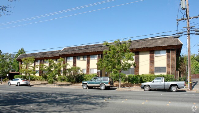
6131 Montecito Blvd, Santa Rosa, CA 95409


Property Detail
6131 Montecito Blvd
182-130-010
REMAP 032-240-006 08/11/98 LT137 MONTECITO VLG #1
Apartment
Sonoma
R3
California
B and X Area of moderate flood hazard, usually the area between the limits of the 100-year and 500-year floods.
137
2025
0.68 AC
2025
Outer Santa Rosa
152205
North Bay/Santa Rosa
24,504 SF
Santa Rosa-Petaluma, CA
NEARBY LISTINGS FOR SALE OR LEASE
DEMOGRAPHICS near 6131 Montecito Blvd
1 mile
3 mile
5 mile
2025 Total Population
12,762
68,660
166,230
2030 Population
12,792
69,220
167,571
Pop Growth 2025-2030
+ 0.24%
+ 0.82%
+ 0.81%
Average Age
44
45
42
2025 Total Households
5,210
28,662
63,303
HH Growth 2025-2030
+ 0.25%
+ 1.00%
+ 0.88%
Median Household Inc
$103,860
$110,662
$98,027
Avg Household Size
2.40
2.30
2.50
2025 Avg HH Vehicles
2.00
2.00
2.00
Median Home Value
$757,659
$819,692
$758,898
Median Year Built
1979
1975
1979
Nearby Places
Map Layers
Map Styles
 Street
 Aerial
Layers
 Traffic
 Biking
Places
Listings with unknown addresses are not visible on the map
- Restaurants
- Banks
- Shops
- Fitness
- Groceries
PUBLIC TRANSPORTATION
COMMUTER RAIL
Drive
Walk
Distance
10 min
4.3 mi
Drive
Walk
Distance
8 min
4.4 mi
AIRPORT
Charles M Schulz - Sonoma County
Drive
Walk
Distance
Charles M Schulz - Sonoma County
17 min
9.0 mi
Freight Ports
Port of Richmond
Drive
Walk
Distance
Port of Richmond
69 min
52.6 mi
Nearby Properties
Address
Land Use
TOTAL SIZE
Lot Size
Zoning
Address
Land Use
TOTAL SIZE
Lot Size
Zoning
191,452 SF
128.68 AC
CITYSR
Address
Land Use
TOTAL SIZE
Lot Size
Zoning
142,169 SF
7.42 AC
CITYSR
Address
Land Use
TOTAL SIZE
Lot Size
Zoning
22.45 AC
MCPD
Address
Land Use
TOTAL SIZE
Lot Size
Zoning
13,592 SF
30.22 AC
Address
Land Use
TOTAL SIZE
Lot Size
Zoning
Address
Land Use
TOTAL SIZE
Lot Size
Zoning
191,385 SF
13.77 AC
C2P
Address
Land Use
TOTAL SIZE
Lot Size
Zoning
131,210 SF
10.41 AC
Address
Land Use
TOTAL SIZE
Lot Size
Zoning
14,956 SF
9.77 AC
PC
Address
Land Use
TOTAL SIZE
Lot Size
Zoning
90,079 SF
3.09 AC
Address
Land Use
TOTAL SIZE
Lot Size
Zoning
184,758 SF
9.23 AC
Address
Land Use
TOTAL SIZE
Lot Size
Zoning
9,450 SF
0.76 AC
Address
Land Use
TOTAL SIZE
Lot Size
Zoning
107,765 SF
5.70 AC
CITYSR
Address
Land Use
TOTAL SIZE
Lot Size
Zoning
119,819 SF
7.37 AC
CITYSR
Address
Land Use
TOTAL SIZE
Lot Size
Zoning
19,996 SF
6.33 AC
Address
Land Use
TOTAL SIZE
Lot Size
Zoning
19,013 SF
9.46 AC
CITYSR
Address
Land Use
TOTAL SIZE
Lot Size
Zoning
58,551 SF
4.24 AC
Address
Land Use
TOTAL SIZE
Lot Size
Zoning
181,593 SF
0.80 AC
R3PD
Address
Land Use
TOTAL SIZE
Lot Size
Zoning
89,168 SF
5.50 AC
CITYSR
Address
Land Use
TOTAL SIZE
Lot Size
Zoning
53,024 SF
13.82 AC
CITYSR
Address
Land Use
TOTAL SIZE
Lot Size
Zoning
131,502 SF
8.60 AC
Address
Land Use
TOTAL SIZE
Lot Size
Zoning
28,384 SF
2.94 AC
CITYSR
Address
Land Use
TOTAL SIZE
Lot Size
Zoning
56,151 SF
4.21 AC
Address
Land Use
TOTAL SIZE
Lot Size
Zoning
128,092 SF
7.12 AC
Address
Land Use
TOTAL SIZE
Lot Size
Zoning
2,507 SF
4.19 AC
CITYSR
Address
Land Use
TOTAL SIZE
Lot Size
Zoning
38,567 SF
3.80 AC
PC
Address
Land Use
TOTAL SIZE
Lot Size
Zoning
26,320 SF
1.94 AC
CITYSR
Address
Land Use
TOTAL SIZE
Lot Size
Zoning
103,894 SF
4.27 AC
CITYSR
Address
Land Use
TOTAL SIZE
Lot Size
Zoning
6,150 SF
6.57 AC
CITYSR
Address
Land Use
TOTAL SIZE
Lot Size
Zoning
99,362 SF
0.77 AC
CITYSR
Address
Land Use
TOTAL SIZE
Lot Size
Zoning
52,150 SF
1.30 AC
R330
The World's #1 Commercial Real Estate Marketplace
Connect with us
© 2026 CoStar Group
The information above has been obtained from sources believed reliable. While we do not doubt its accuracy we have not verified it and make no guarantee, warranty or representation about it. It is your responsibility to independently confirm its accuracy and completeness. Any projections, opinions, assumptions, or estimates used are for example only and do not represent the current or future performance of the property. The value of this transaction to you depends on tax and other factors which should be evaluated by your tax, financial, and legal advisors. You and your advisors should conduct a careful, independent investigation of the property to determine to your satisfaction the suitability of the property for your needs.