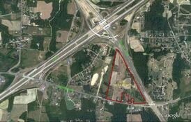
Property Record
6132 Modlin Grove Rd, High Point, NC 27263

Property Detail
6132 Modlin Grove Rd
0161634
13.28AC MODLIN SR 1148 6226-155&162
Agriculturalland
GUILFORD
AG
North Carolina
B and X Area of moderate flood hazard, usually the area between the limits of the 100-year and 500-year floods.
10
2024
13.28 AC
2025
High Point/SW Guilford Cty
016600
Greensboro/Winston-Salem
1,934 SF
Greensboro-High Point, NC
NEARBY LISTINGS FOR SALE OR LEASE
DEMOGRAPHICS near 6132 Modlin Grove Rd
1 mile
3 mile
5 mile
2025 Total Population
1,041
16,192
58,816
2030 Population
1,076
16,516
60,897
Pop Growth 2025-2030
+ 3.36%
+ 2.00%
+ 3.54%
Average Age
44
41
40
2025 Total Households
433
6,471
23,313
HH Growth 2025-2030
+ 3.70%
+ 2.07%
+ 3.68%
Median Household Inc
$44,385
$53,476
$49,480
Avg Household Size
2.40
2.50
2.40
2025 Avg HH Vehicles
2.00
2.00
2.00
Median Home Value
$233,467
$199,031
$188,807
Median Year Built
1975
1979
1976
Nearby Places
Map Layers
Map Styles
 Street
 Aerial
Transit
 Traffic
 Biking
Places
Listings with unknown addresses are not visible on the map
- Restaurants
- Banks
- Shops
- Fitness
- Groceries
PUBLIC TRANSPORTATION
COMMUTER RAIL
High Point Station (Piedmont - North Carolina by Train (NC Train))
Drive
Walk
Distance
High Point Station (Piedmont - North Carolina by Train (NC Train))
12 min
6.3 mi
AIRPORT
Piedmont Triad International
Drive
Walk
Distance
Piedmont Triad International
31 min
19.0 mi
Freight Ports
Port of Wilmington
Drive
Walk
Distance
Port of Wilmington
245 min
207.6 mi
Nearby Properties
Address
Land Use
TOTAL SIZE
Lot Size
Zoning
Address
Land Use
TOTAL SIZE
Lot Size
Zoning
299,349 SF
21.76 AC
RM-16
Address
Land Use
TOTAL SIZE
Lot Size
Zoning
113,866 SF
11.53 AC
LI
Address
Land Use
TOTAL SIZE
Lot Size
Zoning
107,417 SF
6.46 AC
RM-26
Address
Land Use
TOTAL SIZE
Lot Size
Zoning
299,394 SF
8.60 AC
M-2
Address
Land Use
TOTAL SIZE
Lot Size
Zoning
90,000 SF
15.36 AC
M-2
Address
Land Use
TOTAL SIZE
Lot Size
Zoning
89,183 SF
17.12 AC
GB
Address
Land Use
TOTAL SIZE
Lot Size
Zoning
7,680 SF
9.95 AC
GRD
Address
Land Use
TOTAL SIZE
Lot Size
Zoning
69,094 SF
5.47 AC
M-2
Address
Land Use
TOTAL SIZE
Lot Size
Zoning
7,168 SF
7.51 AC
GRD
Address
Land Use
TOTAL SIZE
Lot Size
Zoning
73,658 SF
8.45 AC
B-1
Address
Land Use
TOTAL SIZE
Lot Size
Zoning
13,311 SF
162.92 AC
HI
Address
Land Use
TOTAL SIZE
Lot Size
Zoning
48,913 SF
2.25 AC
B-1
Address
Land Use
TOTAL SIZE
Lot Size
Zoning
35,620 SF
5.47 AC
M-2
Address
Land Use
TOTAL SIZE
Lot Size
Zoning
65,733 SF
124.36 AC
HI
Address
Land Use
TOTAL SIZE
Lot Size
Zoning
53,520 SF
5.48 AC
B-1
Address
Land Use
TOTAL SIZE
Lot Size
Zoning
66,487 SF
10.16 AC
LI
Address
Land Use
TOTAL SIZE
Lot Size
Zoning
8,927 SF
3.60 AC
OI
Address
Land Use
TOTAL SIZE
Lot Size
Zoning
40,275 SF
2.31 AC
B-1
Address
Land Use
TOTAL SIZE
Lot Size
Zoning
42,112 SF
6.41 AC
HB
Address
Land Use
TOTAL SIZE
Lot Size
Zoning
35,611 SF
8.92 AC
LI
Address
Land Use
TOTAL SIZE
Lot Size
Zoning
189,060 SF
17.64 AC
LI
Address
Land Use
TOTAL SIZE
Lot Size
Zoning
43,328 SF
2.11 AC
B-1
Address
Land Use
TOTAL SIZE
Lot Size
Zoning
33,470 SF
30.41 AC
HI
Address
Land Use
TOTAL SIZE
Lot Size
Zoning
37,680 SF
1.66 AC
CD HB
Address
Land Use
TOTAL SIZE
Lot Size
Zoning
105,208 SF
9 AC
CP
Address
Land Use
TOTAL SIZE
Lot Size
Zoning
18.23 AC
R-15
Address
Land Use
TOTAL SIZE
Lot Size
Zoning
27,601 SF
8.28 AC
SU R-10
Address
Land Use
TOTAL SIZE
Lot Size
Zoning
152,260 SF
20.59 AC
LI
Address
Land Use
TOTAL SIZE
Lot Size
Zoning
41,876 SF
21 AC
R-5
Address
Land Use
TOTAL SIZE
Lot Size
Zoning
33,423 SF
4.48 AC
R-5
The World's #1 Commercial Real Estate Marketplace
Connect with us
© 2026 CoStar Group
The information above has been obtained from sources believed reliable. While we do not doubt its accuracy we have not verified it and make no guarantee, warranty or representation about it. It is your responsibility to independently confirm its accuracy and completeness. Any projections, opinions, assumptions, or estimates used are for example only and do not represent the current or future performance of the property. The value of this transaction to you depends on tax and other factors which should be evaluated by your tax, financial, and legal advisors. You and your advisors should conduct a careful, independent investigation of the property to determine to your satisfaction the suitability of the property for your needs.