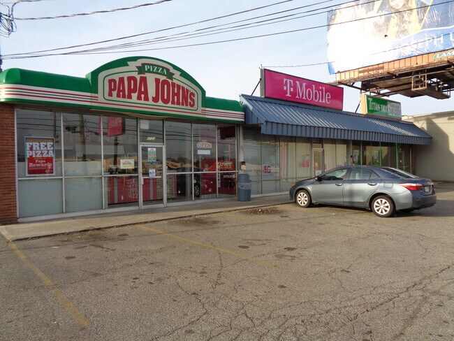
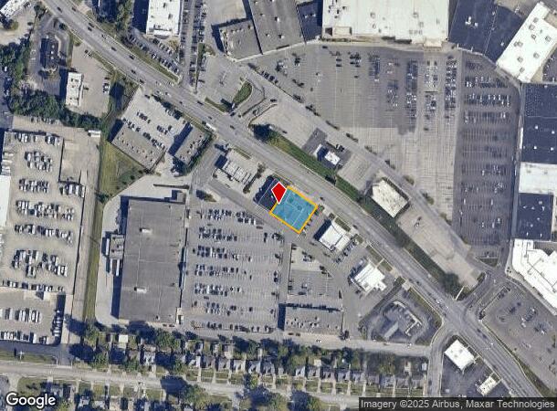
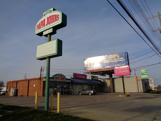
Property Record
6137 Glenway Ave, Cincinnati, OH 45211
NEARBY LISTINGS FOR SALE OR LEASE
Property Detail
6137 Glenway Ave
Cincinnati, OH-KY-IN
Triangle Park Sub
212-0063-0035
6137 GLENWAY AVE 116 X 105 LOTS 5-6 TRIANGLE PARK SUB SEC A PARS 35-36CONS SEC A
Regionalshoppingcenterormallwithanchorstore
Hamilton
X
Ohio
39061C0213E
5-6
2024
0.28 AC
2024
Forest Park/West
010201
Cincinnati/Dayton
4,617 SF
DEMOGRAPHICS near 6137 Glenway Ave
1 Mile
3 Mile
5 Mile
2024 Total Population
15,574
101,575
211,653
2029 Population
15,154
100,322
209,905
Pop Growth 2024-2029
(2.70%)
(1.23%)
(0.83%)
Average Age
39
39
39
2024 Total Households
6,642
41,915
86,881
HH Growth 2024-2029
(2.86%)
(1.29%)
(0.92%)
Median Household Inc
$46,617
$54,559
$53,977
Avg Household Size
2.30
2.30
2.30
2024 Avg HH Vehicles
2.00
2.00
2.00
Median Home Value
$145,095
$160,042
$166,547
Median Year Built
1956
1961
1962
Nearby Places
Map Layers
Map Styles
 Street
 Aerial
- Restaurants
- Banks
- Shops
- Fitness
- Groceries
PUBLIC TRANSPORTATION
COMMUTER RAIL
DRIVE
WALK
Distance
16 min
6.5 mi
AIRPORT
Cincinnati/Northern Kentucky International
DRIVE
WALK
Distance
Cincinnati/Northern Kentucky International
36 min
18.7 mi
SALE & LEASE HISTORY
LISTING DATE
SALE/LEASE

Mar 15, 2023
For Lease
Feb 09, 2021
For Sale
Nearby Properties
Address
Land Use
TOTAL SIZE
Lot Size
Zoning
Address
Land Use
TOTAL SIZE
Lot Size
Zoning
Address
Land Use
TOTAL SIZE
Lot Size
Zoning
9.52 AC
B
Address
Land Use
TOTAL SIZE
Lot Size
Zoning
17,857 SF
26.60 AC
CGA
Address
Land Use
TOTAL SIZE
Lot Size
Zoning
8.18 AC
SF4
Address
Land Use
TOTAL SIZE
Lot Size
Zoning
Address
Land Use
TOTAL SIZE
Lot Size
Zoning
6,620 SF
16.91 AC
Address
Land Use
TOTAL SIZE
Lot Size
Zoning
14.43 AC
Address
Land Use
TOTAL SIZE
Lot Size
Zoning
Address
Land Use
TOTAL SIZE
Lot Size
Zoning
125,405 SF
16.69 AC
SF6
Address
Land Use
TOTAL SIZE
Lot Size
Zoning
360 SF
7.79 AC
F
Address
Land Use
TOTAL SIZE
Lot Size
Zoning
6,000 SF
11.92 AC
G
Address
Land Use
TOTAL SIZE
Lot Size
Zoning
62,160 SF
13.70 AC
RM20
Address
Land Use
TOTAL SIZE
Lot Size
Zoning
55,572 SF
6.12 AC
C
Address
Land Use
TOTAL SIZE
Lot Size
Zoning
14.01 AC
CGA
Address
Land Use
TOTAL SIZE
Lot Size
Zoning
30.39 AC
A2
Address
Land Use
TOTAL SIZE
Lot Size
Zoning
40,080 SF
4.14 AC
SF6
Address
Land Use
TOTAL SIZE
Lot Size
Zoning
76,739 SF
11.44 AC
SF6
Address
Land Use
TOTAL SIZE
Lot Size
Zoning
24,222 SF
3.91 AC
CGA
Address
Land Use
TOTAL SIZE
Lot Size
Zoning
4,017 SF
8.76 AC
Address
Land Use
TOTAL SIZE
Lot Size
Zoning
47,504 SF
14.37 AC
RM20
Address
Land Use
TOTAL SIZE
Lot Size
Zoning
60,751 SF
9.57 AC
C
Address
Land Use
TOTAL SIZE
Lot Size
Zoning
4.33 AC
Address
Land Use
TOTAL SIZE
Lot Size
Zoning
6.91 AC
B
Address
Land Use
TOTAL SIZE
Lot Size
Zoning
11.81 AC
RM20
Address
Land Use
TOTAL SIZE
Lot Size
Zoning
15,998 SF
13.71 AC
SF10
Address
Land Use
TOTAL SIZE
Lot Size
Zoning
9.43 AC
CGA
Address
Land Use
TOTAL SIZE
Lot Size
Zoning
13,068 SF
16.75 AC
RM20
Address
Land Use
TOTAL SIZE
Lot Size
Zoning
1,987 SF
3.71 AC
C
Address
Land Use
TOTAL SIZE
Lot Size
Zoning
2,224 SF
0.13 AC
PR
Address
Land Use
TOTAL SIZE
Lot Size
Zoning
30,752 SF
2.23 AC
RMX
The World's #1 Commercial Real Estate Marketplace
Connect with us
© 2025 CoStar Group
The information above has been obtained from sources believed reliable. While we do not doubt its accuracy we have not verified it and make no guarantee, warranty or representation about it. It is your responsibility to independently confirm its accuracy and completeness. Any projections, opinions, assumptions, or estimates used are for example only and do not represent the current or future performance of the property. The value of this transaction to you depends on tax and other factors which should be evaluated by your tax, financial, and legal advisors. You and your advisors should conduct a careful, independent investigation of the property to determine to your satisfaction the suitability of the property for your needs.