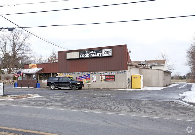
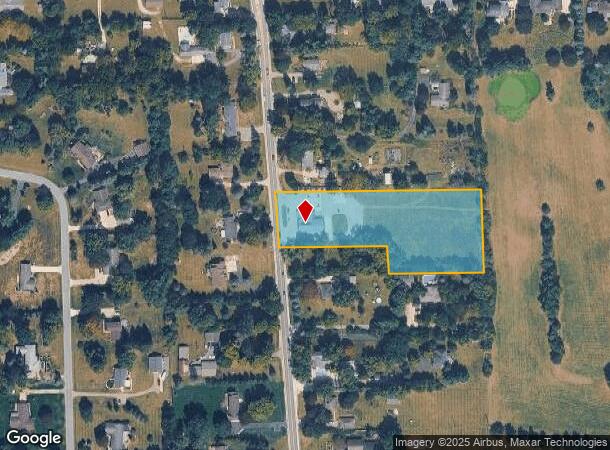
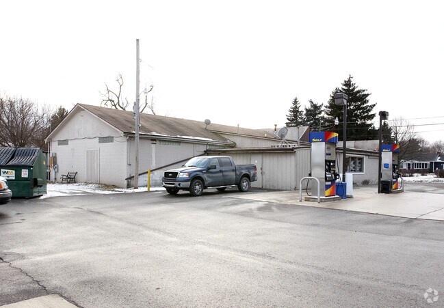
Property Record
6139 Saline Ann Arbor Rd, Saline, MI 48176
NEARBY LISTINGS FOR SALE OR LEASE
Property Detail
6139 Saline Ann Arbor Rd
13-25-200-009
OLD SID - M 13-025-007-00 LO 25-2C-2 COM AT NW COR OF SEC, TH E 14.65 FT ALONG N LINE OF SEC, TH S 2 DEG 22' E 685.63FT TO PL
Commercialnec
Washtenaw
X
Michigan
26161C0383E
2.58 AC
2024
Washtenaw W of 23
2025
Detroit
425000
Ann Arbor, MI
4,088 SF
DEMOGRAPHICS near 6139 Saline Ann Arbor Rd
1 Mile
3 Mile
5 Mile
2024 Total Population
2,409
19,979
51,887
2029 Population
2,364
19,753
51,560
Pop Growth 2024-2029
(1.87%)
(1.13%)
(0.63%)
Average Age
45
43
41
2024 Total Households
867
7,875
21,472
HH Growth 2024-2029
(1.96%)
(1.23%)
(0.76%)
Median Household Inc
$143,408
$114,658
$105,314
Avg Household Size
2.70
2.50
2.40
2024 Avg HH Vehicles
2.00
2.00
2.00
Median Home Value
$444,717
$415,239
$413,158
Median Year Built
1987
1989
1990
Nearby Places
Map Layers
Map Styles
 Street
 Aerial
- Restaurants
- Banks
- Shops
- Fitness
- Groceries
PUBLIC TRANSPORTATION
COMMUTER RAIL
DRIVE
WALK
Distance
16 min
7.6 mi
AIRPORT
Detroit Metro Wayne County
DRIVE
WALK
Distance
Detroit Metro Wayne County
40 min
30.3 mi
Nearby Properties
Address
Land Use
TOTAL SIZE
Lot Size
Zoning
Address
Land Use
TOTAL SIZE
Lot Size
Zoning
105,615 SF
26.31 AC
Address
Land Use
TOTAL SIZE
Lot Size
Zoning
283,484 SF
22.64 AC
R-3
Address
Land Use
TOTAL SIZE
Lot Size
Zoning
1,562,480 SF
189.08 AC
I-4
Address
Land Use
TOTAL SIZE
Lot Size
Zoning
99,663 SF
6.89 AC
R-1A
Address
Land Use
TOTAL SIZE
Lot Size
Zoning
88,657 SF
14.98 AC
Address
Land Use
TOTAL SIZE
Lot Size
Zoning
99,000 SF
12.22 AC
I-2
Address
Land Use
TOTAL SIZE
Lot Size
Zoning
140,284 SF
6.83 AC
I-2
Address
Land Use
TOTAL SIZE
Lot Size
Zoning
84,415 SF
9.96 AC
II
Address
Land Use
TOTAL SIZE
Lot Size
Zoning
65,899 SF
6.37 AC
R-3
Address
Land Use
TOTAL SIZE
Lot Size
Zoning
179,324 SF
14.91 AC
I-2
Address
Land Use
TOTAL SIZE
Lot Size
Zoning
105,418 SF
9.47 AC
I-2
Address
Land Use
TOTAL SIZE
Lot Size
Zoning
86,859 SF
12.33 AC
SPA-1
Address
Land Use
TOTAL SIZE
Lot Size
Zoning
53,876 SF
SPA-1
Address
Land Use
TOTAL SIZE
Lot Size
Zoning
135,417 SF
8.19 AC
I-2
Address
Land Use
TOTAL SIZE
Lot Size
Zoning
8.80 AC
I-2
Address
Land Use
TOTAL SIZE
Lot Size
Zoning
46,698 SF
5.28 AC
Address
Land Use
TOTAL SIZE
Lot Size
Zoning
33,000 SF
I-2
Address
Land Use
TOTAL SIZE
Lot Size
Zoning
35,084 SF
4.60 AC
II
Address
Land Use
TOTAL SIZE
Lot Size
Zoning
49,311 SF
4.90 AC
SPA-1
Address
Land Use
TOTAL SIZE
Lot Size
Zoning
53,244 SF
8.10 AC
SPA-1
Address
Land Use
TOTAL SIZE
Lot Size
Zoning
76,690 SF
8.82 AC
I-2
Address
Land Use
TOTAL SIZE
Lot Size
Zoning
27,258 SF
I-4
Address
Land Use
TOTAL SIZE
Lot Size
Zoning
35,923 SF
7.11 AC
II
Address
Land Use
TOTAL SIZE
Lot Size
Zoning
27,808 SF
115.67 AC
AG
Address
Land Use
TOTAL SIZE
Lot Size
Zoning
6,888 SF
65.56 AC
DH
Address
Land Use
TOTAL SIZE
Lot Size
Zoning
35,057 SF
3.58 AC
II
Address
Land Use
TOTAL SIZE
Lot Size
Zoning
30,229 SF
4 AC
II
Address
Land Use
TOTAL SIZE
Lot Size
Zoning
43,500 SF
I-2
Address
Land Use
TOTAL SIZE
Lot Size
Zoning
111,816 SF
13.98 AC
I-2
Address
Land Use
TOTAL SIZE
Lot Size
Zoning
69,916 SF
5 AC
I-2
The World's #1 Commercial Real Estate Marketplace
Connect with us
© 2026 CoStar Group
The information above has been obtained from sources believed reliable. While we do not doubt its accuracy we have not verified it and make no guarantee, warranty or representation about it. It is your responsibility to independently confirm its accuracy and completeness. Any projections, opinions, assumptions, or estimates used are for example only and do not represent the current or future performance of the property. The value of this transaction to you depends on tax and other factors which should be evaluated by your tax, financial, and legal advisors. You and your advisors should conduct a careful, independent investigation of the property to determine to your satisfaction the suitability of the property for your needs.