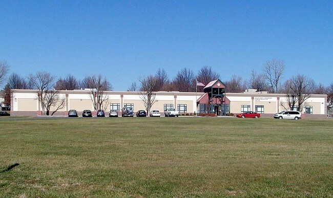
Property Record
614 Mill St, Belton, MO 64012

Property Detail
614 Mill St
05-06-14-200-001-120.001
W2 S2 NW NW
Publicschool
Cass
B and X Area of moderate flood hazard, usually the area between the limits of the 100-year and 500-year floods.
Missouri
0
10 AC
2025
Cass County
060202
Kansas City
28,800 SF
Kansas City, MO-KS
NEARBY LISTINGS FOR SALE OR LEASE
-
-
View all Belton listings for sale on LoopNet.com
DEMOGRAPHICS near 614 Mill St
1 mile
3 mile
5 mile
2025 Total Population
8,071
29,867
64,093
2030 Population
8,320
31,152
66,705
Pop Growth 2025-2030
+ 3.09%
+ 4.30%
+ 4.08%
Average Age
40
39
40
2025 Total Households
3,172
11,833
24,660
HH Growth 2025-2030
+ 3.34%
+ 4.57%
+ 4.22%
Median Household Inc
$69,149
$66,105
$75,822
Avg Household Size
2.50
2.50
2.50
2025 Avg HH Vehicles
2.00
2.00
2.00
Median Home Value
$184,959
$193,535
$271,417
Median Year Built
1975
1988
1992
Nearby Places
Map Layers
Map Styles
 Street
 Aerial
Layers
 Traffic
 Biking
Places
Listings with unknown addresses are not visible on the map
- Restaurants
- Banks
- Shops
- Fitness
- Groceries
PUBLIC TRANSPORTATION
AIRPORT
Kansas City International
Drive
Walk
Distance
Kansas City International
58 min
42.1 mi
Nearby Properties
Address
Land Use
TOTAL SIZE
Lot Size
Zoning
Address
Land Use
TOTAL SIZE
Lot Size
Zoning
38.18 AC
Address
Land Use
TOTAL SIZE
Lot Size
Zoning
11.65 AC
Address
Land Use
TOTAL SIZE
Lot Size
Zoning
4,490 SF
27.52 AC
Address
Land Use
TOTAL SIZE
Lot Size
Zoning
456,840 SF
29.46 AC
Address
Land Use
TOTAL SIZE
Lot Size
Zoning
15.22 AC
Address
Land Use
TOTAL SIZE
Lot Size
Zoning
366,600 SF
9 AC
Address
Land Use
TOTAL SIZE
Lot Size
Zoning
646,513 SF
113.86 AC
Address
Land Use
TOTAL SIZE
Lot Size
Zoning
631,055 SF
71.76 AC
Address
Land Use
TOTAL SIZE
Lot Size
Zoning
267,428 SF
Address
Land Use
TOTAL SIZE
Lot Size
Zoning
425,779 SF
23.23 AC
Address
Land Use
TOTAL SIZE
Lot Size
Zoning
372,085 SF
17.16 AC
Address
Land Use
TOTAL SIZE
Lot Size
Zoning
446,900 SF
19.33 AC
Address
Land Use
TOTAL SIZE
Lot Size
Zoning
944,109 SF
17.75 AC
Address
Land Use
TOTAL SIZE
Lot Size
Zoning
90,842 SF
9 AC
Address
Land Use
TOTAL SIZE
Lot Size
Zoning
53,306 SF
6.70 AC
Address
Land Use
TOTAL SIZE
Lot Size
Zoning
313,997 SF
20.57 AC
Address
Land Use
TOTAL SIZE
Lot Size
Zoning
17,590 SF
18.30 AC
Address
Land Use
TOTAL SIZE
Lot Size
Zoning
5.46 AC
Address
Land Use
TOTAL SIZE
Lot Size
Zoning
402,609 SF
15.11 AC
Address
Land Use
TOTAL SIZE
Lot Size
Zoning
611,460 SF
23.70 AC
Address
Land Use
TOTAL SIZE
Lot Size
Zoning
76,487 SF
9.69 AC
Address
Land Use
TOTAL SIZE
Lot Size
Zoning
Address
Land Use
TOTAL SIZE
Lot Size
Zoning
567,823 SF
9.81 AC
Address
Land Use
TOTAL SIZE
Lot Size
Zoning
91,621 SF
271.60 AC
Address
Land Use
TOTAL SIZE
Lot Size
Zoning
126,730 SF
11.29 AC
Address
Land Use
TOTAL SIZE
Lot Size
Zoning
36,260 SF
18.30 AC
Address
Land Use
TOTAL SIZE
Lot Size
Zoning
57,836 SF
6.49 AC
Address
Land Use
TOTAL SIZE
Lot Size
Zoning
98,070 SF
13.80 AC
Address
Land Use
TOTAL SIZE
Lot Size
Zoning
234,842 SF
7.97 AC
Address
Land Use
TOTAL SIZE
Lot Size
Zoning
81,294 SF
0.50 AC
The World's #1 Commercial Real Estate Marketplace
Connect with us
© 2026 CoStar Group
The information above has been obtained from sources believed reliable. While we do not doubt its accuracy we have not verified it and make no guarantee, warranty or representation about it. It is your responsibility to independently confirm its accuracy and completeness. Any projections, opinions, assumptions, or estimates used are for example only and do not represent the current or future performance of the property. The value of this transaction to you depends on tax and other factors which should be evaluated by your tax, financial, and legal advisors. You and your advisors should conduct a careful, independent investigation of the property to determine to your satisfaction the suitability of the property for your needs.