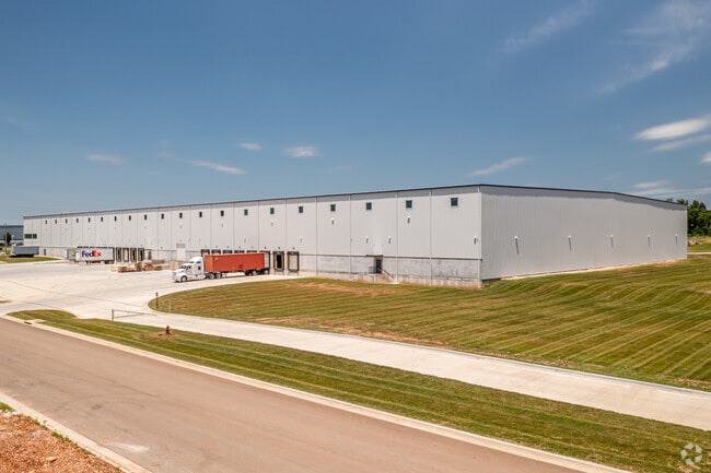
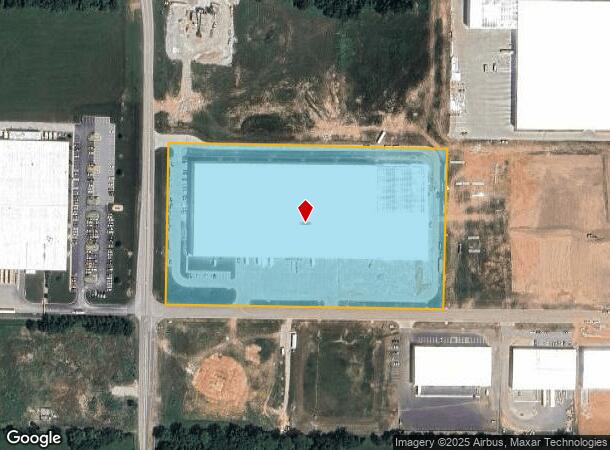
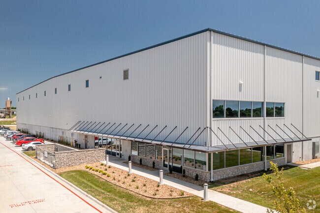
Property Record
614 S State Highway 125, Strafford, MO 65757
NEARBY LISTINGS FOR SALE OR LEASE
Property Detail
614 S State Highway 125
Springfield, MO
STRAFFORD IRR 79.44A M/L LOT 5 NW1/4 (EX NEW R/W) 4/29/20
11-04-208-039
Greene
Warehouse
Missouri
X
5
29077C0244E
10 AC
0
Outlying Greene County
2025
Springfield
004601
DEMOGRAPHICS near 614 S State Highway 125
1 Mile
3 Mile
5 Mile
2024 Total Population
929
4,413
9,907
2029 Population
957
4,553
10,283
Pop Growth 2024-2029
+ 3.01%
+ 3.17%
+ 3.80%
Average Age
40
40
42
2024 Total Households
359
1,682
3,858
HH Growth 2024-2029
+ 3.34%
+ 3.21%
+ 3.89%
Median Household Inc
$58,666
$65,083
$76,596
Avg Household Size
2.50
2.50
2.50
2024 Avg HH Vehicles
2.00
2.00
2.00
Median Home Value
$205,000
$232,036
$287,057
Median Year Built
1982
1987
1990
Nearby Places
Map Layers
Map Styles
 Street
 Aerial
- Restaurants
- Banks
- Shops
- Fitness
- Groceries
PUBLIC TRANSPORTATION
AIRPORT
Springfield-Branson Ntl
DRIVE
WALK
Distance
Springfield-Branson Ntl
29 min
18.9 mi
Freight Ports
Tulsa Port of Inola
DRIVE
WALK
Distance
Tulsa Port of Inola
202 min
181.3 mi
Nearby Properties
Address
Land Use
TOTAL SIZE
Lot Size
Zoning
Address
Land Use
TOTAL SIZE
Lot Size
Zoning
20.01 AC
Address
Land Use
TOTAL SIZE
Lot Size
Zoning
9.17 AC
INC.
Address
Land Use
TOTAL SIZE
Lot Size
Zoning
8.66 AC
INC
Address
Land Use
TOTAL SIZE
Lot Size
Zoning
31.56 AC
INC
Address
Land Use
TOTAL SIZE
Lot Size
Zoning
10.11 AC
INC
Address
Land Use
TOTAL SIZE
Lot Size
Zoning
85.20 AC
Address
Land Use
TOTAL SIZE
Lot Size
Zoning
10.07 AC
INC.
Address
Land Use
TOTAL SIZE
Lot Size
Zoning
75,471 SF
22.31 AC
INC
Address
Land Use
TOTAL SIZE
Lot Size
Zoning
92,899 SF
33.70 AC
M-1
Address
Land Use
TOTAL SIZE
Lot Size
Zoning
17.48 AC
INC
Address
Land Use
TOTAL SIZE
Lot Size
Zoning
Address
Land Use
TOTAL SIZE
Lot Size
Zoning
17.36 AC
INC.
Address
Land Use
TOTAL SIZE
Lot Size
Zoning
12.03 AC
INC
Address
Land Use
TOTAL SIZE
Lot Size
Zoning
14.70 AC
M-1
Address
Land Use
TOTAL SIZE
Lot Size
Zoning
61,640 SF
34.65 AC
INC
Address
Land Use
TOTAL SIZE
Lot Size
Zoning
Address
Land Use
TOTAL SIZE
Lot Size
Zoning
15,626 SF
3.03 AC
INC
Address
Land Use
TOTAL SIZE
Lot Size
Zoning
40,920 SF
4.20 AC
M-1
Address
Land Use
TOTAL SIZE
Lot Size
Zoning
2.97 AC
INC
Address
Land Use
TOTAL SIZE
Lot Size
Zoning
23,806 SF
42.74 AC
INC
Address
Land Use
TOTAL SIZE
Lot Size
Zoning
2.79 AC
INC
Address
Land Use
TOTAL SIZE
Lot Size
Zoning
6.93 AC
INC
Address
Land Use
TOTAL SIZE
Lot Size
Zoning
31,101 SF
12 AC
INC
Address
Land Use
TOTAL SIZE
Lot Size
Zoning
1,364 SF
14.79 AC
INC
Address
Land Use
TOTAL SIZE
Lot Size
Zoning
8.98 AC
INC
Address
Land Use
TOTAL SIZE
Lot Size
Zoning
Address
Land Use
TOTAL SIZE
Lot Size
Zoning
22,450 SF
31.65 AC
INC
Address
Land Use
TOTAL SIZE
Lot Size
Zoning
4.90 AC
INC
Address
Land Use
TOTAL SIZE
Lot Size
Zoning
2.06 AC
INC.
The World's #1 Commercial Real Estate Marketplace
Connect with us
© 2025 CoStar Group
The information above has been obtained from sources believed reliable. While we do not doubt its accuracy we have not verified it and make no guarantee, warranty or representation about it. It is your responsibility to independently confirm its accuracy and completeness. Any projections, opinions, assumptions, or estimates used are for example only and do not represent the current or future performance of the property. The value of this transaction to you depends on tax and other factors which should be evaluated by your tax, financial, and legal advisors. You and your advisors should conduct a careful, independent investigation of the property to determine to your satisfaction the suitability of the property for your needs.