Property Record
6141 N Vine St, Vacaville, CA 95688


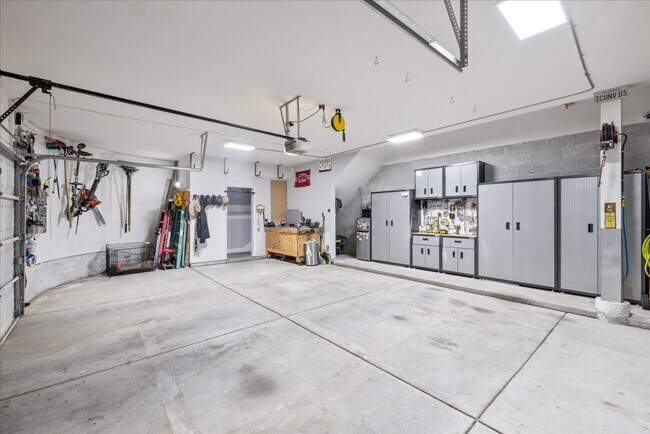
This Property Is For Sale
NEARBY LISTINGS FOR SALE OR LEASE
-
-
View all Vacaville listings for sale on LoopNet.com
Property Detail
6141 N Vine St
Vallejo, CA
North Vine Street Estates
0123-433-040
Solano
Sfr
California
X
0.50 AC
06113C0700G
Vacaville/Dixon
3,324 SF
North Bay/Santa Rosa
DEMOGRAPHICS near 6141 N Vine St
1 Mile
3 Mile
5 Mile
2024 Total Population
6,568
50,584
106,271
2029 Population
6,557
50,887
106,937
Pop Growth 2024-2029
(0.17%)
+ 0.60%
+ 0.63%
Average Age
42
41
41
2024 Total Households
2,280
19,379
36,623
HH Growth 2024-2029
(0.18%)
+ 0.68%
+ 0.65%
Median Household Inc
$146,841
$103,517
$112,061
Avg Household Size
2.80
2.60
2.70
2024 Avg HH Vehicles
2.00
2.00
2.00
Median Home Value
$762,468
$706,847
$716,253
Median Year Built
1983
1979
1984
Nearby Places
Map Layers
Map Styles
 Street
 Aerial
- Restaurants
- Banks
- Shops
- Fitness
- Groceries
PUBLIC TRANSPORTATION
COMMUTER RAIL
Fairfield-Vacaville (Capitol Corridor - Amtrak)
DRIVE
WALK
Distance
Fairfield-Vacaville (Capitol Corridor - Amtrak)
15 min
7.3 mi
Freight Ports
Port of Richmond
DRIVE
WALK
Distance
Port of Richmond
61 min
45.8 mi
Nearby Properties
Address
Land Use
TOTAL SIZE
Lot Size
Zoning
Address
Land Use
TOTAL SIZE
Lot Size
Zoning
Address
Land Use
TOTAL SIZE
Lot Size
Zoning
47.87 AC
Address
Land Use
TOTAL SIZE
Lot Size
Zoning
69.49 AC
Address
Land Use
TOTAL SIZE
Lot Size
Zoning
12.64 AC
Address
Land Use
TOTAL SIZE
Lot Size
Zoning
332,833 SF
18.53 AC
Address
Land Use
TOTAL SIZE
Lot Size
Zoning
104,468 SF
1.30 AC
Address
Land Use
TOTAL SIZE
Lot Size
Zoning
210,900 SF
26.31 AC
Address
Land Use
TOTAL SIZE
Lot Size
Zoning
241,629 SF
9.99 AC
Address
Land Use
TOTAL SIZE
Lot Size
Zoning
151,756 SF
10.07 AC
Address
Land Use
TOTAL SIZE
Lot Size
Zoning
159,056 SF
11.07 AC
Address
Land Use
TOTAL SIZE
Lot Size
Zoning
7.69 AC
Address
Land Use
TOTAL SIZE
Lot Size
Zoning
224,536 SF
11.77 AC
CG W/RES O
Address
Land Use
TOTAL SIZE
Lot Size
Zoning
597,816 SF
32.25 AC
Address
Land Use
TOTAL SIZE
Lot Size
Zoning
11.52 AC
Address
Land Use
TOTAL SIZE
Lot Size
Zoning
173,016 SF
13.79 AC
Address
Land Use
TOTAL SIZE
Lot Size
Zoning
9.78 AC
Address
Land Use
TOTAL SIZE
Lot Size
Zoning
Address
Land Use
TOTAL SIZE
Lot Size
Zoning
164,256 SF
6.74 AC
Address
Land Use
TOTAL SIZE
Lot Size
Zoning
323,918 SF
7.18 AC
Address
Land Use
TOTAL SIZE
Lot Size
Zoning
321,651 SF
21.29 AC
Address
Land Use
TOTAL SIZE
Lot Size
Zoning
7,302 SF
17.10 AC
Address
Land Use
TOTAL SIZE
Lot Size
Zoning
242,472 SF
12.13 AC
Address
Land Use
TOTAL SIZE
Lot Size
Zoning
242,472 SF
12.39 AC
Address
Land Use
TOTAL SIZE
Lot Size
Zoning
323,918 SF
7.72 AC
Address
Land Use
TOTAL SIZE
Lot Size
Zoning
234,916 SF
11.25 AC
Address
Land Use
TOTAL SIZE
Lot Size
Zoning
252,423 SF
14.03 AC
Address
Land Use
TOTAL SIZE
Lot Size
Zoning
42.62 AC
Address
Land Use
TOTAL SIZE
Lot Size
Zoning
177,626 SF
10.04 AC
Address
Land Use
TOTAL SIZE
Lot Size
Zoning
131,348 SF
14.77 AC
Address
Land Use
TOTAL SIZE
Lot Size
Zoning
15.39 AC
The World's #1 Commercial Real Estate Marketplace
Connect with us
© 2026 CoStar Group
The information above has been obtained from sources believed reliable. While we do not doubt its accuracy we have not verified it and make no guarantee, warranty or representation about it. It is your responsibility to independently confirm its accuracy and completeness. Any projections, opinions, assumptions, or estimates used are for example only and do not represent the current or future performance of the property. The value of this transaction to you depends on tax and other factors which should be evaluated by your tax, financial, and legal advisors. You and your advisors should conduct a careful, independent investigation of the property to determine to your satisfaction the suitability of the property for your needs.