Property Record
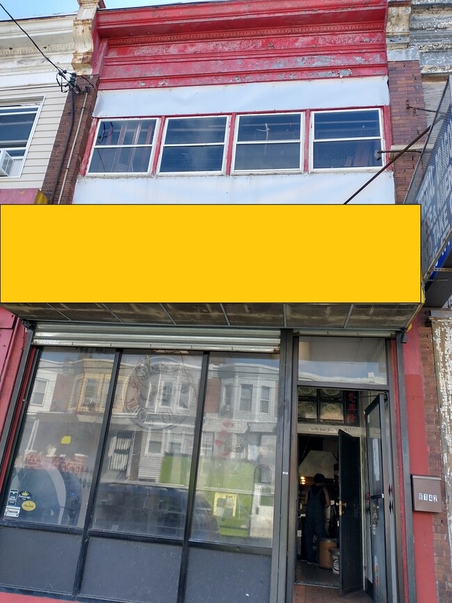
6142 Lansdowne Ave, Philadelphia, PA 19151


Current Lease Availabilities
NEARBY LISTINGS FOR SALE OR LEASE
Property Detail
6142 Lansdowne Ave
871545980
1217/8 W ROBINSON
Commercialnec
Philadelphia
X
Pennsylvania
42091C0451G
57
2024
0.03 AC
2026
West Philadelphia
010100
Philadelphia
1,824 SF
Philadelphia-Camden-Wilmington, PA-NJ-DE-MD
DEMOGRAPHICS near 6142 Lansdowne Ave
1 Mile
3 Mile
5 Mile
2024 Total Population
53,332
334,218
855,599
2029 Population
51,566
328,803
842,611
Pop Growth 2024-2029
(3.31%)
(1.62%)
(1.52%)
Average Age
39
38
38
2024 Total Households
21,452
132,269
356,918
HH Growth 2024-2029
(3.54%)
(1.80%)
(1.77%)
Median Household Inc
$40,238
$48,642
$58,486
Avg Household Size
2.40
2.30
2.20
2024 Avg HH Vehicles
1.00
1.00
1.00
Median Home Value
$136,530
$187,115
$250,001
Median Year Built
1946
1948
1949
Nearby Places
Map Layers
Map Styles
 Street
 Aerial
- Restaurants
- Banks
- Shops
- Fitness
- Groceries
PUBLIC TRANSPORTATION
TRANSIT/SUBWAY
Lansdowne Avenue and 62nd Street (Route 10 - Southeastern Pennsylvania Transportation Authority Rapid Transit (SEPTA Subway & Trolley))
DRIVE
WALK
Distance
Lansdowne Avenue and 62nd Street (Route 10 - Southeastern Pennsylvania Transportation Authority Rapid Transit (SEPTA Subway & Trolley))
0 min
1 min
0.0 mi
Lansdowne Avenue and 61st Street (Route 10 - Southeastern Pennsylvania Transportation Authority Rapid Transit (SEPTA Subway & Trolley))
DRIVE
WALK
Distance
Lansdowne Avenue and 61st Street (Route 10 - Southeastern Pennsylvania Transportation Authority Rapid Transit (SEPTA Subway & Trolley))
0 min
2 min
0.1 mi
Lansdowne Avenue and 63rd Street (Route 10 - Southeastern Pennsylvania Transportation Authority Rapid Transit (SEPTA Subway & Trolley))
DRIVE
WALK
Distance
Lansdowne Avenue and 63rd Street (Route 10 - Southeastern Pennsylvania Transportation Authority Rapid Transit (SEPTA Subway & Trolley))
0 min
3 min
0.1 mi
Lansdowne Avenue and 60th Street (Route 10 - Southeastern Pennsylvania Transportation Authority Rapid Transit (SEPTA Subway & Trolley))
DRIVE
WALK
Distance
Lansdowne Avenue and 60th Street (Route 10 - Southeastern Pennsylvania Transportation Authority Rapid Transit (SEPTA Subway & Trolley))
0 min
3 min
0.2 mi
Lansdowne Avenue and 59th Street (Route 10 - Southeastern Pennsylvania Transportation Authority Rapid Transit (SEPTA Subway & Trolley))
DRIVE
WALK
Distance
Lansdowne Avenue and 59th Street (Route 10 - Southeastern Pennsylvania Transportation Authority Rapid Transit (SEPTA Subway & Trolley))
1 min
5 min
0.2 mi
COMMUTER RAIL
Overbrook (R5 - Southeastern Pennsylvania Transportation Authority Regional Rail (SEPTA Regional Rail))
DRIVE
WALK
Distance
Overbrook (R5 - Southeastern Pennsylvania Transportation Authority Regional Rail (SEPTA Regional Rail))
3 min
1.2 mi
Wynnefield Avenue (R6 - Southeastern Pennsylvania Transportation Authority Regional Rail (SEPTA Regional Rail))
DRIVE
WALK
Distance
Wynnefield Avenue (R6 - Southeastern Pennsylvania Transportation Authority Regional Rail (SEPTA Regional Rail))
6 min
1.8 mi
AIRPORT
Philadelphia International
DRIVE
WALK
Distance
Philadelphia International
24 min
9.5 mi
Trenton Mercer
DRIVE
WALK
Distance
Trenton Mercer
59 min
38.5 mi
Freight Ports
South Jersey Port
DRIVE
WALK
Distance
South Jersey Port
19 min
9.0 mi
Nearby Properties
Address
Land Use
TOTAL SIZE
Lot Size
Zoning
Address
Land Use
TOTAL SIZE
Lot Size
Zoning
696,920 SF
10.55 AC
SPINS
Address
Land Use
TOTAL SIZE
Lot Size
Zoning
376,874 SF
3.14 AC
SPINS
Address
Land Use
TOTAL SIZE
Lot Size
Zoning
428,400 SF
1.02 AC
CMX4
Address
Land Use
TOTAL SIZE
Lot Size
Zoning
373,040 SF
4.17 AC
SPINS
Address
Land Use
TOTAL SIZE
Lot Size
Zoning
391,885 SF
7.15 AC
RM4
Address
Land Use
TOTAL SIZE
Lot Size
Zoning
239,760 SF
5.51 AC
SPINS
Address
Land Use
TOTAL SIZE
Lot Size
Zoning
2,178,860 SF
48.65 AC
R3
Address
Land Use
TOTAL SIZE
Lot Size
Zoning
473,400 SF
0.86 AC
CMX4
Address
Land Use
TOTAL SIZE
Lot Size
Zoning
Address
Land Use
TOTAL SIZE
Lot Size
Zoning
Address
Land Use
TOTAL SIZE
Lot Size
Zoning
354,372 SF
1 AC
CMX4
Address
Land Use
TOTAL SIZE
Lot Size
Zoning
158,496 SF
Address
Land Use
TOTAL SIZE
Lot Size
Zoning
269,171 SF
2.64 AC
SPINS
Address
Land Use
TOTAL SIZE
Lot Size
Zoning
295,293 SF
0.72 AC
CMX4
Address
Land Use
TOTAL SIZE
Lot Size
Zoning
415,239 SF
0.03 AC
CMX4
Address
Land Use
TOTAL SIZE
Lot Size
Zoning
Address
Land Use
TOTAL SIZE
Lot Size
Zoning
300,000 SF
0.37 AC
CMX4
Address
Land Use
TOTAL SIZE
Lot Size
Zoning
175,069 SF
2.20 AC
CMX3
Address
Land Use
TOTAL SIZE
Lot Size
Zoning
206,365 SF
3.40 AC
RSA5
Address
Land Use
TOTAL SIZE
Lot Size
Zoning
473,841 SF
CMX4
Address
Land Use
TOTAL SIZE
Lot Size
Zoning
500,000 SF
3.50 AC
SPINS
Address
Land Use
TOTAL SIZE
Lot Size
Zoning
76,614 SF
1.53 AC
CMX3
Address
Land Use
TOTAL SIZE
Lot Size
Zoning
1,455,130 SF
6.80 AC
RSD3
Address
Land Use
TOTAL SIZE
Lot Size
Zoning
172,000 SF
0.55 AC
CMX4
Address
Land Use
TOTAL SIZE
Lot Size
Zoning
451,857 SF
3.57 AC
CMX2
Address
Land Use
TOTAL SIZE
Lot Size
Zoning
1,188,574 SF
12.58 AC
CMX4
Address
Land Use
TOTAL SIZE
Lot Size
Zoning
162,000 SF
8.16 AC
SPPOA
Address
Land Use
TOTAL SIZE
Lot Size
Zoning
1,600 SF
177.07 AC
SPPOA
Address
Land Use
TOTAL SIZE
Lot Size
Zoning
154,555 SF
1.42 AC
SPINS
Address
Land Use
TOTAL SIZE
Lot Size
Zoning
253,400 SF
10.90 AC
RM2
The World's #1 Commercial Real Estate Marketplace
Connect with us
© 2025 CoStar Group
The information above has been obtained from sources believed reliable. While we do not doubt its accuracy we have not verified it and make no guarantee, warranty or representation about it. It is your responsibility to independently confirm its accuracy and completeness. Any projections, opinions, assumptions, or estimates used are for example only and do not represent the current or future performance of the property. The value of this transaction to you depends on tax and other factors which should be evaluated by your tax, financial, and legal advisors. You and your advisors should conduct a careful, independent investigation of the property to determine to your satisfaction the suitability of the property for your needs.