Property Record
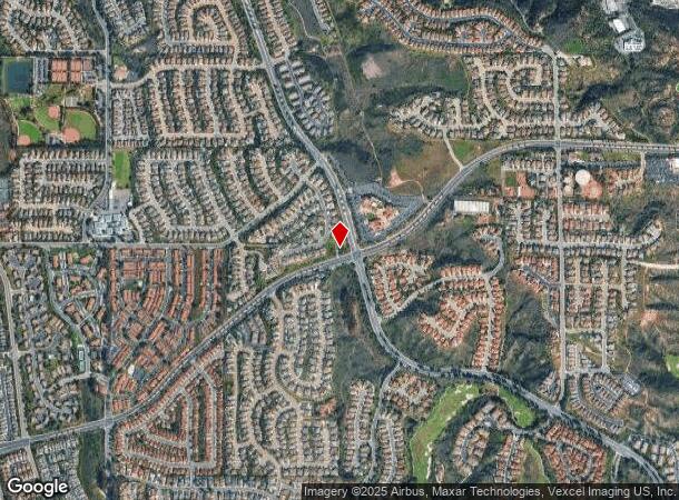
6145 E Laurel Tree Rd, Carlsbad, CA 92011
Property Detail
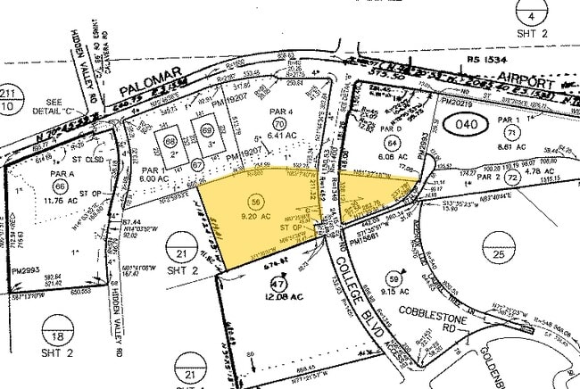
6145 E Laurel Tree Rd
212-040-56
LOT G (EX ST)DOC95-277435 IN TR 000823
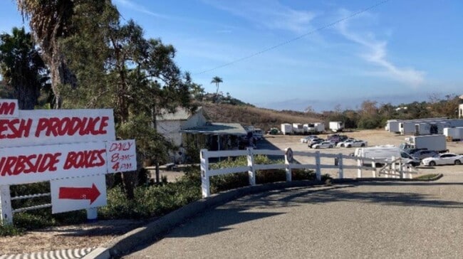
Warehouse
SAN DIEGO
RD-M
California
B and X Area of moderate flood hazard, usually the area between the limits of the 100-year and 500-year floods.
g
2022
9.20 AC
2022
Carlsbad
017811
San Diego
8,000 SF
San Diego-Chula Vista-Carlsbad, CA
NEARBY LISTINGS FOR SALE OR LEASE
DEMOGRAPHICS near 6145 E Laurel Tree Rd
1 mile
3 mile
5 mile
2025 Total Population
7,658
53,242
173,057
2030 Population
7,686
53,735
173,864
Pop Growth 2025-2030
+ 0.37%
+ 0.93%
+ 0.47%
Average Age
41
44
43
2025 Total Households
2,913
20,688
68,363
HH Growth 2025-2030
+ 0.31%
+ 0.82%
+ 0.44%
Median Household Inc
$191,170
$154,671
$131,905
Avg Household Size
2.60
2.50
2.50
2025 Avg HH Vehicles
2.00
2.00
2.00
Median Home Value
$1,057,097
$1,095,579
$1,056,395
Median Year Built
1990
1993
1986
Nearby Places
Map Layers
Map Styles
 Street
 Aerial
Transit
 Traffic
 Biking
Places
Listings with unknown addresses are not visible on the map
- Restaurants
- Banks
- Shops
- Fitness
- Groceries
PUBLIC TRANSPORTATION
COMMUTER RAIL
Carlsbad Poinsettia (Coaster - San Diego North County Transit District (Coaster/Sprinter/Breeze))
Drive
Walk
Distance
Carlsbad Poinsettia (Coaster - San Diego North County Transit District (Coaster/Sprinter/Breeze))
4 min
1.9 mi
Encinitas (Coaster - San Diego North County Transit District (Coaster/Sprinter/Breeze))
Drive
Walk
Distance
Encinitas (Coaster - San Diego North County Transit District (Coaster/Sprinter/Breeze))
9 min
5.7 mi
AIRPORT
San Diego International
Drive
Walk
Distance
San Diego International
37 min
29.1 mi
Freight Ports
Port of San Diego
Drive
Walk
Distance
Port of San Diego
42 min
33.4 mi
Nearby Properties
Address
Land Use
TOTAL SIZE
Lot Size
Zoning
Address
Land Use
TOTAL SIZE
Lot Size
Zoning
132.11 AC
C-T-Q
Address
Land Use
TOTAL SIZE
Lot Size
Zoning
55.06 AC
P-C
Address
Land Use
TOTAL SIZE
Lot Size
Zoning
30.88 AC
P-C
Address
Land Use
TOTAL SIZE
Lot Size
Zoning
26.65 AC
C-2-Q
Address
Land Use
TOTAL SIZE
Lot Size
Zoning
12.62 AC
P-C
Address
Land Use
TOTAL SIZE
Lot Size
Zoning
4.32 AC
N-LVSC
Address
Land Use
TOTAL SIZE
Lot Size
Zoning
21.15 AC
P-C
Address
Land Use
TOTAL SIZE
Lot Size
Zoning
8.76 AC
P-C
Address
Land Use
TOTAL SIZE
Lot Size
Zoning
12.71 AC
P-M
Address
Land Use
TOTAL SIZE
Lot Size
Zoning
7.31 AC
P-C
Address
Land Use
TOTAL SIZE
Lot Size
Zoning
28.15 AC
C-M
Address
Land Use
TOTAL SIZE
Lot Size
Zoning
12.49 AC
P-C
Address
Land Use
TOTAL SIZE
Lot Size
Zoning
16.79 AC
R-3-Q
Address
Land Use
TOTAL SIZE
Lot Size
Zoning
10.96 AC
C-M
Address
Land Use
TOTAL SIZE
Lot Size
Zoning
13.86 AC
C-M
Address
Land Use
TOTAL SIZE
Lot Size
Zoning
13.07 AC
P-M
Address
Land Use
TOTAL SIZE
Lot Size
Zoning
18.34 AC
P-C
Address
Land Use
TOTAL SIZE
Lot Size
Zoning
9.69 AC
C-T-Q
Address
Land Use
TOTAL SIZE
Lot Size
Zoning
5.45 AC
C-T
Address
Land Use
TOTAL SIZE
Lot Size
Zoning
20.86 AC
P-M-Q
Address
Land Use
TOTAL SIZE
Lot Size
Zoning
14.73 AC
C-L
Address
Land Use
TOTAL SIZE
Lot Size
Zoning
60.48 AC
OS
Address
Land Use
TOTAL SIZE
Lot Size
Zoning
91,431 SF
8.69 AC
C-2
Address
Land Use
TOTAL SIZE
Lot Size
Zoning
11.10 AC
RD-M-Q
Address
Land Use
TOTAL SIZE
Lot Size
Zoning
3.17 AC
C-T
Address
Land Use
TOTAL SIZE
Lot Size
Zoning
7.42 AC
P-M
Address
Land Use
TOTAL SIZE
Lot Size
Zoning
9.74 AC
C-M
Address
Land Use
TOTAL SIZE
Lot Size
Zoning
10.44 AC
P-M
Address
Land Use
TOTAL SIZE
Lot Size
Zoning
6.38 AC
P-M
Address
Land Use
TOTAL SIZE
Lot Size
Zoning
7.38 AC
P-M-Q
The World's #1 Commercial Real Estate Marketplace
Connect with us
© 2026 CoStar Group
The information above has been obtained from sources believed reliable. While we do not doubt its accuracy we have not verified it and make no guarantee, warranty or representation about it. It is your responsibility to independently confirm its accuracy and completeness. Any projections, opinions, assumptions, or estimates used are for example only and do not represent the current or future performance of the property. The value of this transaction to you depends on tax and other factors which should be evaluated by your tax, financial, and legal advisors. You and your advisors should conduct a careful, independent investigation of the property to determine to your satisfaction the suitability of the property for your needs.