Property Record
6145 Us Highway 271, Tyler, TX 75708


Property Detail
6145 Us Highway 271
1-00000-0771-00-029000
ABST A0771 T PUGH ABST A0771 T PUGH TRACT 29A TRACT 29
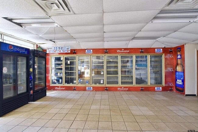
Servicestationmarket
Smith
B and X Area of moderate flood hazard, usually the area between the limits of the 100-year and 500-year floods.
Texas
2025
0.51 AC
2025
Tyler
001702
Other Market Areas
750 SF
Tyler, TX
NEARBY LISTINGS FOR SALE OR LEASE
DEMOGRAPHICS near 6145 Us Highway 271
1 mile
3 mile
5 mile
2024 Total Population
1,477
19,039
57,772
2029 Population
1,606
20,822
63,007
Pop Growth 2024-2029
+ 8.73%
+ 9.36%
+ 9.06%
Average Age
35
34
35
2024 Total Households
477
6,216
19,618
HH Growth 2024-2029
+ 8.39%
+ 8.90%
+ 8.56%
Median Household Inc
$57,021
$48,255
$47,685
Avg Household Size
3.00
2.90
2.70
2024 Avg HH Vehicles
2.00
2.00
2.00
Median Home Value
$138,950
$116,352
$120,228
Median Year Built
1970
1973
1965
Nearby Places
Map Layers
Map Styles
 Street
 Aerial
Transit
 Traffic
 Biking
Places
Listings with unknown addresses are not visible on the map
- Restaurants
- Banks
- Shops
- Fitness
- Groceries
PUBLIC TRANSPORTATION
AIRPORT
Tyler Pounds Regional
Drive
Walk
Distance
Tyler Pounds Regional
21 min
11.6 mi
SALE & LEASE HISTORY
LISTING DATE
SALE/LEASE

Jun 20, 2023
For Sale
Jan 12, 2018
For Sale
Feb 26, 2020
For Sale
Dec 27, 2023
For Sale
Nearby Properties
Address
Land Use
TOTAL SIZE
Lot Size
Zoning
Address
Land Use
TOTAL SIZE
Lot Size
Zoning
14,000 SF
144.13 AC
M2
Address
Land Use
TOTAL SIZE
Lot Size
Zoning
Address
Land Use
TOTAL SIZE
Lot Size
Zoning
Address
Land Use
TOTAL SIZE
Lot Size
Zoning
Address
Land Use
TOTAL SIZE
Lot Size
Zoning
111,750 SF
26 AC
Address
Land Use
TOTAL SIZE
Lot Size
Zoning
Address
Land Use
TOTAL SIZE
Lot Size
Zoning
25.54 AC
INT
Address
Land Use
TOTAL SIZE
Lot Size
Zoning
Address
Land Use
TOTAL SIZE
Lot Size
Zoning
520,081 SF
24.62 AC
M2
Address
Land Use
TOTAL SIZE
Lot Size
Zoning
3,222 SF
7.43 AC
RMF
Address
Land Use
TOTAL SIZE
Lot Size
Zoning
91.33 AC
M2
Address
Land Use
TOTAL SIZE
Lot Size
Zoning
1,375 SF
8.50 AC
RMF
Address
Land Use
TOTAL SIZE
Lot Size
Zoning
2,514 SF
10.58 AC
Address
Land Use
TOTAL SIZE
Lot Size
Zoning
Address
Land Use
TOTAL SIZE
Lot Size
Zoning
72,000 SF
24.16 AC
Address
Land Use
TOTAL SIZE
Lot Size
Zoning
2,454 SF
12.93 AC
M2
Address
Land Use
TOTAL SIZE
Lot Size
Zoning
3,319 SF
18 AC
Address
Land Use
TOTAL SIZE
Lot Size
Zoning
Address
Land Use
TOTAL SIZE
Lot Size
Zoning
14,588 SF
22.07 AC
Address
Land Use
TOTAL SIZE
Lot Size
Zoning
25.81 AC
R1B
Address
Land Use
TOTAL SIZE
Lot Size
Zoning
Address
Land Use
TOTAL SIZE
Lot Size
Zoning
59,269 SF
8.73 AC
Address
Land Use
TOTAL SIZE
Lot Size
Zoning
9,729 SF
2.73 AC
R2
Address
Land Use
TOTAL SIZE
Lot Size
Zoning
15,364 SF
43.24 AC
Address
Land Use
TOTAL SIZE
Lot Size
Zoning
2,400 SF
9.48 AC
Address
Land Use
TOTAL SIZE
Lot Size
Zoning
9,973 SF
8.24 AC
Address
Land Use
TOTAL SIZE
Lot Size
Zoning
40,985 SF
4.35 AC
M2
Address
Land Use
TOTAL SIZE
Lot Size
Zoning
8.97 AC
Address
Land Use
TOTAL SIZE
Lot Size
Zoning
14,400 SF
3.67 AC
Address
Land Use
TOTAL SIZE
Lot Size
Zoning
186,925 SF
6.11 AC
M2
The World's #1 Commercial Real Estate Marketplace
Connect with us
© 2026 CoStar Group
The information above has been obtained from sources believed reliable. While we do not doubt its accuracy we have not verified it and make no guarantee, warranty or representation about it. It is your responsibility to independently confirm its accuracy and completeness. Any projections, opinions, assumptions, or estimates used are for example only and do not represent the current or future performance of the property. The value of this transaction to you depends on tax and other factors which should be evaluated by your tax, financial, and legal advisors. You and your advisors should conduct a careful, independent investigation of the property to determine to your satisfaction the suitability of the property for your needs.