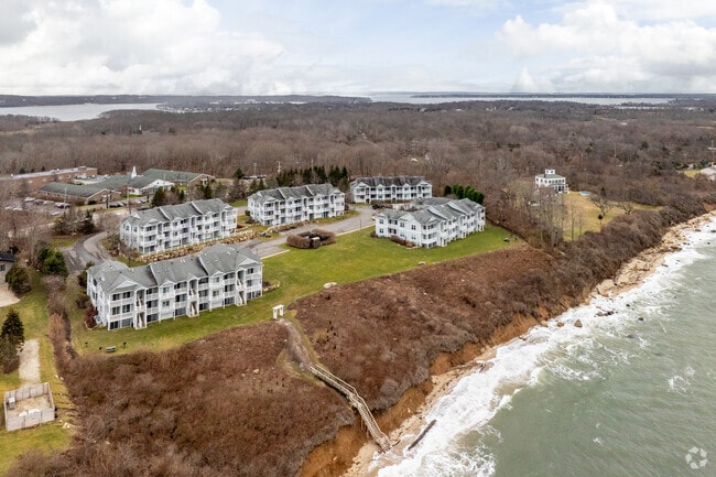
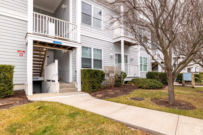
Property Record
61475 Route 48, Greenport, NY 11944
NEARBY LISTINGS FOR SALE OR LEASE
-
-
View all Greenport listings for sale on LoopNet.com
Property Detail
61475 Route 48
1000-045-01-02-00-011-000
Suffolk
Apartment
New York
X
21
36103C0157H
0.02 AC
2024
Suffolk
2024
Long Island (New York)
170205
Nassau County-Suffolk County, NY
DEMOGRAPHICS near 61475 Route 48
1 Mile
3 Mile
5 Mile
2024 Total Population
784
9,997
19,134
2029 Population
823
10,318
19,710
Pop Growth 2024-2029
+ 4.97%
+ 3.21%
+ 3.01%
Average Age
51
48
49
2024 Total Households
361
4,271
8,289
HH Growth 2024-2029
+ 4.99%
+ 3.32%
+ 3.00%
Median Household Inc
$86,363
$79,108
$92,086
Avg Household Size
2.00
2.20
2.20
2024 Avg HH Vehicles
2.00
2.00
2.00
Median Home Value
$751,497
$741,691
$761,614
Median Year Built
1978
1970
1972
Nearby Places
- Restaurants
- Banks
- Shops
- Fitness
- Groceries
PUBLIC TRANSPORTATION
COMMUTER RAIL
Greenport Station (Greenport Branch - Long Island Rail Road)
DRIVE
WALK
Distance
Greenport Station (Greenport Branch - Long Island Rail Road)
5 min
2.2 mi
Southold Station (Greenport Branch - Long Island Rail Road)
DRIVE
WALK
Distance
Southold Station (Greenport Branch - Long Island Rail Road)
6 min
3.6 mi
Freight Ports
Port of New Haven
DRIVE
WALK
Distance
Port of New Haven
167 min
73.4 mi
Nearby Properties
Address
Land Use
TOTAL SIZE
Lot Size
Zoning
Address
Land Use
TOTAL SIZE
Lot Size
Zoning
9,468 SF
3.20 AC
AA
Address
Land Use
TOTAL SIZE
Lot Size
Zoning
8.70 AC
AA
Address
Land Use
TOTAL SIZE
Lot Size
Zoning
2,076 SF
42.20 AC
AA
Address
Land Use
TOTAL SIZE
Lot Size
Zoning
904 SF
20.30 AC
AA
Address
Land Use
TOTAL SIZE
Lot Size
Zoning
2,000 SF
0.54 AC
B
Address
Land Use
TOTAL SIZE
Lot Size
Zoning
7,022 SF
0.70 AC
C
Address
Land Use
TOTAL SIZE
Lot Size
Zoning
0.74 AC
AA
Address
Land Use
TOTAL SIZE
Lot Size
Zoning
8.10 AC
A
Address
Land Use
TOTAL SIZE
Lot Size
Zoning
4.80 AC
A
Address
Land Use
TOTAL SIZE
Lot Size
Zoning
0.88 AC
AA
Address
Land Use
TOTAL SIZE
Lot Size
Zoning
778 SF
7.68 AC
AA
Address
Land Use
TOTAL SIZE
Lot Size
Zoning
4.12 AC
AA
Address
Land Use
TOTAL SIZE
Lot Size
Zoning
3,910 SF
0.30 AC
B
Address
Land Use
TOTAL SIZE
Lot Size
Zoning
3,709 SF
0.15 AC
B
Address
Land Use
TOTAL SIZE
Lot Size
Zoning
3,140 SF
0.62 AC
B
Address
Land Use
TOTAL SIZE
Lot Size
Zoning
4,402 SF
0.25 AC
R4
Address
Land Use
TOTAL SIZE
Lot Size
Zoning
3,579 SF
0.10 AC
B
Address
Land Use
TOTAL SIZE
Lot Size
Zoning
2,292 SF
0.25 AC
AA
Address
Land Use
TOTAL SIZE
Lot Size
Zoning
4,586 SF
1.10 AC
C
Address
Land Use
TOTAL SIZE
Lot Size
Zoning
Address
Land Use
TOTAL SIZE
Lot Size
Zoning
2,356 SF
0.41 AC
AA
Address
Land Use
TOTAL SIZE
Lot Size
Zoning
5,900 SF
0.12 AC
B
Address
Land Use
TOTAL SIZE
Lot Size
Zoning
2.70 AC
A
Address
Land Use
TOTAL SIZE
Lot Size
Zoning
1,632 SF
0.36 AC
B
Address
Land Use
TOTAL SIZE
Lot Size
Zoning
145.01 AC
HD R-80
Address
Land Use
TOTAL SIZE
Lot Size
Zoning
Address
Land Use
TOTAL SIZE
Lot Size
Zoning
1,200 SF
1.40 AC
B
Address
Land Use
TOTAL SIZE
Lot Size
Zoning
7,938 SF
0.41 AC
B1
Address
Land Use
TOTAL SIZE
Lot Size
Zoning
3.10 AC
A
Address
Land Use
TOTAL SIZE
Lot Size
Zoning
1.80 AC
AA
The World's #1 Commercial Real Estate Marketplace
Connect with us
© 2025 CoStar Group
The information above has been obtained from sources believed reliable. While we do not doubt its accuracy we have not verified it and make no guarantee, warranty or representation about it. It is your responsibility to independently confirm its accuracy and completeness. Any projections, opinions, assumptions, or estimates used are for example only and do not represent the current or future performance of the property. The value of this transaction to you depends on tax and other factors which should be evaluated by your tax, financial, and legal advisors. You and your advisors should conduct a careful, independent investigation of the property to determine to your satisfaction the suitability of the property for your needs.