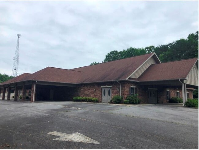
Property Record
615 E 52 Byp, Pilot Mountain, NC 27041

Property Detail
615 E 52 Byp
5976-17-12-5193-601
PB 39 PG 36
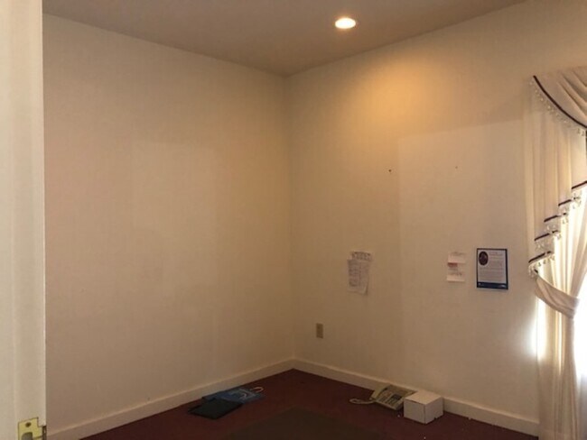
Officebuilding
Surry
HB
North Carolina
B and X Area of moderate flood hazard, usually the area between the limits of the 100-year and 500-year floods.
1.95 AC
0
Hickory/Morganton
2025
Other Market Areas
931200
Mount Airy, NC
10,016 SF
NEARBY LISTINGS FOR SALE OR LEASE
-
-
View all Pilot Mountain listings for sale on LoopNet.com
DEMOGRAPHICS near 615 E 52 Byp
1 mile
3 mile
5 mile
2025 Total Population
1,027
5,100
9,931
2030 Population
1,026
5,150
10,053
Pop Growth 2025-2030
(0.10%)
+ 0.98%
+ 1.23%
Average Age
42
43
43
2025 Total Households
443
2,172
4,140
HH Growth 2025-2030
0.00%
+ 0.97%
+ 1.23%
Median Household Inc
$67,777
$73,308
$73,755
Avg Household Size
2.30
2.30
2.40
2025 Avg HH Vehicles
2.00
2.00
2.00
Median Home Value
$224,752
$231,620
$231,230
Median Year Built
1976
1980
1982
Nearby Places
Map Layers
Map Styles
 Street
 Aerial
Layers
 Traffic
 Biking
Places
Listings with unknown addresses are not visible on the map
- Restaurants
- Banks
- Shops
- Fitness
- Groceries
SALE & LEASE HISTORY
LISTING DATE
SALE/LEASE

Feb 04, 2021
For Sale
Nearby Properties
Address
Land Use
TOTAL SIZE
Lot Size
Zoning
Address
Land Use
TOTAL SIZE
Lot Size
Zoning
97,223 SF
43.55 AC
RA
Address
Land Use
TOTAL SIZE
Lot Size
Zoning
58,340 SF
16.89 AC
R20
Address
Land Use
TOTAL SIZE
Lot Size
Zoning
19,656 SF
25.72 AC
R20
Address
Land Use
TOTAL SIZE
Lot Size
Zoning
7,147 SF
36.62 AC
RA
Address
Land Use
TOTAL SIZE
Lot Size
Zoning
50,542 SF
8.17 AC
GB
Address
Land Use
TOTAL SIZE
Lot Size
Zoning
5,198 SF
3.90 AC
GB
Address
Land Use
TOTAL SIZE
Lot Size
Zoning
1,584 SF
19.60 AC
RA
Address
Land Use
TOTAL SIZE
Lot Size
Zoning
6,478 SF
160.71 AC
RA
Address
Land Use
TOTAL SIZE
Lot Size
Zoning
39,082 SF
7.27 AC
GM
Address
Land Use
TOTAL SIZE
Lot Size
Zoning
10,125 SF
1.06 AC
CB
Address
Land Use
TOTAL SIZE
Lot Size
Zoning
18,128 SF
14.61 AC
RL
Address
Land Use
TOTAL SIZE
Lot Size
Zoning
3,072 SF
3.22 AC
RM
Address
Land Use
TOTAL SIZE
Lot Size
Zoning
12,446 SF
1.91 AC
HB
Address
Land Use
TOTAL SIZE
Lot Size
Zoning
4,000 SF
8.62 AC
HB
Address
Land Use
TOTAL SIZE
Lot Size
Zoning
832 SF
5.75 AC
RH
Address
Land Use
TOTAL SIZE
Lot Size
Zoning
24,650 SF
1.32 AC
RM
Address
Land Use
TOTAL SIZE
Lot Size
Zoning
17,664 SF
11.21 AC
GM
Address
Land Use
TOTAL SIZE
Lot Size
Zoning
16,535 SF
3.52 AC
GB
Address
Land Use
TOTAL SIZE
Lot Size
Zoning
11,580 SF
1.30 AC
CB
Address
Land Use
TOTAL SIZE
Lot Size
Zoning
13,366 SF
2.99 AC
R20
Address
Land Use
TOTAL SIZE
Lot Size
Zoning
49,908 SF
5.42 AC
GB
Address
Land Use
TOTAL SIZE
Lot Size
Zoning
68,980 SF
8.32 AC
GM
Address
Land Use
TOTAL SIZE
Lot Size
Zoning
172,456 SF
16.90 AC
GM
Address
Land Use
TOTAL SIZE
Lot Size
Zoning
10,640 SF
3 AC
HB
Address
Land Use
TOTAL SIZE
Lot Size
Zoning
13,000 SF
6.01 AC
GB
Address
Land Use
TOTAL SIZE
Lot Size
Zoning
9,586 SF
2.67 AC
GB
Address
Land Use
TOTAL SIZE
Lot Size
Zoning
4,759 SF
1.01 AC
GB
Address
Land Use
TOTAL SIZE
Lot Size
Zoning
52,192 SF
4.36 AC
GM
Address
Land Use
TOTAL SIZE
Lot Size
Zoning
8,160 SF
1.72 AC
GB
The World's #1 Commercial Real Estate Marketplace
Connect with us
© 2026 CoStar Group
The information above has been obtained from sources believed reliable. While we do not doubt its accuracy we have not verified it and make no guarantee, warranty or representation about it. It is your responsibility to independently confirm its accuracy and completeness. Any projections, opinions, assumptions, or estimates used are for example only and do not represent the current or future performance of the property. The value of this transaction to you depends on tax and other factors which should be evaluated by your tax, financial, and legal advisors. You and your advisors should conduct a careful, independent investigation of the property to determine to your satisfaction the suitability of the property for your needs.