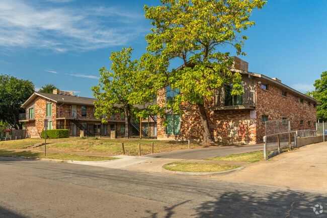
Property Record
615 Elsbeth St, Dallas, TX 75208
NEARBY LISTINGS FOR SALE OR LEASE
Property Detail
615 Elsbeth St
Dallas-Fort Worth-Arlington, TX
Miller & Stemmons
00000262942000000
MILLER & STEMMONS BLK 3/3325 LT 7 & S50FT LT 6 ACS 0.598 INT202400174380 DD08192024 CO-DC 3325 003 00700 2003325 003
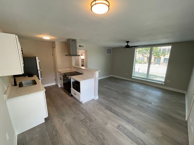
Apartment
Dallas
X
Texas
48113C0480K
7,6
2024
0.59 AC
2025
Bishop Arts District
004201
Dallas/Ft Worth
15,180 SF
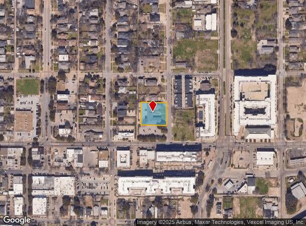
DEMOGRAPHICS near 615 Elsbeth St
1 Mile
3 Mile
5 Mile
2024 Total Population
20,819
142,799
382,951
2029 Population
21,253
143,655
385,145
Pop Growth 2024-2029
+ 2.08%
+ 0.60%
+ 0.57%
Average Age
36
36
36
2024 Total Households
8,177
54,247
159,448
HH Growth 2024-2029
+ 1.91%
+ 1.03%
+ 0.80%
Median Household Inc
$51,523
$58,602
$58,221
Avg Household Size
2.50
2.50
2.30
2024 Avg HH Vehicles
2.00
2.00
2.00
Median Home Value
$422,667
$250,966
$228,469
Median Year Built
1964
1965
1984
Nearby Places
Map Layers
Map Styles
 Street
 Aerial
- Restaurants
- Banks
- Shops
- Fitness
- Groceries
PUBLIC TRANSPORTATION
TRANSIT/SUBWAY
Bishop Arts Station (DALLAS STREETCAR - Dallas Area Rapid Transit (DART))
DRIVE
WALK
Distance
Bishop Arts Station (DALLAS STREETCAR - Dallas Area Rapid Transit (DART))
1 min
3 min
0.2 mi
6Th Streetcar Station (DALLAS STREETCAR - Dallas Area Rapid Transit (DART))
DRIVE
WALK
Distance
6Th Streetcar Station (DALLAS STREETCAR - Dallas Area Rapid Transit (DART))
1 min
6 min
0.4 mi
Beckley Streetcar Station (DALLAS STREETCAR - Dallas Area Rapid Transit (DART))
DRIVE
WALK
Distance
Beckley Streetcar Station (DALLAS STREETCAR - Dallas Area Rapid Transit (DART))
2 min
14 min
0.7 mi
Oakenwald Streetcar Station (DALLAS STREETCAR - Dallas Area Rapid Transit (DART))
DRIVE
WALK
Distance
Oakenwald Streetcar Station (DALLAS STREETCAR - Dallas Area Rapid Transit (DART))
2 min
18 min
0.9 mi
COMMUTER RAIL
Victory Station (DART LIGHT RAIL - GREEN LINE - Dallas Area Rapid Transit (DART), DART LIGHT RAIL - ORANGE LINE - Dallas Area Rapid Transit (DART), TRINITY RAILWAY - Dallas Area Rapid Transit (DART))
DRIVE
WALK
Distance
Victory Station (DART LIGHT RAIL - GREEN LINE - Dallas Area Rapid Transit (DART), DART LIGHT RAIL - ORANGE LINE - Dallas Area Rapid Transit (DART), TRINITY RAILWAY - Dallas Area Rapid Transit (DART))
7 min
3.6 mi
Medical/Market Ctr Station (TRINITY RAILWAY - Dallas Area Rapid Transit (DART))
DRIVE
WALK
Distance
Medical/Market Ctr Station (TRINITY RAILWAY - Dallas Area Rapid Transit (DART))
11 min
6.2 mi
AIRPORT
Dallas Love Field
DRIVE
WALK
Distance
Dallas Love Field
17 min
8.6 mi
Dallas-Fort Worth International
DRIVE
WALK
Distance
Dallas-Fort Worth International
31 min
22.7 mi
Freight Ports
Port of Shreveport
DRIVE
WALK
Distance
Port of Shreveport
216 min
199.0 mi
SALE & LEASE HISTORY
LISTING DATE
SALE/LEASE

Sep 16, 2021
For Sale
Nearby Properties
Address
Land Use
TOTAL SIZE
Lot Size
Zoning
Address
Land Use
TOTAL SIZE
Lot Size
Zoning
1,298,826 SF
33.16 AC
Z163
Address
Land Use
TOTAL SIZE
Lot Size
Zoning
815,000 SF
7.20 AC
Z239
Address
Land Use
TOTAL SIZE
Lot Size
Zoning
1,308,710 SF
8.42 AC
Z21
Address
Land Use
TOTAL SIZE
Lot Size
Zoning
1,480,246 SF
1.86 AC
Z21
Address
Land Use
TOTAL SIZE
Lot Size
Zoning
1,424,070 SF
1.36 AC
Z21
Address
Land Use
TOTAL SIZE
Lot Size
Zoning
893,159 SF
1.17 AC
Z21
Address
Land Use
TOTAL SIZE
Lot Size
Zoning
857,292 SF
1.47 AC
Z239
Address
Land Use
TOTAL SIZE
Lot Size
Zoning
638,046 SF
2.11 AC
Z239
Address
Land Use
TOTAL SIZE
Lot Size
Zoning
784,725 SF
2.33 AC
Z239
Address
Land Use
TOTAL SIZE
Lot Size
Zoning
180,000 SF
4.66 AC
Z116
Address
Land Use
TOTAL SIZE
Lot Size
Zoning
818,188 SF
2.89 AC
Z239
Address
Land Use
TOTAL SIZE
Lot Size
Zoning
536,660 SF
2.02 AC
Z239
Address
Land Use
TOTAL SIZE
Lot Size
Zoning
858,120 SF
2.21 AC
Z21
Address
Land Use
TOTAL SIZE
Lot Size
Zoning
2,326,857 SF
4.43 AC
Z21
Address
Land Use
TOTAL SIZE
Lot Size
Zoning
539,723 SF
0.58 AC
Z239
Address
Land Use
TOTAL SIZE
Lot Size
Zoning
432,919 SF
0.69 AC
Z21
Address
Land Use
TOTAL SIZE
Lot Size
Zoning
1,912,762 SF
1.54 AC
Z21
Address
Land Use
TOTAL SIZE
Lot Size
Zoning
1,979,594 SF
1.81 AC
Z21
Address
Land Use
TOTAL SIZE
Lot Size
Zoning
307,597 SF
15.21 AC
Z116
Address
Land Use
TOTAL SIZE
Lot Size
Zoning
1,173,721 SF
1.22 AC
Z21
Address
Land Use
TOTAL SIZE
Lot Size
Zoning
568,384 SF
1.04 AC
Z115
Address
Land Use
TOTAL SIZE
Lot Size
Zoning
1,018,066 SF
1.20 AC
Z21
Address
Land Use
TOTAL SIZE
Lot Size
Zoning
741,673 SF
1.30 AC
Z21
Address
Land Use
TOTAL SIZE
Lot Size
Zoning
732,117 SF
5 AC
Z239
Address
Land Use
TOTAL SIZE
Lot Size
Zoning
464,405 SF
1.41 AC
Z21
Address
Land Use
TOTAL SIZE
Lot Size
Zoning
517,345 SF
2.02 AC
Z239
Address
Land Use
TOTAL SIZE
Lot Size
Zoning
600,907 SF
3.88 AC
Z239
Address
Land Use
TOTAL SIZE
Lot Size
Zoning
724,888 SF
2.59 AC
Address
Land Use
TOTAL SIZE
Lot Size
Zoning
26,896 SF
3.56 AC
Z239
Address
Land Use
TOTAL SIZE
Lot Size
Zoning
288,971 SF
1.09 AC
Z239
The World's #1 Commercial Real Estate Marketplace
Connect with us
© 2025 CoStar Group
The information above has been obtained from sources believed reliable. While we do not doubt its accuracy we have not verified it and make no guarantee, warranty or representation about it. It is your responsibility to independently confirm its accuracy and completeness. Any projections, opinions, assumptions, or estimates used are for example only and do not represent the current or future performance of the property. The value of this transaction to you depends on tax and other factors which should be evaluated by your tax, financial, and legal advisors. You and your advisors should conduct a careful, independent investigation of the property to determine to your satisfaction the suitability of the property for your needs.