Property Record
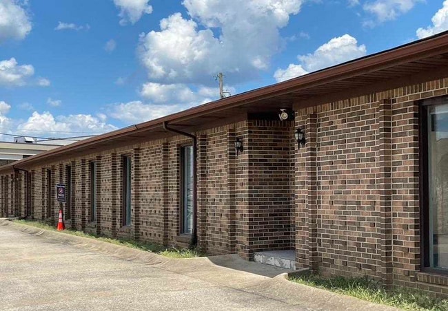
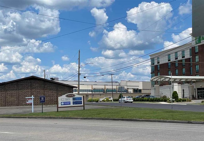
615 N 4Th St, Paducah, KY 42001

Property Detail
615 N 4Th St
Other Market Areas
1-33-1A,2-7,8A,17 615-633 NO 4TH L1-4
Paducah, KY-IL
MCCRACKEN
111-24-02-006
Kentucky
Commercialnec
1-4
2025
0.16 AC
2025
Kentucky West Area
031402
NEARBY LISTINGS FOR SALE OR LEASE
DEMOGRAPHICS near 615 N 4Th St
1 mile
3 mile
5 mile
2025 Total Population
4,081
19,780
36,866
2030 Population
4,117
19,850
36,924
Pop Growth 2025-2030
+ 0.88%
+ 0.35%
+ 0.16%
Average Age
42
40
41
2025 Total Households
1,407
8,496
15,954
HH Growth 2025-2030
+ 0.57%
+ 0.31%
+ 0.14%
Median Household Inc
$25,280
$36,085
$49,302
Avg Household Size
1.90
2.10
2.10
2025 Avg HH Vehicles
1.00
1.00
2.00
Median Home Value
$162,499
$96,378
$137,968
Median Year Built
1949
1961
1972
Nearby Places
Map Layers
Map Styles
 Street
 Aerial
Layers
 Traffic
 Biking
Places
Listings with unknown addresses are not visible on the map
- Restaurants
- Banks
- Shops
- Fitness
- Groceries
SALE & LEASE HISTORY
LISTING DATE
SALE/LEASE

Nov 10, 2023
For Sale
Nearby Properties
Address
Land Use
TOTAL SIZE
Lot Size
Zoning
Address
Land Use
TOTAL SIZE
Lot Size
Zoning
Address
Land Use
TOTAL SIZE
Lot Size
Zoning
33.35 AC
Address
Land Use
TOTAL SIZE
Lot Size
Zoning
4.27 AC
Address
Land Use
TOTAL SIZE
Lot Size
Zoning
Address
Land Use
TOTAL SIZE
Lot Size
Zoning
Address
Land Use
TOTAL SIZE
Lot Size
Zoning
7.05 AC
Address
Land Use
TOTAL SIZE
Lot Size
Zoning
Address
Land Use
TOTAL SIZE
Lot Size
Zoning
1.37 AC
Address
Land Use
TOTAL SIZE
Lot Size
Zoning
8.54 AC
Address
Land Use
TOTAL SIZE
Lot Size
Zoning
13.90 AC
Address
Land Use
TOTAL SIZE
Lot Size
Zoning
4,000 SF
18 AC
Address
Land Use
TOTAL SIZE
Lot Size
Zoning
Address
Land Use
TOTAL SIZE
Lot Size
Zoning
Address
Land Use
TOTAL SIZE
Lot Size
Zoning
783,470 SF
0.34 AC
Address
Land Use
TOTAL SIZE
Lot Size
Zoning
Address
Land Use
TOTAL SIZE
Lot Size
Zoning
Address
Land Use
TOTAL SIZE
Lot Size
Zoning
10.57 AC
Address
Land Use
TOTAL SIZE
Lot Size
Zoning
7.25 AC
Address
Land Use
TOTAL SIZE
Lot Size
Zoning
9.22 AC
Address
Land Use
TOTAL SIZE
Lot Size
Zoning
Address
Land Use
TOTAL SIZE
Lot Size
Zoning
0.08 AC
Address
Land Use
TOTAL SIZE
Lot Size
Zoning
11.42 AC
Address
Land Use
TOTAL SIZE
Lot Size
Zoning
1.95 AC
Address
Land Use
TOTAL SIZE
Lot Size
Zoning
11.46 AC
Address
Land Use
TOTAL SIZE
Lot Size
Zoning
1.72 AC
Address
Land Use
TOTAL SIZE
Lot Size
Zoning
1.77 AC
Address
Land Use
TOTAL SIZE
Lot Size
Zoning
1.34 AC
Address
Land Use
TOTAL SIZE
Lot Size
Zoning
0.33 AC
Address
Land Use
TOTAL SIZE
Lot Size
Zoning
Address
Land Use
TOTAL SIZE
Lot Size
Zoning
2.75 AC
The World's #1 Commercial Real Estate Marketplace
Connect with us
© 2026 CoStar Group
The information above has been obtained from sources believed reliable. While we do not doubt its accuracy we have not verified it and make no guarantee, warranty or representation about it. It is your responsibility to independently confirm its accuracy and completeness. Any projections, opinions, assumptions, or estimates used are for example only and do not represent the current or future performance of the property. The value of this transaction to you depends on tax and other factors which should be evaluated by your tax, financial, and legal advisors. You and your advisors should conduct a careful, independent investigation of the property to determine to your satisfaction the suitability of the property for your needs.