Property Record
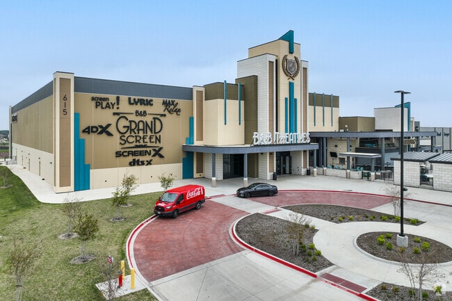
615 N Interstate 35 Rd, Red Oak, TX 75154


Property Detail
615 N Interstate 35 Rd
Dallas-Fort Worth-Arlington, TX
LOT 1 BLK A RED OAK LEGACY SQUARE ADDN 8.37 AC
283678
ELLIS
Commercialnec
Texas
2024
1
2025
8.37 AC
060206
Southwest Outlying
80,000 SF
Dallas/Ft Worth
NEARBY LISTINGS FOR SALE OR LEASE
DEMOGRAPHICS near 615 N Interstate 35 Rd
1 mile
3 mile
5 mile
2025 Total Population
7,346
47,657
111,268
2030 Population
8,624
53,532
121,426
Pop Growth 2025-2030
+ 17.40%
+ 12.33%
+ 9.13%
Average Age
36
37
38
2025 Total Households
2,450
15,837
37,284
HH Growth 2025-2030
+ 17.59%
+ 12.53%
+ 9.15%
Median Household Inc
$74,497
$89,916
$92,159
Avg Household Size
2.90
3.00
2.90
2025 Avg HH Vehicles
2.00
2.00
2.00
Median Home Value
$318,901
$333,787
$329,130
Median Year Built
2003
2001
1999
Nearby Places
Map Layers
Map Styles
 Street
 Aerial
Transit
 Traffic
 Biking
Places
Listings with unknown addresses are not visible on the map
- Restaurants
- Banks
- Shops
- Fitness
- Groceries
PUBLIC TRANSPORTATION
AIRPORT
Dallas Love Field
Drive
Walk
Distance
Dallas Love Field
35 min
24.5 mi
Dallas-Fort Worth International
Drive
Walk
Distance
Dallas-Fort Worth International
48 min
38.2 mi
Freight Ports
Port of Shreveport
Drive
Walk
Distance
Port of Shreveport
221 min
205.7 mi
SALE & LEASE HISTORY
LISTING DATE
SALE/LEASE

Jan 06, 2021
For Lease
Feb 24, 2020
For Lease
Nearby Properties
Address
Land Use
TOTAL SIZE
Lot Size
Zoning
Address
Land Use
TOTAL SIZE
Lot Size
Zoning
268,416 SF
33.28 AC
Address
Land Use
TOTAL SIZE
Lot Size
Zoning
268,416 SF
19.04 AC
Address
Land Use
TOTAL SIZE
Lot Size
Zoning
268,416 SF
20.02 AC
Address
Land Use
TOTAL SIZE
Lot Size
Zoning
268,416 SF
19.18 AC
Address
Land Use
TOTAL SIZE
Lot Size
Zoning
364,814 SF
105.96 AC
Address
Land Use
TOTAL SIZE
Lot Size
Zoning
288,368 SF
86.46 AC
Address
Land Use
TOTAL SIZE
Lot Size
Zoning
316,312 SF
17.09 AC
Address
Land Use
TOTAL SIZE
Lot Size
Zoning
332,510 SF
18.45 AC
Address
Land Use
TOTAL SIZE
Lot Size
Zoning
268,416 SF
22.11 AC
Address
Land Use
TOTAL SIZE
Lot Size
Zoning
345,348 SF
19.22 AC
Address
Land Use
TOTAL SIZE
Lot Size
Zoning
227,423 SF
13.86 AC
Z236
Address
Land Use
TOTAL SIZE
Lot Size
Zoning
281,669 SF
16.02 AC
Z312
Address
Land Use
TOTAL SIZE
Lot Size
Zoning
281,216 SF
75.37 AC
Address
Land Use
TOTAL SIZE
Lot Size
Zoning
330,541 SF
14.85 AC
Address
Land Use
TOTAL SIZE
Lot Size
Zoning
140,590 SF
4.90 AC
Z236
Address
Land Use
TOTAL SIZE
Lot Size
Zoning
55,213 SF
11.83 AC
Z197
Address
Land Use
TOTAL SIZE
Lot Size
Zoning
383 SF
56.48 AC
Z07
Address
Land Use
TOTAL SIZE
Lot Size
Zoning
196,670 SF
47.43 AC
Address
Land Use
TOTAL SIZE
Lot Size
Zoning
109,500 SF
12.13 AC
Z370
Address
Land Use
TOTAL SIZE
Lot Size
Zoning
268,416 SF
18.38 AC
Address
Land Use
TOTAL SIZE
Lot Size
Zoning
276,880 SF
14.17 AC
Address
Land Use
TOTAL SIZE
Lot Size
Zoning
327,382 SF
15.68 AC
Address
Land Use
TOTAL SIZE
Lot Size
Zoning
41,390 SF
90.38 AC
Address
Land Use
TOTAL SIZE
Lot Size
Zoning
104,885 SF
8 AC
Address
Land Use
TOTAL SIZE
Lot Size
Zoning
111,715 SF
4.81 AC
Address
Land Use
TOTAL SIZE
Lot Size
Zoning
117,564 SF
25.59 AC
Address
Land Use
TOTAL SIZE
Lot Size
Zoning
268,416 SF
18.32 AC
Address
Land Use
TOTAL SIZE
Lot Size
Zoning
268,416 SF
91.89 AC
Address
Land Use
TOTAL SIZE
Lot Size
Zoning
110,065 SF
8.29 AC
The World's #1 Commercial Real Estate Marketplace
Connect with us
© 2026 CoStar Group
The information above has been obtained from sources believed reliable. While we do not doubt its accuracy we have not verified it and make no guarantee, warranty or representation about it. It is your responsibility to independently confirm its accuracy and completeness. Any projections, opinions, assumptions, or estimates used are for example only and do not represent the current or future performance of the property. The value of this transaction to you depends on tax and other factors which should be evaluated by your tax, financial, and legal advisors. You and your advisors should conduct a careful, independent investigation of the property to determine to your satisfaction the suitability of the property for your needs.