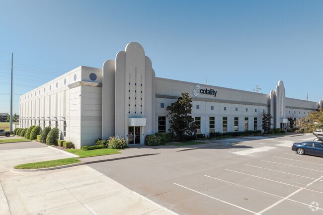
Property Record
501 Ne 122Nd St, Oklahoma City, OK 73114
Current Lease Availabilities
NEARBY LISTINGS FOR SALE OR LEASE
Property Detail
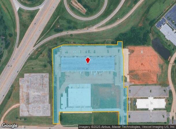
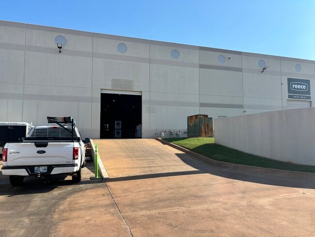
501 Ne 122Nd St
Oklahoma City, OK
Unpltd Pt Sec 15 13N 3W
134876540
UNPLTD PT SEC 15 13N 3W PT SE4 SEC 15 13N 3W BEG 70FT N OF SW/C SE4 TH N833.27FT NELY122.20FT E599.88FT N30FT E112.55FT S972.77FT W95FT N177.67FT W656.34FT S107.67FT W77FT TO BEG & LESS A TR BEG NW/C LOT 9 TH S442.77FT S23.06FT SW33.62FT W9FT N337.9F
Storebuilding
Oklahoma
0
Oklahoma
2024
14.63 AC
108302
Northeast
138,894 SF
Oklahoma City
DEMOGRAPHICS near 501 Ne 122Nd St
1 Mile
3 Mile
5 Mile
2024 Total Population
2,937
55,094
158,463
2029 Population
3,077
56,471
161,879
Pop Growth 2024-2029
+ 4.77%
+ 2.50%
+ 2.16%
Average Age
32
36
38
2024 Total Households
1,521
23,581
67,572
HH Growth 2024-2029
+ 4.80%
+ 2.70%
+ 2.36%
Median Household Inc
$51,243
$50,484
$65,016
Avg Household Size
1.90
2.20
2.30
2024 Avg HH Vehicles
1.00
2.00
2.00
Median Home Value
$144,347
$179,463
$227,368
Median Year Built
2000
1985
1985
Nearby Places
Map Layers
Map Styles
 Street
 Aerial
- Restaurants
- Banks
- Shops
- Fitness
- Groceries
PUBLIC TRANSPORTATION
COMMUTER RAIL
Oklahoma City (Heartland Flyer - Amtrak)
DRIVE
WALK
Distance
Oklahoma City (Heartland Flyer - Amtrak)
15 min
9.8 mi
AIRPORT
Will Rogers World
DRIVE
WALK
Distance
Will Rogers World
32 min
18.7 mi
Freight Ports
Tulsa Port Of Catoosa
DRIVE
WALK
Distance
Tulsa Port Of Catoosa
127 min
116.8 mi
Nearby Properties
Address
Land Use
TOTAL SIZE
Lot Size
Zoning
Address
Land Use
TOTAL SIZE
Lot Size
Zoning
233,053 SF
18.93 AC
O-2
Address
Land Use
TOTAL SIZE
Lot Size
Zoning
777,727 SF
54.25 AC
I-2
Address
Land Use
TOTAL SIZE
Lot Size
Zoning
366,844 SF
18.47 AC
PUD
Address
Land Use
TOTAL SIZE
Lot Size
Zoning
469,063 SF
71.44 AC
I-2
Address
Land Use
TOTAL SIZE
Lot Size
Zoning
391,776 SF
10.12 AC
PUD
Address
Land Use
TOTAL SIZE
Lot Size
Zoning
268,796 SF
45.68 AC
I-2
Address
Land Use
TOTAL SIZE
Lot Size
Zoning
304,423 SF
31.20 AC
PUD
Address
Land Use
TOTAL SIZE
Lot Size
Zoning
399,688 SF
80.57 AC
PUD
Address
Land Use
TOTAL SIZE
Lot Size
Zoning
358,436 SF
18.03 AC
PUD
Address
Land Use
TOTAL SIZE
Lot Size
Zoning
470,139 SF
80.39 AC
I-2
Address
Land Use
TOTAL SIZE
Lot Size
Zoning
291,228 SF
14.15 AC
PUD
Address
Land Use
TOTAL SIZE
Lot Size
Zoning
285,136 SF
13.04 AC
PUD
Address
Land Use
TOTAL SIZE
Lot Size
Zoning
105,426 SF
15.58 AC
O-2
Address
Land Use
TOTAL SIZE
Lot Size
Zoning
158,078 SF
15.58 AC
PUD
Address
Land Use
TOTAL SIZE
Lot Size
Zoning
12,633 SF
2 AC
C-3
Address
Land Use
TOTAL SIZE
Lot Size
Zoning
316,212 SF
16.36 AC
PUD
Address
Land Use
TOTAL SIZE
Lot Size
Zoning
225,492 SF
11.86 AC
R-4
Address
Land Use
TOTAL SIZE
Lot Size
Zoning
13,101 SF
1.22 AC
PUD
Address
Land Use
TOTAL SIZE
Lot Size
Zoning
200,836 SF
10.79 AC
R-4
Address
Land Use
TOTAL SIZE
Lot Size
Zoning
43,489 SF
14.86 AC
PUD
Address
Land Use
TOTAL SIZE
Lot Size
Zoning
140,153 SF
13.07 AC
PUD
Address
Land Use
TOTAL SIZE
Lot Size
Zoning
7.42 AC
PUD
Address
Land Use
TOTAL SIZE
Lot Size
Zoning
242,907 SF
I-2
Address
Land Use
TOTAL SIZE
Lot Size
Zoning
333,902 SF
19.32 AC
PUD
Address
Land Use
TOTAL SIZE
Lot Size
Zoning
574,062 SF
57.69 AC
I-2
Address
Land Use
TOTAL SIZE
Lot Size
Zoning
203,712 SF
10.01 AC
R-4
Address
Land Use
TOTAL SIZE
Lot Size
Zoning
242,196 SF
14.07 AC
Address
Land Use
TOTAL SIZE
Lot Size
Zoning
234,208 SF
8.61 AC
PUD
Address
Land Use
TOTAL SIZE
Lot Size
Zoning
102,304 SF
9.89 AC
PUD
The World's #1 Commercial Real Estate Marketplace
Connect with us
© 2026 CoStar Group
The information above has been obtained from sources believed reliable. While we do not doubt its accuracy we have not verified it and make no guarantee, warranty or representation about it. It is your responsibility to independently confirm its accuracy and completeness. Any projections, opinions, assumptions, or estimates used are for example only and do not represent the current or future performance of the property. The value of this transaction to you depends on tax and other factors which should be evaluated by your tax, financial, and legal advisors. You and your advisors should conduct a careful, independent investigation of the property to determine to your satisfaction the suitability of the property for your needs.