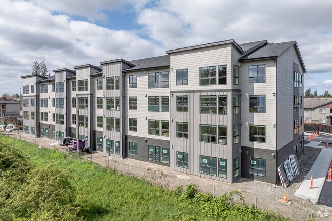
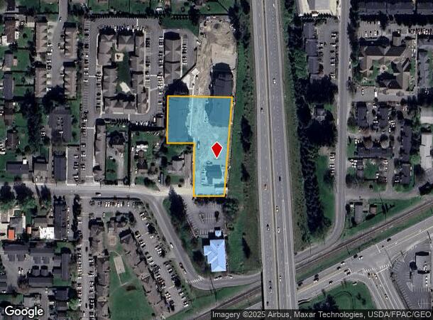
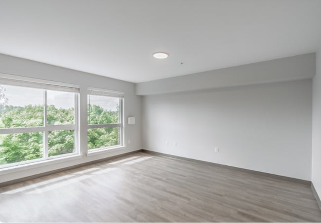
Property Record
615 Peterson Rd, Burlington, WA 98233
NEARBY LISTINGS FOR SALE OR LEASE
Property Detail
615 Peterson Rd
Other Market Areas
Burlington Ac
Mount Vernon-Anacortes, WA
(0.2787 AC) DK 12: THAT PORTION OF THE EAST HALF OF TRACT 49, PLAT OF THE BURLINGTON ACREAGE PROPERTY, AS PER PLAT RECORDED IN VOLUME 1 OF PLATS, PAGE 49, EXCEPT THE SOUTH 162.00 FEET OF THE WEST 100.00 FEET AND EXCEPT TRACT 2 OF SKAGIT COUNTY SHORT
P62618
Skagit
Multifamilydwelling
Washington
2025
49
2025
1.14 AC
951800
Bellingham/Northwest
2,940 SF
DEMOGRAPHICS near 615 Peterson Rd
1 Mile
3 Mile
5 Mile
2024 Total Population
6,963
23,755
60,129
2029 Population
7,388
24,842
62,591
Pop Growth 2024-2029
+ 6.10%
+ 4.58%
+ 4.09%
Average Age
38
40
40
2024 Total Households
2,614
8,841
22,219
HH Growth 2024-2029
+ 6.58%
+ 4.78%
+ 4.27%
Median Household Inc
$49,271
$60,052
$67,301
Avg Household Size
2.60
2.60
2.60
2024 Avg HH Vehicles
2.00
2.00
2.00
Median Home Value
$413,333
$423,347
$421,195
Median Year Built
1990
1989
1986
Nearby Places
Map Layers
Map Styles
 Street
 Aerial
- Restaurants
- Banks
- Shops
- Fitness
- Groceries
PUBLIC TRANSPORTATION
COMMUTER RAIL
DRIVE
WALK
Distance
7 min
4.3 mi
AIRPORT
Bellingham International
DRIVE
WALK
Distance
Bellingham International
39 min
29.6 mi
Freight Ports
DRIVE
WALK
Distance
25 min
16.4 mi
Nearby Properties
Address
Land Use
TOTAL SIZE
Lot Size
Zoning
Address
Land Use
TOTAL SIZE
Lot Size
Zoning
16,345 SF
32.99 AC
Address
Land Use
TOTAL SIZE
Lot Size
Zoning
Address
Land Use
TOTAL SIZE
Lot Size
Zoning
1,500 SF
9.93 AC
Address
Land Use
TOTAL SIZE
Lot Size
Zoning
279,914 SF
14.56 AC
Address
Land Use
TOTAL SIZE
Lot Size
Zoning
Address
Land Use
TOTAL SIZE
Lot Size
Zoning
129,102 SF
131 SF
Address
Land Use
TOTAL SIZE
Lot Size
Zoning
212,480 SF
35.36 AC
Address
Land Use
TOTAL SIZE
Lot Size
Zoning
179,460 SF
10 AC
Address
Land Use
TOTAL SIZE
Lot Size
Zoning
101,404 SF
24.20 AC
Address
Land Use
TOTAL SIZE
Lot Size
Zoning
Address
Land Use
TOTAL SIZE
Lot Size
Zoning
96,782 SF
4.50 AC
Address
Land Use
TOTAL SIZE
Lot Size
Zoning
200,145 SF
9.35 AC
Address
Land Use
TOTAL SIZE
Lot Size
Zoning
74,608 SF
87 SF
Address
Land Use
TOTAL SIZE
Lot Size
Zoning
0.01 AC
Address
Land Use
TOTAL SIZE
Lot Size
Zoning
1,120 SF
18.88 AC
Address
Land Use
TOTAL SIZE
Lot Size
Zoning
0.01 AC
Address
Land Use
TOTAL SIZE
Lot Size
Zoning
64,668 SF
0.29 AC
Address
Land Use
TOTAL SIZE
Lot Size
Zoning
114,589 SF
10.63 AC
Address
Land Use
TOTAL SIZE
Lot Size
Zoning
4,034 SF
87 SF
Address
Land Use
TOTAL SIZE
Lot Size
Zoning
0.01 AC
Address
Land Use
TOTAL SIZE
Lot Size
Zoning
177,896 SF
20.30 AC
Address
Land Use
TOTAL SIZE
Lot Size
Zoning
68,326 SF
5.29 AC
Address
Land Use
TOTAL SIZE
Lot Size
Zoning
75,744 SF
4 AC
Address
Land Use
TOTAL SIZE
Lot Size
Zoning
74,419 SF
2.16 AC
Address
Land Use
TOTAL SIZE
Lot Size
Zoning
42,139 SF
6.15 AC
Address
Land Use
TOTAL SIZE
Lot Size
Zoning
44,812 SF
6 AC
Address
Land Use
TOTAL SIZE
Lot Size
Zoning
40,159 SF
3.08 AC
Address
Land Use
TOTAL SIZE
Lot Size
Zoning
143,806 SF
5.50 AC
Address
Land Use
TOTAL SIZE
Lot Size
Zoning
93,720 SF
4.82 AC
Address
Land Use
TOTAL SIZE
Lot Size
Zoning
87,836 SF
7.12 AC
The World's #1 Commercial Real Estate Marketplace
Connect with us
© 2025 CoStar Group
The information above has been obtained from sources believed reliable. While we do not doubt its accuracy we have not verified it and make no guarantee, warranty or representation about it. It is your responsibility to independently confirm its accuracy and completeness. Any projections, opinions, assumptions, or estimates used are for example only and do not represent the current or future performance of the property. The value of this transaction to you depends on tax and other factors which should be evaluated by your tax, financial, and legal advisors. You and your advisors should conduct a careful, independent investigation of the property to determine to your satisfaction the suitability of the property for your needs.