Property Record
615 S Fm 1015, Weslaco, TX 78596
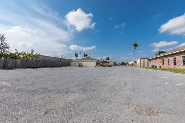

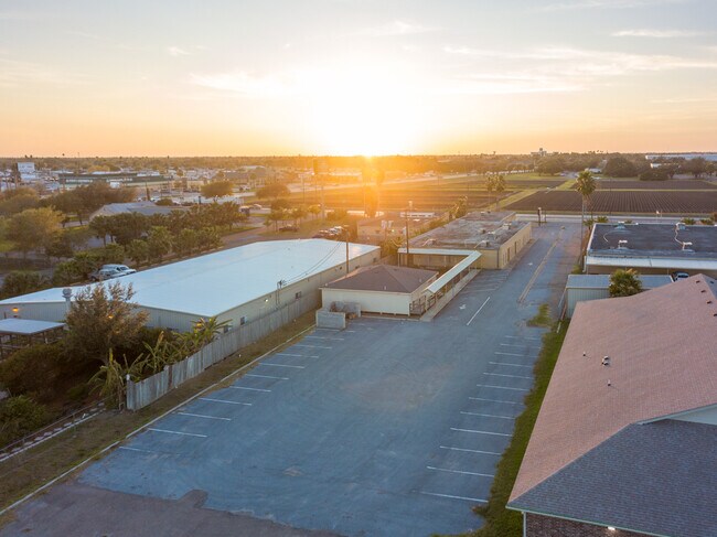
Property Detail
615 S Fm 1015
McAllen-Edinburg-Mission, TX
ADAMS TRACT W598.8-S95.5-N335.24 FT 1097 1.31AC GR 1.22AC NET
A0800-00-000-1097-03
HIDALGO
Commercialnec
Texas
2024
1097
2025
1.22 AC
022703
Outlying Hidalgo County
9,999 SF
McAllen/Edinburg/Pharr
NEARBY LISTINGS FOR SALE OR LEASE
DEMOGRAPHICS near 615 S Fm 1015
1 mile
3 mile
5 mile
2025 Total Population
5,623
49,737
102,228
2030 Population
6,202
53,152
108,016
Pop Growth 2025-2030
+ 10.30%
+ 6.87%
+ 5.66%
Average Age
39
38
36
2025 Total Households
1,915
16,778
31,542
HH Growth 2025-2030
+ 10.91%
+ 7.31%
+ 6.18%
Median Household Inc
$44,404
$45,954
$52,766
Avg Household Size
2.80
2.90
3.10
2025 Avg HH Vehicles
2.00
2.00
2.00
Median Home Value
$111,128
$112,760
$121,577
Median Year Built
1995
1992
1995
Nearby Places
Map Layers
Map Styles
 Street
 Aerial
Layers
 Traffic
 Biking
Places
Listings with unknown addresses are not visible on the map
- Restaurants
- Banks
- Shops
- Fitness
- Groceries
PUBLIC TRANSPORTATION
AIRPORT
McAllen International
Drive
Walk
Distance
McAllen International
26 min
19.7 mi
Valley International
Drive
Walk
Distance
Valley International
30 min
22.6 mi
Freight Ports
Port of Brownsville
Drive
Walk
Distance
Port of Brownsville
48 min
41.9 mi
SALE & LEASE HISTORY
LISTING DATE
SALE/LEASE

Jan 31, 2020
For Sale
Nearby Properties
Address
Land Use
TOTAL SIZE
Lot Size
Zoning
Address
Land Use
TOTAL SIZE
Lot Size
Zoning
401,046 SF
13.97 AC
Address
Land Use
TOTAL SIZE
Lot Size
Zoning
307,987 SF
39.11 AC
Address
Land Use
TOTAL SIZE
Lot Size
Zoning
552,365 SF
72.02 AC
GT
Address
Land Use
TOTAL SIZE
Lot Size
Zoning
255,276 SF
25 AC
Address
Land Use
TOTAL SIZE
Lot Size
Zoning
415,762 SF
56.31 AC
CO
Address
Land Use
TOTAL SIZE
Lot Size
Zoning
258,111 SF
51.09 AC
Address
Land Use
TOTAL SIZE
Lot Size
Zoning
205,544 SF
20.48 AC
C
Address
Land Use
TOTAL SIZE
Lot Size
Zoning
113,449 SF
19.01 AC
Address
Land Use
TOTAL SIZE
Lot Size
Zoning
2 SF
48.88 AC
GT
Address
Land Use
TOTAL SIZE
Lot Size
Zoning
342,760 SF
42.33 AC
Address
Land Use
TOTAL SIZE
Lot Size
Zoning
108,541 SF
16.50 AC
Address
Land Use
TOTAL SIZE
Lot Size
Zoning
160,873 SF
78.76 AC
Address
Land Use
TOTAL SIZE
Lot Size
Zoning
5 SF
2.15 AC
Address
Land Use
TOTAL SIZE
Lot Size
Zoning
79,517 SF
16.26 AC
Address
Land Use
TOTAL SIZE
Lot Size
Zoning
192,171 SF
16.56 AC
Address
Land Use
TOTAL SIZE
Lot Size
Zoning
108.55 AC
MP
Address
Land Use
TOTAL SIZE
Lot Size
Zoning
76,552 SF
19.48 AC
CO
Address
Land Use
TOTAL SIZE
Lot Size
Zoning
28,768 SF
3.20 AC
Address
Land Use
TOTAL SIZE
Lot Size
Zoning
6 SF
3.97 AC
Address
Land Use
TOTAL SIZE
Lot Size
Zoning
74,470 SF
34 AC
Address
Land Use
TOTAL SIZE
Lot Size
Zoning
112,706 SF
10.13 AC
Address
Land Use
TOTAL SIZE
Lot Size
Zoning
135,639 SF
40 AC
Address
Land Use
TOTAL SIZE
Lot Size
Zoning
61,420 SF
5.01 AC
CO
Address
Land Use
TOTAL SIZE
Lot Size
Zoning
13 SF
29 AC
Address
Land Use
TOTAL SIZE
Lot Size
Zoning
9 SF
15.24 AC
Address
Land Use
TOTAL SIZE
Lot Size
Zoning
70,035 SF
16.46 AC
Address
Land Use
TOTAL SIZE
Lot Size
Zoning
94,901 SF
8.80 AC
CO
Address
Land Use
TOTAL SIZE
Lot Size
Zoning
42,589 SF
4.46 AC
Address
Land Use
TOTAL SIZE
Lot Size
Zoning
9 SF
21.03 AC
Address
Land Use
TOTAL SIZE
Lot Size
Zoning
8 SF
18.79 AC
The World's #1 Commercial Real Estate Marketplace
Connect with us
© 2026 CoStar Group
The information above has been obtained from sources believed reliable. While we do not doubt its accuracy we have not verified it and make no guarantee, warranty or representation about it. It is your responsibility to independently confirm its accuracy and completeness. Any projections, opinions, assumptions, or estimates used are for example only and do not represent the current or future performance of the property. The value of this transaction to you depends on tax and other factors which should be evaluated by your tax, financial, and legal advisors. You and your advisors should conduct a careful, independent investigation of the property to determine to your satisfaction the suitability of the property for your needs.