Property Record
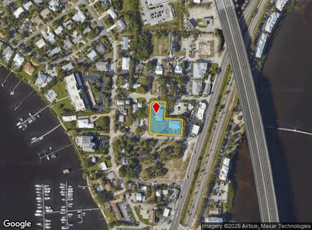
615 Nw Oleander St, Stuart, FL 34994


NEARBY LISTINGS FOR SALE OR LEASE
Property Detail
615 Nw Oleander St
Port St Lucie, FL
Riverside Park
32-37-41-004-005-00110-1
RIVERSIDE PARK LOTS 11 THRU 23 BLK E (FNA - VILLA LAMAR CONDO PER OR 568/705 - TERMINATED PER OR 826/2638)
Multifamilydwelling
Martin
X
Florida
12085C0134H
11-23
2024
0.82 AC
2025
North River Shores
000701
Port St Lucie/Fort Pierce
12,404 SF
DEMOGRAPHICS near 615 Nw Oleander St
1 Mile
3 Mile
5 Mile
2024 Total Population
2,859
46,241
106,722
2029 Population
3,003
49,272
116,422
Pop Growth 2024-2029
+ 5.04%
+ 6.55%
+ 9.09%
Average Age
49
49
48
2024 Total Households
1,380
21,231
46,945
HH Growth 2024-2029
+ 5.00%
+ 6.57%
+ 8.98%
Median Household Inc
$62,903
$60,702
$66,698
Avg Household Size
2.00
2.10
2.20
2024 Avg HH Vehicles
2.00
2.00
2.00
Median Home Value
$437,500
$331,529
$330,783
Median Year Built
1979
1984
1986
Nearby Places
Map Layers
Map Styles
 Street
 Aerial
- Restaurants
- Banks
- Shops
- Fitness
- Groceries
Nearby Properties
Address
Land Use
TOTAL SIZE
Lot Size
Zoning
Address
Land Use
TOTAL SIZE
Lot Size
Zoning
609,195 SF
13.77 AC
H
Address
Land Use
TOTAL SIZE
Lot Size
Zoning
481,508 SF
59.41 AC
PUDC
Address
Land Use
TOTAL SIZE
Lot Size
Zoning
11.34 AC
Address
Land Use
TOTAL SIZE
Lot Size
Zoning
292,279 SF
65.79 AC
R2
Address
Land Use
TOTAL SIZE
Lot Size
Zoning
309,031 SF
76.74 AC
RPUD
Address
Land Use
TOTAL SIZE
Lot Size
Zoning
378,814 SF
34.25 AC
PUDR
Address
Land Use
TOTAL SIZE
Lot Size
Zoning
14.86 AC
M1
Address
Land Use
TOTAL SIZE
Lot Size
Zoning
310,460 SF
48.85 AC
PS2
Address
Land Use
TOTAL SIZE
Lot Size
Zoning
6.66 AC
RPUD
Address
Land Use
TOTAL SIZE
Lot Size
Zoning
23.08 AC
RM8
Address
Land Use
TOTAL SIZE
Lot Size
Zoning
9.45 AC
RS6
Address
Land Use
TOTAL SIZE
Lot Size
Zoning
160,211 SF
17.44 AC
CPUD
Address
Land Use
TOTAL SIZE
Lot Size
Zoning
195,729 SF
20.25 AC
CPUD
Address
Land Use
TOTAL SIZE
Lot Size
Zoning
127,238 SF
3.62 AC
P
Address
Land Use
TOTAL SIZE
Lot Size
Zoning
106,357 SF
22.96 AC
Address
Land Use
TOTAL SIZE
Lot Size
Zoning
189,035 SF
20.63 AC
R3
Address
Land Use
TOTAL SIZE
Lot Size
Zoning
196,180 SF
18.71 AC
B1
Address
Land Use
TOTAL SIZE
Lot Size
Zoning
175,170 SF
19.53 AC
B1
Address
Land Use
TOTAL SIZE
Lot Size
Zoning
1,050 SF
5.33 AC
R3
Address
Land Use
TOTAL SIZE
Lot Size
Zoning
23,640 SF
15.28 AC
B2
Address
Land Use
TOTAL SIZE
Lot Size
Zoning
124,082 SF
4.60 AC
P
Address
Land Use
TOTAL SIZE
Lot Size
Zoning
2,221 SF
18.12 AC
R3A
Address
Land Use
TOTAL SIZE
Lot Size
Zoning
2,400 SF
7.31 AC
INDUST
Address
Land Use
TOTAL SIZE
Lot Size
Zoning
116,258 SF
14.58 AC
R3
Address
Land Use
TOTAL SIZE
Lot Size
Zoning
259,952 SF
25.50 AC
PS
Address
Land Use
TOTAL SIZE
Lot Size
Zoning
204,538 SF
22.65 AC
P
Address
Land Use
TOTAL SIZE
Lot Size
Zoning
152,826 SF
15 AC
B2
Address
Land Use
TOTAL SIZE
Lot Size
Zoning
198,758 SF
39.92 AC
RM5
Address
Land Use
TOTAL SIZE
Lot Size
Zoning
111,534 SF
11.59 AC
PUDC
Address
Land Use
TOTAL SIZE
Lot Size
Zoning
96,999 SF
11.72 AC
MH
The World's #1 Commercial Real Estate Marketplace
Connect with us
© 2025 CoStar Group
The information above has been obtained from sources believed reliable. While we do not doubt its accuracy we have not verified it and make no guarantee, warranty or representation about it. It is your responsibility to independently confirm its accuracy and completeness. Any projections, opinions, assumptions, or estimates used are for example only and do not represent the current or future performance of the property. The value of this transaction to you depends on tax and other factors which should be evaluated by your tax, financial, and legal advisors. You and your advisors should conduct a careful, independent investigation of the property to determine to your satisfaction the suitability of the property for your needs.