Property Record
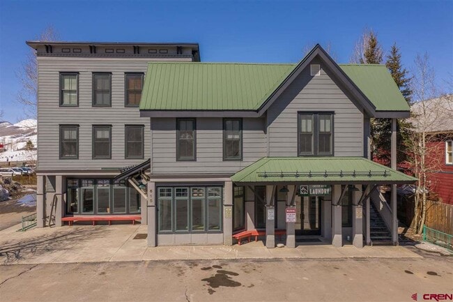
615 Teocalli Ave, Crested Butte, CO 81224


Property Detail
615 Teocalli Ave
R002784
LOTS 22-25, BLOCK 56, CRESTED BUTTE, #705186
Commercialofficeresidentialmixeduse
Gunnison
B and X Area of moderate flood hazard, usually the area between the limits of the 100-year and 500-year floods.
Colorado
2025
22-25
2025
0.29 AC
963800
Colorado Ski Area
1,881 SF
Other Market Areas
NEARBY LISTINGS FOR SALE OR LEASE
-
-
View all Crested Butte listings for sale on LoopNet.com
DEMOGRAPHICS near 615 Teocalli Ave
1 mile
3 mile
5 mile
2024 Total Population
1,364
3,605
4,003
2029 Population
1,380
3,655
4,067
Pop Growth 2024-2029
+ 1.17%
+ 1.39%
+ 1.60%
Average Age
41
41
41
2024 Total Households
635
1,662
1,830
HH Growth 2024-2029
+ 1.10%
+ 1.26%
+ 1.42%
Median Household Inc
$87,995
$86,936
$86,352
Avg Household Size
2.10
2.20
2.20
2024 Avg HH Vehicles
2.00
2.00
2.00
Median Home Value
$919,921
$885,506
$856,504
Median Year Built
1984
1985
1985
Nearby Places
Map Layers
Map Styles
 Street
 Aerial
Transit
 Traffic
 Biking
Places
Listings with unknown addresses are not visible on the map
- Restaurants
- Banks
- Shops
- Fitness
- Groceries
PUBLIC TRANSPORTATION
AIRPORT
Gunnison-Crested Butte Regional
Drive
Walk
Distance
Gunnison-Crested Butte Regional
60 min
30.1 mi
Freight Ports
Tulsa Port Of Catoosa
Drive
Walk
Distance
Tulsa Port Of Catoosa
981 min
788.2 mi
SALE & LEASE HISTORY
LISTING DATE
SALE/LEASE

Apr 28, 2021
For Sale
Nearby Properties
Address
Land Use
TOTAL SIZE
Lot Size
Zoning
Address
Land Use
TOTAL SIZE
Lot Size
Zoning
99,681 SF
11.48 AC
Address
Land Use
TOTAL SIZE
Lot Size
Zoning
2,693 SF
5.36 AC
Address
Land Use
TOTAL SIZE
Lot Size
Zoning
9,000 SF
3.21 AC
Address
Land Use
TOTAL SIZE
Lot Size
Zoning
6,955 SF
1.87 AC
Address
Land Use
TOTAL SIZE
Lot Size
Zoning
26,832 SF
0.53 AC
Address
Land Use
TOTAL SIZE
Lot Size
Zoning
1,382 SF
1.33 AC
Address
Land Use
TOTAL SIZE
Lot Size
Zoning
3,967 SF
0.11 AC
Address
Land Use
TOTAL SIZE
Lot Size
Zoning
1.42 AC
Address
Land Use
TOTAL SIZE
Lot Size
Zoning
11,197 SF
0.16 AC
Address
Land Use
TOTAL SIZE
Lot Size
Zoning
18,068 SF
0.22 AC
Address
Land Use
TOTAL SIZE
Lot Size
Zoning
6,063 SF
0.21 AC
Address
Land Use
TOTAL SIZE
Lot Size
Zoning
5,454 SF
0.14 AC
Address
Land Use
TOTAL SIZE
Lot Size
Zoning
11.50 AC
Address
Land Use
TOTAL SIZE
Lot Size
Zoning
0.20 AC
Address
Land Use
TOTAL SIZE
Lot Size
Zoning
Address
Land Use
TOTAL SIZE
Lot Size
Zoning
0.21 AC
Address
Land Use
TOTAL SIZE
Lot Size
Zoning
Address
Land Use
TOTAL SIZE
Lot Size
Zoning
Address
Land Use
TOTAL SIZE
Lot Size
Zoning
0.37 AC
Address
Land Use
TOTAL SIZE
Lot Size
Zoning
0.19 AC
Address
Land Use
TOTAL SIZE
Lot Size
Zoning
6,655 SF
0.14 AC
Address
Land Use
TOTAL SIZE
Lot Size
Zoning
4,073 SF
1.34 AC
Address
Land Use
TOTAL SIZE
Lot Size
Zoning
428 SF
0.36 AC
Address
Land Use
TOTAL SIZE
Lot Size
Zoning
16,050 SF
0.41 AC
Address
Land Use
TOTAL SIZE
Lot Size
Zoning
3,111 SF
0.21 AC
Address
Land Use
TOTAL SIZE
Lot Size
Zoning
5,630 SF
0.09 AC
Address
Land Use
TOTAL SIZE
Lot Size
Zoning
4,184 SF
0.22 AC
Address
Land Use
TOTAL SIZE
Lot Size
Zoning
Address
Land Use
TOTAL SIZE
Lot Size
Zoning
Address
Land Use
TOTAL SIZE
Lot Size
Zoning
1,205 SF
0.11 AC
The World's #1 Commercial Real Estate Marketplace
Connect with us
© 2026 CoStar Group
The information above has been obtained from sources believed reliable. While we do not doubt its accuracy we have not verified it and make no guarantee, warranty or representation about it. It is your responsibility to independently confirm its accuracy and completeness. Any projections, opinions, assumptions, or estimates used are for example only and do not represent the current or future performance of the property. The value of this transaction to you depends on tax and other factors which should be evaluated by your tax, financial, and legal advisors. You and your advisors should conduct a careful, independent investigation of the property to determine to your satisfaction the suitability of the property for your needs.