Property Record
615 W 5Th St, Eureka, MO 63025

Property Detail
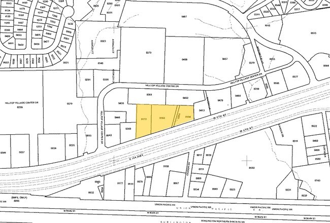
615 W 5Th St
29V-51-0183
COURTOIS TR LOT PT 42 LOCATED 150 FT NE OF W LOT LINE 9 3 76
Vacantlandnec
Saint Louis
R3
Missouri
B and X Area of moderate flood hazard, usually the area between the limits of the 100-year and 500-year floods.
42
2024
1.28 AC
2025
West County
221502
St. Louis
700 SF
St. Louis, MO-IL
NEARBY LISTINGS FOR SALE OR LEASE
DEMOGRAPHICS near 615 W 5Th St
1 mile
3 mile
5 mile
2025 Total Population
6,107
17,138
28,965
2030 Population
6,121
17,362
29,219
Pop Growth 2025-2030
+ 0.23%
+ 1.31%
+ 0.88%
Average Age
40
40
41
2025 Total Households
2,015
5,643
9,997
HH Growth 2025-2030
+ 0.15%
+ 1.24%
+ 0.85%
Median Household Inc
$115,050
$133,965
$134,529
Avg Household Size
2.70
2.80
2.70
2025 Avg HH Vehicles
2.00
2.00
2.00
Median Home Value
$377,486
$404,588
$412,480
Median Year Built
1995
1997
1995
Nearby Places
Map Layers
Map Styles
 Street
 Aerial
Layers
 Traffic
 Biking
Places
Listings with unknown addresses are not visible on the map
- Restaurants
- Banks
- Shops
- Fitness
- Groceries
PUBLIC TRANSPORTATION
AIRPORT
St Louis Lambert International
Drive
Walk
Distance
St Louis Lambert International
44 min
31.1 mi
Freight Ports
Tulsa Port of Inola
Drive
Walk
Distance
Tulsa Port of Inola
391 min
356.9 mi
SALE & LEASE HISTORY
LISTING DATE
SALE/LEASE

Mar 28, 2023
For Sale
Jun 22, 2022
For Sale
Nearby Properties
Address
Land Use
TOTAL SIZE
Lot Size
Zoning
Address
Land Use
TOTAL SIZE
Lot Size
Zoning
3,373 SF
1,418.57 AC
PS
Address
Land Use
TOTAL SIZE
Lot Size
Zoning
12,274 SF
86.91 AC
R1
Address
Land Use
TOTAL SIZE
Lot Size
Zoning
1,387.09 AC
PS
Address
Land Use
TOTAL SIZE
Lot Size
Zoning
207,499 SF
10.11 AC
98R-5
Address
Land Use
TOTAL SIZE
Lot Size
Zoning
13.13 AC
Address
Land Use
TOTAL SIZE
Lot Size
Zoning
39.97 AC
98PI
Address
Land Use
TOTAL SIZE
Lot Size
Zoning
351,908 SF
308.90 AC
NU
Address
Land Use
TOTAL SIZE
Lot Size
Zoning
153,647 SF
22.80 AC
98C
Address
Land Use
TOTAL SIZE
Lot Size
Zoning
250,959 SF
22.13 AC
98M-1
Address
Land Use
TOTAL SIZE
Lot Size
Zoning
85,759 SF
8.25 AC
H
Address
Land Use
TOTAL SIZE
Lot Size
Zoning
203,960 SF
12.88 AC
NU
Address
Land Use
TOTAL SIZE
Lot Size
Zoning
7.50 AC
98R-1
Address
Land Use
TOTAL SIZE
Lot Size
Zoning
8.30 AC
Address
Land Use
TOTAL SIZE
Lot Size
Zoning
29,960 SF
14.54 AC
NU
Address
Land Use
TOTAL SIZE
Lot Size
Zoning
131,963 SF
61.74 AC
NU
Address
Land Use
TOTAL SIZE
Lot Size
Zoning
899 SF
1.41 AC
R3
Address
Land Use
TOTAL SIZE
Lot Size
Zoning
27,588 SF
11.07 AC
H
Address
Land Use
TOTAL SIZE
Lot Size
Zoning
7.26 AC
R3
Address
Land Use
TOTAL SIZE
Lot Size
Zoning
7.48 AC
R4
Address
Land Use
TOTAL SIZE
Lot Size
Zoning
46,777 SF
71 AC
107NU
Address
Land Use
TOTAL SIZE
Lot Size
Zoning
46,615 SF
6.91 AC
98C
Address
Land Use
TOTAL SIZE
Lot Size
Zoning
1,530 SF
0.89 AC
Address
Land Use
TOTAL SIZE
Lot Size
Zoning
60,655 SF
2.95 AC
R-5
Address
Land Use
TOTAL SIZE
Lot Size
Zoning
99.75 AC
R1
Address
Land Use
TOTAL SIZE
Lot Size
Zoning
26,024 SF
2.65 AC
98PC
Address
Land Use
TOTAL SIZE
Lot Size
Zoning
69,225 SF
2.45 AC
98C
Address
Land Use
TOTAL SIZE
Lot Size
Zoning
9.10 AC
98R-1
Address
Land Use
TOTAL SIZE
Lot Size
Zoning
36,184 SF
13.15 AC
98R-5
Address
Land Use
TOTAL SIZE
Lot Size
Zoning
9,538 SF
17.04 AC
98M-1
Address
Land Use
TOTAL SIZE
Lot Size
Zoning
43,052 SF
112.19 AC
107NU
The World's #1 Commercial Real Estate Marketplace
Connect with us
© 2026 CoStar Group
The information above has been obtained from sources believed reliable. While we do not doubt its accuracy we have not verified it and make no guarantee, warranty or representation about it. It is your responsibility to independently confirm its accuracy and completeness. Any projections, opinions, assumptions, or estimates used are for example only and do not represent the current or future performance of the property. The value of this transaction to you depends on tax and other factors which should be evaluated by your tax, financial, and legal advisors. You and your advisors should conduct a careful, independent investigation of the property to determine to your satisfaction the suitability of the property for your needs.