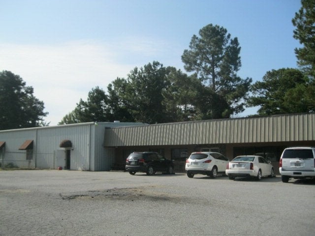
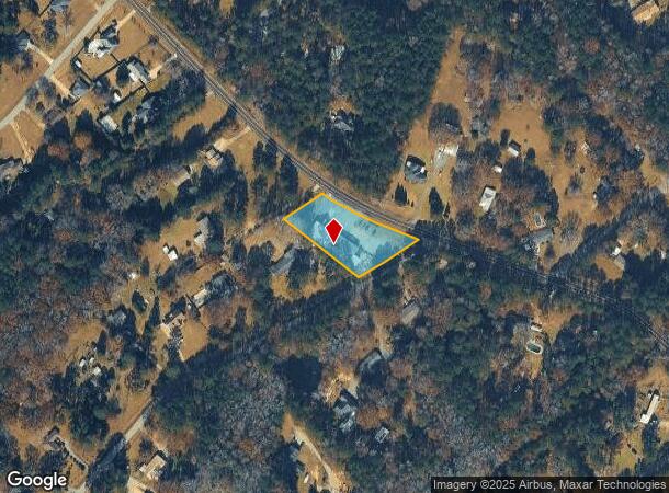
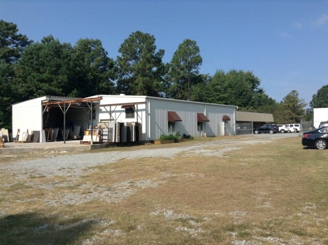
Property Record
615 W Bonacre Rd, Cataula, GA 31804
NEARBY LISTINGS FOR SALE OR LEASE
-
-
View all Cataula listings for sale on LoopNet.com
Property Detail
615 W Bonacre Rd
048A068
Ac 20000
Officebuilding
LL 158 DIST 19
X
Harris
13145C0193C
Georgia
2025
1.08 AC
2025
Harris County
120401
Columbus GA
6,750 SF
Columbus, GA-AL
DEMOGRAPHICS near 615 W Bonacre Rd
1 Mile
3 Mile
5 Mile
2024 Total Population
1,438
6,198
21,619
2029 Population
1,615
6,908
22,826
Pop Growth 2024-2029
+ 12.31%
+ 11.46%
+ 5.58%
Average Age
43
40
39
2024 Total Households
521
2,263
8,174
HH Growth 2024-2029
+ 12.28%
+ 11.18%
+ 4.94%
Median Household Inc
$107,164
$102,917
$96,460
Avg Household Size
2.80
2.70
2.60
2024 Avg HH Vehicles
2.00
2.00
2.00
Median Home Value
$295,054
$305,866
$305,480
Median Year Built
1993
1999
2003
Nearby Places
Map Layers
Map Styles
 Street
 Aerial
- Restaurants
- Banks
- Shops
- Fitness
- Groceries
PUBLIC TRANSPORTATION
AIRPORT
Columbus
DRIVE
WALK
Distance
Columbus
18 min
9.9 mi
Freight Ports
Port of Panama City
DRIVE
WALK
Distance
Port of Panama City
253 min
196.8 mi
SALE & LEASE HISTORY
LISTING DATE
SALE/LEASE

Sep 28, 2016
For Sale
Sep 24, 2016
For Sale
May 04, 2018
For Sale
Nearby Properties
Address
Land Use
TOTAL SIZE
Lot Size
Zoning
Address
Land Use
TOTAL SIZE
Lot Size
Zoning
1,010 SF
38.44 AC
Address
Land Use
TOTAL SIZE
Lot Size
Zoning
1,539.67 AC
004
Address
Land Use
TOTAL SIZE
Lot Size
Zoning
933.05 AC
004
Address
Land Use
TOTAL SIZE
Lot Size
Zoning
16.91 AC
Address
Land Use
TOTAL SIZE
Lot Size
Zoning
1,080 SF
61.49 AC
Address
Land Use
TOTAL SIZE
Lot Size
Zoning
9,301 SF
2.60 AC
Address
Land Use
TOTAL SIZE
Lot Size
Zoning
3,000 SF
4.94 AC
002
Address
Land Use
TOTAL SIZE
Lot Size
Zoning
1,232 SF
19.93 AC
Address
Land Use
TOTAL SIZE
Lot Size
Zoning
2,700 SF
1 AC
Address
Land Use
TOTAL SIZE
Lot Size
Zoning
56.20 AC
Address
Land Use
TOTAL SIZE
Lot Size
Zoning
161.68 AC
Address
Land Use
TOTAL SIZE
Lot Size
Zoning
Address
Land Use
TOTAL SIZE
Lot Size
Zoning
2,103 SF
41.98 AC
Address
Land Use
TOTAL SIZE
Lot Size
Zoning
3,240 SF
1.65 AC
Address
Land Use
TOTAL SIZE
Lot Size
Zoning
3,108 SF
1.44 AC
001
Address
Land Use
TOTAL SIZE
Lot Size
Zoning
19.34 AC
Address
Land Use
TOTAL SIZE
Lot Size
Zoning
25.03 AC
Address
Land Use
TOTAL SIZE
Lot Size
Zoning
5,084 SF
7.86 AC
Address
Land Use
TOTAL SIZE
Lot Size
Zoning
2,145 SF
143.27 AC
004
Address
Land Use
TOTAL SIZE
Lot Size
Zoning
6,696 SF
2 AC
Address
Land Use
TOTAL SIZE
Lot Size
Zoning
9,000 SF
11.50 AC
002
Address
Land Use
TOTAL SIZE
Lot Size
Zoning
135.42 AC
Address
Land Use
TOTAL SIZE
Lot Size
Zoning
4.85 AC
Address
Land Use
TOTAL SIZE
Lot Size
Zoning
104.79 AC
001
Address
Land Use
TOTAL SIZE
Lot Size
Zoning
78.34 AC
Address
Land Use
TOTAL SIZE
Lot Size
Zoning
20.75 AC
Address
Land Use
TOTAL SIZE
Lot Size
Zoning
4,400 SF
1.72 AC
Address
Land Use
TOTAL SIZE
Lot Size
Zoning
5,925 SF
1.09 AC
001
Address
Land Use
TOTAL SIZE
Lot Size
Zoning
81.69 AC
004
The World's #1 Commercial Real Estate Marketplace
Connect with us
© 2026 CoStar Group
The information above has been obtained from sources believed reliable. While we do not doubt its accuracy we have not verified it and make no guarantee, warranty or representation about it. It is your responsibility to independently confirm its accuracy and completeness. Any projections, opinions, assumptions, or estimates used are for example only and do not represent the current or future performance of the property. The value of this transaction to you depends on tax and other factors which should be evaluated by your tax, financial, and legal advisors. You and your advisors should conduct a careful, independent investigation of the property to determine to your satisfaction the suitability of the property for your needs.