Property Record
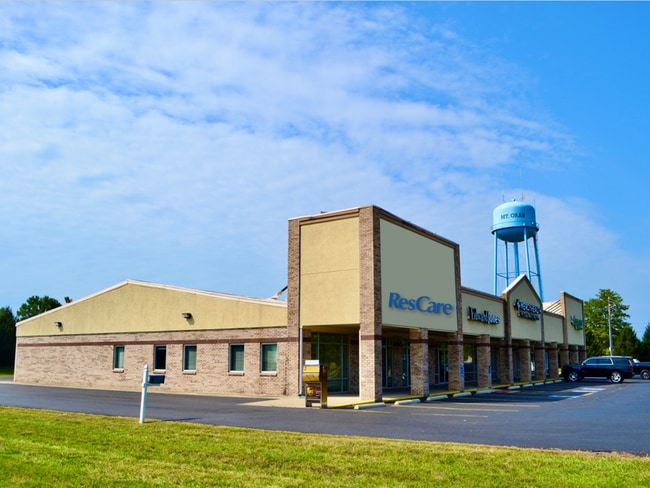
615 W Main St, Mount Orab, OH 45154


Property Detail
615 W Main St
Cincinnati, OH-KY-IN
S7041 1.78 A LAND MT ORAB VILLAGE WESTERN BRN LSD
44-073068-0101
Brown
Stripcommercialcenter
Ohio
B and X Area of moderate flood hazard, usually the area between the limits of the 100-year and 500-year floods.
1.78 AC
2025
Brown County
2025
Cincinnati/Dayton
951202
NEARBY LISTINGS FOR SALE OR LEASE
-
-
View all Mount Orab listings for lease on LoopNet.com
DEMOGRAPHICS near 615 W Main St
1 mile
3 mile
5 mile
2025 Total Population
2,024
7,519
12,868
2030 Population
2,060
7,627
13,042
Pop Growth 2025-2030
+ 1.78%
+ 1.44%
+ 1.35%
Average Age
38
40
41
2025 Total Households
742
2,914
4,945
HH Growth 2025-2030
+ 1.75%
+ 1.41%
+ 1.33%
Median Household Inc
$80,897
$69,977
$70,893
Avg Household Size
2.70
2.60
2.60
2025 Avg HH Vehicles
2.00
2.00
2.00
Median Home Value
$171,459
$206,436
$210,089
Median Year Built
1995
1992
1991
Nearby Places
Map Layers
Map Styles
 Street
 Aerial
Layers
 Traffic
 Biking
Places
Listings with unknown addresses are not visible on the map
- Restaurants
- Banks
- Shops
- Fitness
- Groceries
SALE & LEASE HISTORY
LISTING DATE
SALE/LEASE

Oct 21, 2020
For Sale
Aug 17, 2022
For Lease
Nearby Properties
Address
Land Use
TOTAL SIZE
Lot Size
Zoning
Address
Land Use
TOTAL SIZE
Lot Size
Zoning
27.40 AC
Address
Land Use
TOTAL SIZE
Lot Size
Zoning
44.55 AC
Address
Land Use
TOTAL SIZE
Lot Size
Zoning
47.39 AC
Address
Land Use
TOTAL SIZE
Lot Size
Zoning
Address
Land Use
TOTAL SIZE
Lot Size
Zoning
Address
Land Use
TOTAL SIZE
Lot Size
Zoning
60.01 AC
Address
Land Use
TOTAL SIZE
Lot Size
Zoning
16.99 AC
Address
Land Use
TOTAL SIZE
Lot Size
Zoning
30.63 AC
Address
Land Use
TOTAL SIZE
Lot Size
Zoning
54.58 AC
Address
Land Use
TOTAL SIZE
Lot Size
Zoning
Address
Land Use
TOTAL SIZE
Lot Size
Zoning
Address
Land Use
TOTAL SIZE
Lot Size
Zoning
4,494 SF
297.05 AC
Address
Land Use
TOTAL SIZE
Lot Size
Zoning
12,060 SF
15.82 AC
Address
Land Use
TOTAL SIZE
Lot Size
Zoning
7.05 AC
Address
Land Use
TOTAL SIZE
Lot Size
Zoning
3,956 SF
18.03 AC
Address
Land Use
TOTAL SIZE
Lot Size
Zoning
3.12 AC
Address
Land Use
TOTAL SIZE
Lot Size
Zoning
Address
Land Use
TOTAL SIZE
Lot Size
Zoning
3.47 AC
Address
Land Use
TOTAL SIZE
Lot Size
Zoning
0.97 AC
Address
Land Use
TOTAL SIZE
Lot Size
Zoning
3.17 AC
Address
Land Use
TOTAL SIZE
Lot Size
Zoning
481 SF
8.69 AC
Address
Land Use
TOTAL SIZE
Lot Size
Zoning
153.85 AC
Address
Land Use
TOTAL SIZE
Lot Size
Zoning
1.44 AC
Address
Land Use
TOTAL SIZE
Lot Size
Zoning
1.91 AC
Address
Land Use
TOTAL SIZE
Lot Size
Zoning
3.43 AC
Address
Land Use
TOTAL SIZE
Lot Size
Zoning
1.66 AC
Address
Land Use
TOTAL SIZE
Lot Size
Zoning
60.57 AC
Address
Land Use
TOTAL SIZE
Lot Size
Zoning
Address
Land Use
TOTAL SIZE
Lot Size
Zoning
1.74 AC
Address
Land Use
TOTAL SIZE
Lot Size
Zoning
11,122 SF
2.07 AC
The World's #1 Commercial Real Estate Marketplace
Connect with us
© 2026 CoStar Group
The information above has been obtained from sources believed reliable. While we do not doubt its accuracy we have not verified it and make no guarantee, warranty or representation about it. It is your responsibility to independently confirm its accuracy and completeness. Any projections, opinions, assumptions, or estimates used are for example only and do not represent the current or future performance of the property. The value of this transaction to you depends on tax and other factors which should be evaluated by your tax, financial, and legal advisors. You and your advisors should conduct a careful, independent investigation of the property to determine to your satisfaction the suitability of the property for your needs.