Property Record
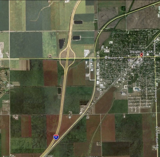
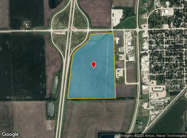
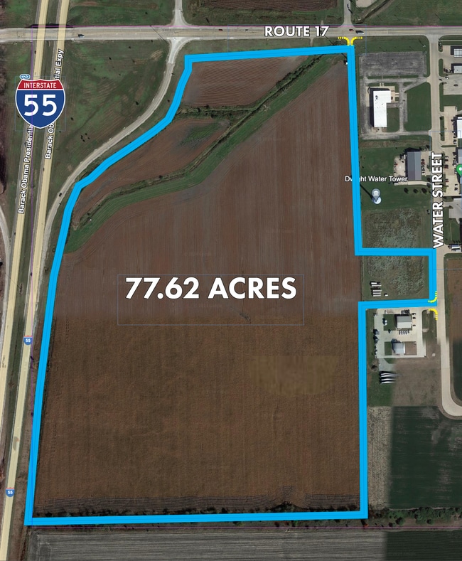
615 W Mazon Ave, Dwight, IL 60420
NEARBY LISTINGS FOR SALE OR LEASE
Property Detail
615 W Mazon Ave
Pontiac, IL
Str
05-05-08-201-002
NW4 S8 T30N R7E
Ruralagriculturalresidence
Livingston
A
Illinois
17063C0300F
86.41 AC
2024
Illinois North Area
2024
Other Market Areas
960100
DEMOGRAPHICS near 615 W Mazon Ave
1 Mile
3 Mile
5 Mile
2024 Total Population
1,554
4,489
4,729
2029 Population
1,560
4,502
4,736
Pop Growth 2024-2029
+ 0.39%
+ 0.29%
+ 0.15%
Average Age
40
43
43
2024 Total Households
623
1,886
1,981
HH Growth 2024-2029
+ 0.32%
+ 0.27%
+ 0.15%
Median Household Inc
$61,467
$62,876
$63,404
Avg Household Size
2.30
2.20
2.30
2024 Avg HH Vehicles
2.00
2.00
2.00
Median Home Value
$103,571
$135,255
$138,230
Median Year Built
1948
1963
1963
Nearby Places
Map Layers
Map Styles
 Street
 Aerial
- Restaurants
- Banks
- Shops
- Fitness
- Groceries
PUBLIC TRANSPORTATION
COMMUTER RAIL
Dwight Amtrak Station (Lincoln Service - Amtrak, Lincoln Service Missouri River Runner - Amtrak)
DRIVE
WALK
Distance
Dwight Amtrak Station (Lincoln Service - Amtrak, Lincoln Service Missouri River Runner - Amtrak)
4 min
1.4 mi
Freight Ports
Port Milwaukee
DRIVE
WALK
Distance
Port Milwaukee
182 min
152.7 mi
SALE & LEASE HISTORY
LISTING DATE
SALE/LEASE

Sep 24, 2016
For Sale
Apr 18, 2024
For Sale
Apr 11, 2024
For Sale
Nearby Properties
Address
Land Use
TOTAL SIZE
Lot Size
Zoning
Address
Land Use
TOTAL SIZE
Lot Size
Zoning
124.95 AC
Address
Land Use
TOTAL SIZE
Lot Size
Zoning
266,116 SF
97.85 AC
Address
Land Use
TOTAL SIZE
Lot Size
Zoning
25,196 SF
3.43 AC
Address
Land Use
TOTAL SIZE
Lot Size
Zoning
903 SF
9.98 AC
Address
Land Use
TOTAL SIZE
Lot Size
Zoning
4.66 AC
Address
Land Use
TOTAL SIZE
Lot Size
Zoning
30,714 SF
3.44 AC
Address
Land Use
TOTAL SIZE
Lot Size
Zoning
2,072 SF
21.82 AC
Address
Land Use
TOTAL SIZE
Lot Size
Zoning
3,000 SF
1.27 AC
Address
Land Use
TOTAL SIZE
Lot Size
Zoning
1.84 AC
Address
Land Use
TOTAL SIZE
Lot Size
Zoning
1.20 AC
Address
Land Use
TOTAL SIZE
Lot Size
Zoning
14,320 SF
10 AC
Address
Land Use
TOTAL SIZE
Lot Size
Zoning
8,178 SF
2.31 AC
Address
Land Use
TOTAL SIZE
Lot Size
Zoning
9,028 SF
2 AC
Address
Land Use
TOTAL SIZE
Lot Size
Zoning
2,475 SF
10.50 AC
Address
Land Use
TOTAL SIZE
Lot Size
Zoning
26,254 SF
2.53 AC
Address
Land Use
TOTAL SIZE
Lot Size
Zoning
27,667 SF
3.23 AC
Address
Land Use
TOTAL SIZE
Lot Size
Zoning
6,720 SF
5 AC
Address
Land Use
TOTAL SIZE
Lot Size
Zoning
480 SF
0.59 AC
Address
Land Use
TOTAL SIZE
Lot Size
Zoning
3,597 SF
1.33 AC
Address
Land Use
TOTAL SIZE
Lot Size
Zoning
8,146 SF
0.55 AC
Address
Land Use
TOTAL SIZE
Lot Size
Zoning
6,045 SF
5.78 AC
Address
Land Use
TOTAL SIZE
Lot Size
Zoning
16,360 SF
2.28 AC
Address
Land Use
TOTAL SIZE
Lot Size
Zoning
4,566 SF
0.21 AC
Address
Land Use
TOTAL SIZE
Lot Size
Zoning
1,560 SF
640 AC
Address
Land Use
TOTAL SIZE
Lot Size
Zoning
4,440 SF
5 AC
Address
Land Use
TOTAL SIZE
Lot Size
Zoning
4,107 SF
1.77 AC
Address
Land Use
TOTAL SIZE
Lot Size
Zoning
0.66 AC
Address
Land Use
TOTAL SIZE
Lot Size
Zoning
3,366 SF
1.09 AC
Address
Land Use
TOTAL SIZE
Lot Size
Zoning
6,596 SF
1.38 AC
Address
Land Use
TOTAL SIZE
Lot Size
Zoning
3,300 SF
1.88 AC
The World's #1 Commercial Real Estate Marketplace
Connect with us
© 2026 CoStar Group
The information above has been obtained from sources believed reliable. While we do not doubt its accuracy we have not verified it and make no guarantee, warranty or representation about it. It is your responsibility to independently confirm its accuracy and completeness. Any projections, opinions, assumptions, or estimates used are for example only and do not represent the current or future performance of the property. The value of this transaction to you depends on tax and other factors which should be evaluated by your tax, financial, and legal advisors. You and your advisors should conduct a careful, independent investigation of the property to determine to your satisfaction the suitability of the property for your needs.