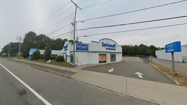
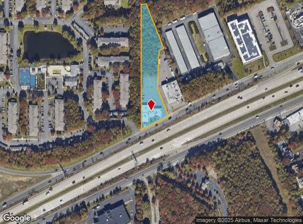
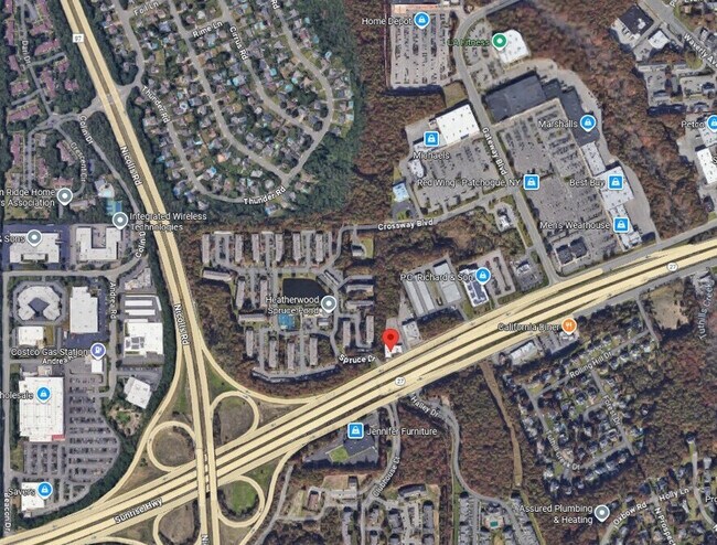
Property Record
615 N Sunrise Hwy, Patchogue, NY 11772
Current Lease Availabilities
NEARBY LISTINGS FOR SALE OR LEASE
Property Detail
615 N Sunrise Hwy
Nassau County-Suffolk County, NY
Blue Point
0200-975-20-01-00-002-001
N PATCH ASSOC E FRIED-ANO S SUNRISE
Commercialnec
Suffolk
X
New York
36103C0693H
2
2024
1.63 AC
2024
Central Suffolk
159109
Long Island (New York)
DEMOGRAPHICS near 615 N Sunrise Hwy
1 Mile
3 Mile
5 Mile
2024 Total Population
9,041
82,862
181,997
2029 Population
8,934
81,948
180,037
Pop Growth 2024-2029
(1.18%)
(1.10%)
(1.08%)
Average Age
45
42
42
2024 Total Households
3,894
30,878
64,617
HH Growth 2024-2029
(1.00%)
(1.29%)
(1.23%)
Median Household Inc
$104,312
$112,476
$112,206
Avg Household Size
2.30
2.60
2.70
2024 Avg HH Vehicles
2.00
2.00
2.00
Median Home Value
$488,037
$463,968
$451,327
Median Year Built
1977
1973
1972
Nearby Places
- Restaurants
- Banks
- Shops
- Fitness
- Groceries
PUBLIC TRANSPORTATION
COMMUTER RAIL
Patchogue Station (Montauk Branch - Long Island Rail Road)
DRIVE
WALK
Distance
Patchogue Station (Montauk Branch - Long Island Rail Road)
7 min
4.2 mi
Sayville Station (Montauk Branch - Long Island Rail Road)
DRIVE
WALK
Distance
Sayville Station (Montauk Branch - Long Island Rail Road)
9 min
4.7 mi
AIRPORT
Long Island MacArthur
DRIVE
WALK
Distance
Long Island MacArthur
8 min
4.1 mi
Freight Ports
Port of New Haven
DRIVE
WALK
Distance
Port of New Haven
131 min
50.9 mi
Nearby Properties
Address
Land Use
TOTAL SIZE
Lot Size
Zoning
Address
Land Use
TOTAL SIZE
Lot Size
Zoning
27.90 AC
AA
Address
Land Use
TOTAL SIZE
Lot Size
Zoning
30.25 AC
CA
Address
Land Use
TOTAL SIZE
Lot Size
Zoning
33.47 AC
AA
Address
Land Use
TOTAL SIZE
Lot Size
Zoning
29.86 AC
CA
Address
Land Use
TOTAL SIZE
Lot Size
Zoning
26.28 AC
CA
Address
Land Use
TOTAL SIZE
Lot Size
Zoning
27.63 AC
C
Address
Land Use
TOTAL SIZE
Lot Size
Zoning
23.50 AC
AA
Address
Land Use
TOTAL SIZE
Lot Size
Zoning
26,811 SF
43.20 AC
CA
Address
Land Use
TOTAL SIZE
Lot Size
Zoning
7,290 SF
15.71 AC
CA
Address
Land Use
TOTAL SIZE
Lot Size
Zoning
18.68 AC
IND1
Address
Land Use
TOTAL SIZE
Lot Size
Zoning
96 SF
18.29 AC
BUS3
Address
Land Use
TOTAL SIZE
Lot Size
Zoning
16 AC
AA
Address
Land Use
TOTAL SIZE
Lot Size
Zoning
3,025 SF
5.60 AC
AA
Address
Land Use
TOTAL SIZE
Lot Size
Zoning
23.90 AC
AA
Address
Land Use
TOTAL SIZE
Lot Size
Zoning
722 SF
24.39 AC
BUS3
Address
Land Use
TOTAL SIZE
Lot Size
Zoning
12.70 AC
IND1
Address
Land Use
TOTAL SIZE
Lot Size
Zoning
5.01 AC
AA278
Address
Land Use
TOTAL SIZE
Lot Size
Zoning
42.37 AC
Address
Land Use
TOTAL SIZE
Lot Size
Zoning
12.14 AC
BUS3
Address
Land Use
TOTAL SIZE
Lot Size
Zoning
14.73 AC
AA
Address
Land Use
TOTAL SIZE
Lot Size
Zoning
11.19 AC
Address
Land Use
TOTAL SIZE
Lot Size
Zoning
15 AC
AA
Address
Land Use
TOTAL SIZE
Lot Size
Zoning
16.90 AC
AA
Address
Land Use
TOTAL SIZE
Lot Size
Zoning
19.70 AC
AA
Address
Land Use
TOTAL SIZE
Lot Size
Zoning
14.70 AC
BUS3
Address
Land Use
TOTAL SIZE
Lot Size
Zoning
14.48 AC
IND1
Address
Land Use
TOTAL SIZE
Lot Size
Zoning
17.52 AC
ICD
Address
Land Use
TOTAL SIZE
Lot Size
Zoning
9,148 SF
10.30 AC
CA
Address
Land Use
TOTAL SIZE
Lot Size
Zoning
26.18 AC
IND1
Address
Land Use
TOTAL SIZE
Lot Size
Zoning
14.75 AC
CA
The World's #1 Commercial Real Estate Marketplace
Connect with us
© 2025 CoStar Group
The information above has been obtained from sources believed reliable. While we do not doubt its accuracy we have not verified it and make no guarantee, warranty or representation about it. It is your responsibility to independently confirm its accuracy and completeness. Any projections, opinions, assumptions, or estimates used are for example only and do not represent the current or future performance of the property. The value of this transaction to you depends on tax and other factors which should be evaluated by your tax, financial, and legal advisors. You and your advisors should conduct a careful, independent investigation of the property to determine to your satisfaction the suitability of the property for your needs.