Property Record
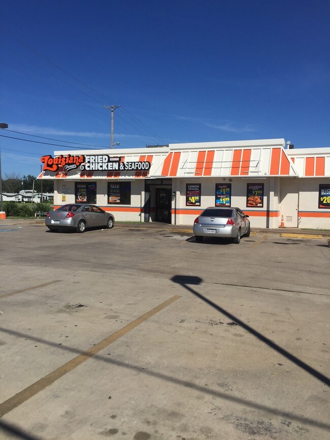
6150 Ramey Ave, Fort Worth, TX 76112


NEARBY LISTINGS FOR SALE OR LEASE
Property Detail
6150 Ramey Ave
Dallas-Fort Worth-Arlington, TX
Carver Heights
06249639
HANDLEY HEIGHTS SOUTH ADDITION BLOCK 1 LOT 1B & CARVER HTS BLK 21 LT 1R1B
Commercialnec
Tarrant
X
Texas
48439C0330K
1b,1
2024
0.53 AC
2025
South Arlington
101302
Dallas/Ft Worth
2,740 SF
DEMOGRAPHICS near 6150 Ramey Ave
1 Mile
3 Mile
5 Mile
2024 Total Population
6,584
92,272
243,906
2029 Population
6,969
97,641
257,804
Pop Growth 2024-2029
+ 5.85%
+ 5.82%
+ 5.70%
Average Age
37
37
37
2024 Total Households
2,154
31,712
87,303
HH Growth 2024-2029
+ 5.85%
+ 5.84%
+ 5.71%
Median Household Inc
$39,351
$52,097
$55,843
Avg Household Size
3.00
2.80
2.70
2024 Avg HH Vehicles
2.00
2.00
2.00
Median Home Value
$90,349
$184,701
$220,964
Median Year Built
1963
1972
1978
Nearby Places
Map Layers
Map Styles
 Street
 Aerial
- Restaurants
- Banks
- Shops
- Fitness
- Groceries
PUBLIC TRANSPORTATION
COMMUTER RAIL
Richland Hills (Trinity Railway Express - Dallas Area Rapid Transit (DART))
DRIVE
WALK
Distance
Richland Hills (Trinity Railway Express - Dallas Area Rapid Transit (DART))
10 min
6.4 mi
DRIVE
WALK
Distance
10 min
6.7 mi
AIRPORT
Dallas-Fort Worth International
DRIVE
WALK
Distance
Dallas-Fort Worth International
31 min
22.7 mi
Dallas Love Field
DRIVE
WALK
Distance
Dallas Love Field
41 min
31.3 mi
SALE & LEASE HISTORY
LISTING DATE
SALE/LEASE

Nov 08, 2018
For Sale
May 16, 2018
For Sale
Nearby Properties
Address
Land Use
TOTAL SIZE
Lot Size
Zoning
Address
Land Use
TOTAL SIZE
Lot Size
Zoning
605,489 SF
35.12 AC
Address
Land Use
TOTAL SIZE
Lot Size
Zoning
163,000 SF
12.36 AC
Address
Land Use
TOTAL SIZE
Lot Size
Zoning
171,769 SF
4.96 AC
Address
Land Use
TOTAL SIZE
Lot Size
Zoning
131,582 SF
10.61 AC
Address
Land Use
TOTAL SIZE
Lot Size
Zoning
239,360 SF
17.55 AC
Address
Land Use
TOTAL SIZE
Lot Size
Zoning
204,094 SF
16.99 AC
Address
Land Use
TOTAL SIZE
Lot Size
Zoning
190,755 SF
33.09 AC
Address
Land Use
TOTAL SIZE
Lot Size
Zoning
222,978 SF
12.46 AC
Address
Land Use
TOTAL SIZE
Lot Size
Zoning
133,193 SF
14.56 AC
Address
Land Use
TOTAL SIZE
Lot Size
Zoning
204,636 SF
9.98 AC
Address
Land Use
TOTAL SIZE
Lot Size
Zoning
208,085 SF
12 AC
Address
Land Use
TOTAL SIZE
Lot Size
Zoning
194,637 SF
13.75 AC
Address
Land Use
TOTAL SIZE
Lot Size
Zoning
209,784 SF
48.86 AC
Address
Land Use
TOTAL SIZE
Lot Size
Zoning
182,272 SF
7.86 AC
Address
Land Use
TOTAL SIZE
Lot Size
Zoning
85,001 SF
29.35 AC
Address
Land Use
TOTAL SIZE
Lot Size
Zoning
110,684 SF
7 AC
Address
Land Use
TOTAL SIZE
Lot Size
Zoning
148,020 SF
9.89 AC
Address
Land Use
TOTAL SIZE
Lot Size
Zoning
135,168 SF
6.28 AC
Address
Land Use
TOTAL SIZE
Lot Size
Zoning
102,700 SF
5 AC
Address
Land Use
TOTAL SIZE
Lot Size
Zoning
134,800 SF
7.33 AC
Address
Land Use
TOTAL SIZE
Lot Size
Zoning
132,800 SF
5.03 AC
Address
Land Use
TOTAL SIZE
Lot Size
Zoning
124,382 SF
4.59 AC
Address
Land Use
TOTAL SIZE
Lot Size
Zoning
189,323 SF
44.29 AC
Address
Land Use
TOTAL SIZE
Lot Size
Zoning
107,033 SF
12.52 AC
Address
Land Use
TOTAL SIZE
Lot Size
Zoning
238,977 SF
58.29 AC
Address
Land Use
TOTAL SIZE
Lot Size
Zoning
96,266 SF
4.41 AC
Address
Land Use
TOTAL SIZE
Lot Size
Zoning
87,968 SF
3.15 AC
Address
Land Use
TOTAL SIZE
Lot Size
Zoning
262,200 SF
18.66 AC
Address
Land Use
TOTAL SIZE
Lot Size
Zoning
98,168 SF
4.88 AC
Address
Land Use
TOTAL SIZE
Lot Size
Zoning
45,625 SF
2.91 AC
The World's #1 Commercial Real Estate Marketplace
Connect with us
© 2026 CoStar Group
The information above has been obtained from sources believed reliable. While we do not doubt its accuracy we have not verified it and make no guarantee, warranty or representation about it. It is your responsibility to independently confirm its accuracy and completeness. Any projections, opinions, assumptions, or estimates used are for example only and do not represent the current or future performance of the property. The value of this transaction to you depends on tax and other factors which should be evaluated by your tax, financial, and legal advisors. You and your advisors should conduct a careful, independent investigation of the property to determine to your satisfaction the suitability of the property for your needs.