Property Record
6152 14Th St W, Bradenton, FL 34207


NEARBY LISTINGS FOR SALE OR LEASE
Property Detail
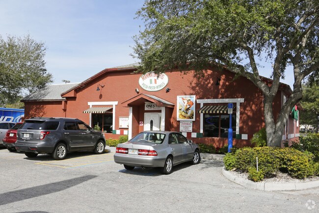
6152 14Th St W
North Port-Bradenton-Sarasota, FL
Bayshore Gardens Shopping Center
59053-0125-4
LOT 5 BAYSHORE GARDENS SHOPPING CENTER PI#59053.0125/4
Restaurantbuilding
Manatee
X
Florida
12081C0312F
5
2024
0.51 AC
2025
Manatee
000312
Tampa/St Petersburg
4,968 SF
DEMOGRAPHICS near 6152 14Th St W
1 mile
3 mile
5 mile
2024 Total Population
20,247
89,183
189,429
2029 Population
23,681
104,083
220,944
Pop Growth 2024-2029
+ 16.96%
+ 16.71%
+ 16.64%
Average Age
44
44
45
2024 Total Households
8,615
38,128
80,523
HH Growth 2024-2029
+ 15.90%
+ 15.97%
+ 16.01%
Median Household Inc
$43,476
$44,657
$51,676
Avg Household Size
2.20
2.20
2.20
2024 Avg HH Vehicles
1.00
1.00
2.00
Median Home Value
$124,078
$150,562
$223,531
Median Year Built
1973
1977
1980
Nearby Places
Map Layers
Map Styles
 Street
 Aerial
Transit
 Traffic
 Biking
Places
Listings with unknown addresses are not visible on the map
- Restaurants
- Banks
- Shops
- Fitness
- Groceries
PUBLIC TRANSPORTATION
AIRPORT
Sarasota/Bradenton International
Drive
Walk
Distance
Sarasota/Bradenton International
7 min
3.1 mi
St Pete-Clearwater International
Drive
Walk
Distance
St Pete-Clearwater International
62 min
40.8 mi
Nearby Properties
Address
Land Use
TOTAL SIZE
Lot Size
Zoning
Address
Land Use
TOTAL SIZE
Lot Size
Zoning
623,436 SF
88.25 AC
PD-R,MP-I
Address
Land Use
TOTAL SIZE
Lot Size
Zoning
437,460 SF
46.14 AC
PD-R
Address
Land Use
TOTAL SIZE
Lot Size
Zoning
456,263 SF
28.02 AC
BR_R-3
Address
Land Use
TOTAL SIZE
Lot Size
Zoning
314,018 SF
28.20 AC
BR_R-3
Address
Land Use
TOTAL SIZE
Lot Size
Zoning
645,805 SF
91.21 AC
PD-PI
Address
Land Use
TOTAL SIZE
Lot Size
Zoning
507,194 SF
8.49 AC
Address
Land Use
TOTAL SIZE
Lot Size
Zoning
247,280 SF
17.72 AC
PD-R
Address
Land Use
TOTAL SIZE
Lot Size
Zoning
331,816 SF
574.64 AC
Address
Land Use
TOTAL SIZE
Lot Size
Zoning
296,612 SF
576.25 AC
PD-MU
Address
Land Use
TOTAL SIZE
Lot Size
Zoning
294,609 SF
19.15 AC
RMF9
Address
Land Use
TOTAL SIZE
Lot Size
Zoning
117,547 SF
11.64 AC
MP-I
Address
Land Use
TOTAL SIZE
Lot Size
Zoning
153,663 SF
110.35 AC
MP-I
Address
Land Use
TOTAL SIZE
Lot Size
Zoning
500,923 SF
47.91 AC
Address
Land Use
TOTAL SIZE
Lot Size
Zoning
397,863 SF
21.60 AC
GC GENERA
Address
Land Use
TOTAL SIZE
Lot Size
Zoning
247,592 SF
13.39 AC
GC,RMF-6
Address
Land Use
TOTAL SIZE
Lot Size
Zoning
7,785 SF
75.25 AC
Address
Land Use
TOTAL SIZE
Lot Size
Zoning
7,772 SF
58.52 AC
RSMH-6
Address
Land Use
TOTAL SIZE
Lot Size
Zoning
198,036 SF
8.32 AC
GC GENERA
Address
Land Use
TOTAL SIZE
Lot Size
Zoning
331,144 SF
40.48 AC
PD-PI
Address
Land Use
TOTAL SIZE
Lot Size
Zoning
159,960 SF
11.30 AC
RMF-9 MULT
Address
Land Use
TOTAL SIZE
Lot Size
Zoning
359,950 SF
34.91 AC
LM LIGHT M
Address
Land Use
TOTAL SIZE
Lot Size
Zoning
214,350 SF
16.07 AC
LM LIGHT M
Address
Land Use
TOTAL SIZE
Lot Size
Zoning
139,944 SF
28.50 AC
GC,PD-R
Address
Land Use
TOTAL SIZE
Lot Size
Zoning
163,394 SF
15.49 AC
PD-MU
Address
Land Use
TOTAL SIZE
Lot Size
Zoning
179,650 SF
10.63 AC
RMF-9 MULT
Address
Land Use
TOTAL SIZE
Lot Size
Zoning
179,042 SF
6.60 AC
PD-MU
Address
Land Use
TOTAL SIZE
Lot Size
Zoning
318,009 SF
34.60 AC
LM LIGHT M
Address
Land Use
TOTAL SIZE
Lot Size
Zoning
271,970 SF
31.11 AC
PD-I
Address
Land Use
TOTAL SIZE
Lot Size
Zoning
148,992 SF
9.81 AC
RMF-9,GC
Address
Land Use
TOTAL SIZE
Lot Size
Zoning
183,257 SF
4.19 AC
PD-R
The World's #1 Commercial Real Estate Marketplace
Connect with us
© 2026 CoStar Group
The information above has been obtained from sources believed reliable. While we do not doubt its accuracy we have not verified it and make no guarantee, warranty or representation about it. It is your responsibility to independently confirm its accuracy and completeness. Any projections, opinions, assumptions, or estimates used are for example only and do not represent the current or future performance of the property. The value of this transaction to you depends on tax and other factors which should be evaluated by your tax, financial, and legal advisors. You and your advisors should conduct a careful, independent investigation of the property to determine to your satisfaction the suitability of the property for your needs.