Property Record
6153 Hickory Valley Rd, Chattanooga, TN 37416


NEARBY LISTINGS FOR SALE OR LEASE
Property Detail
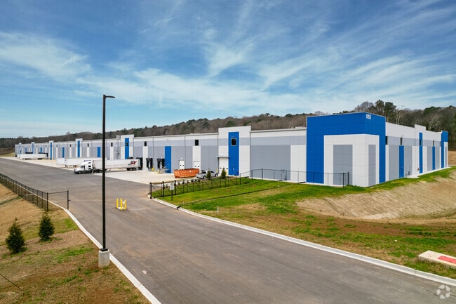
6153 Hickory Valley Rd
Chattanooga, TN-GA
Enterprise South Industrial Park
130-001.38
LT 32 ENTERPRISE SOUTH INDUSTRIAL PARK PB 119 PG 32 OUT OF 130 001.08
Warehouse
Hamilton
X
Tennessee
47065C0358G
32
2024
26.51 AC
2024
Outlying Chattanooga
980200
Chattanooga
300,040 SF
DEMOGRAPHICS near 6153 Hickory Valley Rd
1 Mile
3 Mile
5 Mile
2024 Total Population
2,522
26,546
83,515
2029 Population
2,680
28,213
88,904
Pop Growth 2024-2029
+ 6.26%
+ 6.28%
+ 6.45%
Average Age
40
42
42
2024 Total Households
1,052
11,442
34,349
HH Growth 2024-2029
+ 6.46%
+ 6.48%
+ 6.63%
Median Household Inc
$45,817
$58,283
$68,039
Avg Household Size
2.30
2.20
2.30
2024 Avg HH Vehicles
2.00
2.00
2.00
Median Home Value
$140,296
$194,758
$231,594
Median Year Built
1964
1980
1985
Nearby Places
Map Layers
Map Styles
 Street
 Aerial
- Restaurants
- Banks
- Shops
- Fitness
- Groceries
PUBLIC TRANSPORTATION
AIRPORT
Lovell Field
DRIVE
WALK
Distance
Lovell Field
17 min
7.6 mi
Freight Ports
Georgia Ports - Savannah
DRIVE
WALK
Distance
Georgia Ports - Savannah
412 min
365.6 mi
Nearby Properties
Address
Land Use
TOTAL SIZE
Lot Size
Zoning
Address
Land Use
TOTAL SIZE
Lot Size
Zoning
2,025,141 SF
1,096 AC
M1
Address
Land Use
TOTAL SIZE
Lot Size
Zoning
0.53 AC
M1
Address
Land Use
TOTAL SIZE
Lot Size
Zoning
523,520 SF
12.03 AC
M1
Address
Land Use
TOTAL SIZE
Lot Size
Zoning
292,309 SF
45.28 AC
M1
Address
Land Use
TOTAL SIZE
Lot Size
Zoning
213,416 SF
56.75 AC
Address
Land Use
TOTAL SIZE
Lot Size
Zoning
1,015,861 SF
83.82 AC
M1
Address
Land Use
TOTAL SIZE
Lot Size
Zoning
242,788 SF
27 AC
Address
Land Use
TOTAL SIZE
Lot Size
Zoning
320,068 SF
42.83 AC
R4
Address
Land Use
TOTAL SIZE
Lot Size
Zoning
102,382 SF
29.80 AC
M2
Address
Land Use
TOTAL SIZE
Lot Size
Zoning
291,314 SF
29.69 AC
M1
Address
Land Use
TOTAL SIZE
Lot Size
Zoning
82,000 SF
22.45 AC
M1
Address
Land Use
TOTAL SIZE
Lot Size
Zoning
254,362 SF
14.41 AC
R4
Address
Land Use
TOTAL SIZE
Lot Size
Zoning
99,202 SF
17.32 AC
Address
Land Use
TOTAL SIZE
Lot Size
Zoning
254,432 SF
16.20 AC
R1
Address
Land Use
TOTAL SIZE
Lot Size
Zoning
2,460 SF
15.30 AC
R3
Address
Land Use
TOTAL SIZE
Lot Size
Zoning
1,024 AC
Address
Land Use
TOTAL SIZE
Lot Size
Zoning
50,506 SF
5.14 AC
MD
Address
Land Use
TOTAL SIZE
Lot Size
Zoning
49,857 SF
1.93 AC
R1
Address
Land Use
TOTAL SIZE
Lot Size
Zoning
8,557 SF
14.30 AC
R2
Address
Land Use
TOTAL SIZE
Lot Size
Zoning
236,880 SF
18.90 AC
R2
Address
Land Use
TOTAL SIZE
Lot Size
Zoning
156,170 SF
6.60 AC
M1
Address
Land Use
TOTAL SIZE
Lot Size
Zoning
266,271 SF
26.27 AC
R2
Address
Land Use
TOTAL SIZE
Lot Size
Zoning
170.82 AC
M1
Address
Land Use
TOTAL SIZE
Lot Size
Zoning
186,892 SF
19.97 AC
Address
Land Use
TOTAL SIZE
Lot Size
Zoning
249,066 SF
19.80 AC
Address
Land Use
TOTAL SIZE
Lot Size
Zoning
38,242 SF
4.30 AC
C2
Address
Land Use
TOTAL SIZE
Lot Size
Zoning
90,413 SF
1.69 AC
C2
Address
Land Use
TOTAL SIZE
Lot Size
Zoning
152,363 SF
5.40 AC
R1
Address
Land Use
TOTAL SIZE
Lot Size
Zoning
925 SF
10.05 AC
R1
Address
Land Use
TOTAL SIZE
Lot Size
Zoning
75,987 SF
8 AC
C4
The World's #1 Commercial Real Estate Marketplace
Connect with us
© 2025 CoStar Group
The information above has been obtained from sources believed reliable. While we do not doubt its accuracy we have not verified it and make no guarantee, warranty or representation about it. It is your responsibility to independently confirm its accuracy and completeness. Any projections, opinions, assumptions, or estimates used are for example only and do not represent the current or future performance of the property. The value of this transaction to you depends on tax and other factors which should be evaluated by your tax, financial, and legal advisors. You and your advisors should conduct a careful, independent investigation of the property to determine to your satisfaction the suitability of the property for your needs.