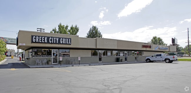
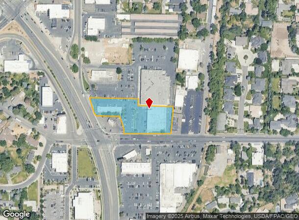
Property Record
6153 S Highland Dr, Holladay, UT 84121
NEARBY LISTINGS FOR SALE OR LEASE
Property Detail
6153 S Highland Dr
Salt Lake City, UT
Radius Curve
22-15-352-054-0000
BEG S 89^56 E 351.68 FT & N 5^44 E 40.20 FT FR SW COR SEC 15, T 2S, R 1E, SLM; N 5^44 E 164.40 FT; N 88^30 W 214.28 FT; N 1^30 E 41.53 FT; N 88^30 W 295.43 FT; SELY ALG A 1106.30 FT RADIUS CURVE TO L 95.71 FT; S 26^08 E 21.20 FT; S 88^30 E 145.50 FT;
Regionalshoppingcenterormallwithanchorstore
Salt Lake
X
Utah
49035C0314G
95
2024
1.71 AC
2025
Central Valley East
111001
Salt Lake City
19,512 SF
DEMOGRAPHICS near 6153 S Highland Dr
1 Mile
3 Mile
5 Mile
2024 Total Population
11,562
111,780
288,709
2029 Population
11,569
112,658
291,230
Pop Growth 2024-2029
+ 0.06%
+ 0.79%
+ 0.87%
Average Age
43
41
39
2024 Total Households
4,657
43,670
110,060
HH Growth 2024-2029
(0.17%)
+ 0.70%
+ 0.81%
Median Household Inc
$91,951
$84,583
$80,856
Avg Household Size
2.50
2.50
2.60
2024 Avg HH Vehicles
2.00
2.00
2.00
Median Home Value
$668,028
$560,133
$496,209
Median Year Built
1978
1976
1977
Nearby Places
Map Layers
Map Styles
 Street
 Aerial
- Restaurants
- Banks
- Shops
- Fitness
- Groceries
PUBLIC TRANSPORTATION
AIRPORT
Salt Lake City International
DRIVE
WALK
Distance
Salt Lake City International
23 min
16.3 mi
Freight Ports
Port of Stockton
DRIVE
WALK
Distance
Port of Stockton
723 min
705.2 mi
Nearby Properties
Address
Land Use
TOTAL SIZE
Lot Size
Zoning
Address
Land Use
TOTAL SIZE
Lot Size
Zoning
659,583 SF
18.32 AC
CDC
Address
Land Use
TOTAL SIZE
Lot Size
Zoning
257,906 SF
36.42 AC
1110
Address
Land Use
TOTAL SIZE
Lot Size
Zoning
235,963 SF
35.56 AC
SF1-DO
Address
Land Use
TOTAL SIZE
Lot Size
Zoning
186,717 SF
21.58 AC
RM
Address
Land Use
TOTAL SIZE
Lot Size
Zoning
251,867 SF
25.66 AC
H
Address
Land Use
TOTAL SIZE
Lot Size
Zoning
524,108 SF
34.46 AC
RM
Address
Land Use
TOTAL SIZE
Lot Size
Zoning
133,669 SF
19.81 AC
R-M
Address
Land Use
TOTAL SIZE
Lot Size
Zoning
191,718 SF
6.74 AC
RM-25
Address
Land Use
TOTAL SIZE
Lot Size
Zoning
191,718 SF
0.83 AC
RM-25
Address
Land Use
TOTAL SIZE
Lot Size
Zoning
302,944 SF
5.47 AC
Address
Land Use
TOTAL SIZE
Lot Size
Zoning
225,849 SF
16.36 AC
RM-ZC
Address
Land Use
TOTAL SIZE
Lot Size
Zoning
21,057 SF
17.96 AC
RM20
Address
Land Use
TOTAL SIZE
Lot Size
Zoning
125,518 SF
11.03 AC
RMZC
Address
Land Use
TOTAL SIZE
Lot Size
Zoning
327,940 SF
3.95 AC
SD
Address
Land Use
TOTAL SIZE
Lot Size
Zoning
103,114 SF
14.82 AC
RM 25
Address
Land Use
TOTAL SIZE
Lot Size
Zoning
371,607 SF
10.77 AC
A-1
Address
Land Use
TOTAL SIZE
Lot Size
Zoning
37,563 SF
15.34 AC
RM20
Address
Land Use
TOTAL SIZE
Lot Size
Zoning
327,940 SF
3.37 AC
SD
Address
Land Use
TOTAL SIZE
Lot Size
Zoning
28,078 SF
15.33 AC
RM-10
Address
Land Use
TOTAL SIZE
Lot Size
Zoning
241,418 SF
8.84 AC
ORD
Address
Land Use
TOTAL SIZE
Lot Size
Zoning
422,482 SF
3.42 AC
RC
Address
Land Use
TOTAL SIZE
Lot Size
Zoning
126,900 SF
0.38 AC
1108
Address
Land Use
TOTAL SIZE
Lot Size
Zoning
106,016 SF
32.73 AC
1108
Address
Land Use
TOTAL SIZE
Lot Size
Zoning
131,979 SF
12.38 AC
PUD15
Address
Land Use
TOTAL SIZE
Lot Size
Zoning
382,939 SF
5.70 AC
PDD-1
Address
Land Use
TOTAL SIZE
Lot Size
Zoning
99,702 SF
12.73 AC
R-M
Address
Land Use
TOTAL SIZE
Lot Size
Zoning
81,180 SF
11.37 AC
R-M-15
Address
Land Use
TOTAL SIZE
Lot Size
Zoning
317,495 SF
2.75 AC
O-R-D
Address
Land Use
TOTAL SIZE
Lot Size
Zoning
95,950 SF
9.40 AC
RM-25
Address
Land Use
TOTAL SIZE
Lot Size
Zoning
77,051 SF
8.34 AC
RM/ZC
The World's #1 Commercial Real Estate Marketplace
Connect with us
© 2025 CoStar Group
The information above has been obtained from sources believed reliable. While we do not doubt its accuracy we have not verified it and make no guarantee, warranty or representation about it. It is your responsibility to independently confirm its accuracy and completeness. Any projections, opinions, assumptions, or estimates used are for example only and do not represent the current or future performance of the property. The value of this transaction to you depends on tax and other factors which should be evaluated by your tax, financial, and legal advisors. You and your advisors should conduct a careful, independent investigation of the property to determine to your satisfaction the suitability of the property for your needs.