Property Record
6155 Mesker St, Schofield, WI 54476


Save to a Folder
{{folder.Name}}
{{folder.ListingIds.length}} Properties
{{folder.ListingIds.length}} Property
Create a New Folder
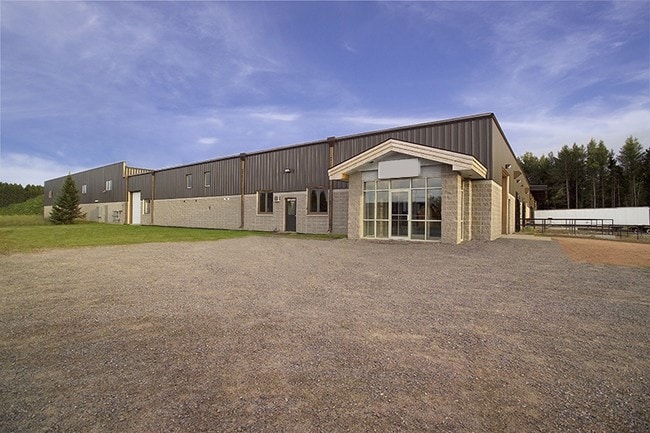
Property Detail
6155 Mesker St
Wausau, WI
SEC 21-28-08 PT OF NE 1/4 NE 1/4 & PT OF LOT 1 KINGS ADD - LOT 2 CSM VOL 84 PG 116 (#17609)(DOC# 1728192)
192-2808-211-0952
Marathon
Industrialgeneral
Wisconsin
LI
1
B and X Area of moderate flood hazard, usually the area between the limits of the 100-year and 500-year floods.
3.83 AC
2025
Wausau/Stevens Point
2025
Other Market Areas
001106
NEARBY LISTINGS FOR SALE OR LEASE
DEMOGRAPHICS near 6155 Mesker St
1 mile
3 mile
5 mile
2025 Total Population
3,847
19,559
42,479
2030 Population
3,888
19,799
42,946
Pop Growth 2025-2030
+ 1.07%
+ 1.23%
+ 1.10%
Average Age
41
41
42
2025 Total Households
1,514
8,129
17,549
HH Growth 2025-2030
+ 1.25%
+ 1.35%
+ 1.14%
Median Household Inc
$71,352
$72,867
$73,521
Avg Household Size
2.40
2.30
2.30
2025 Avg HH Vehicles
2.00
2.00
2.00
Median Home Value
$230,958
$226,680
$213,507
Median Year Built
1991
1988
1979
Nearby Places
Map Layers
Map Styles
 Street
 Aerial
Layers
 Traffic
 Biking
Places
Listings with unknown addresses are not visible on the map
- Restaurants
- Banks
- Shops
- Fitness
- Groceries
PUBLIC TRANSPORTATION
AIRPORT
Central Wisconsin
Drive
Walk
Distance
Central Wisconsin
22 min
13.8 mi
SALE & LEASE HISTORY
LISTING DATE
SALE/LEASE

Sep 23, 2016
For Sale
Nearby Properties
Address
Land Use
TOTAL SIZE
Lot Size
Zoning
Address
Land Use
TOTAL SIZE
Lot Size
Zoning
40.87 AC
Address
Land Use
TOTAL SIZE
Lot Size
Zoning
3 AC
INT
Address
Land Use
TOTAL SIZE
Lot Size
Zoning
26.27 AC
INT
Address
Land Use
TOTAL SIZE
Lot Size
Zoning
1.82 AC
Address
Land Use
TOTAL SIZE
Lot Size
Zoning
12.58 AC
B2
Address
Land Use
TOTAL SIZE
Lot Size
Zoning
16.58 AC
B3
Address
Land Use
TOTAL SIZE
Lot Size
Zoning
31.43 AC
Address
Land Use
TOTAL SIZE
Lot Size
Zoning
43.18 AC
Address
Land Use
TOTAL SIZE
Lot Size
Zoning
27.50 AC
MF
Address
Land Use
TOTAL SIZE
Lot Size
Zoning
12.96 AC
Address
Land Use
TOTAL SIZE
Lot Size
Zoning
15.96 AC
GI
Address
Land Use
TOTAL SIZE
Lot Size
Zoning
8.19 AC
Address
Land Use
TOTAL SIZE
Lot Size
Zoning
7.58 AC
INT
Address
Land Use
TOTAL SIZE
Lot Size
Zoning
10.23 AC
MF
Address
Land Use
TOTAL SIZE
Lot Size
Zoning
9.94 AC
MF
Address
Land Use
TOTAL SIZE
Lot Size
Zoning
10.26 AC
Address
Land Use
TOTAL SIZE
Lot Size
Zoning
5.19 AC
GI
Address
Land Use
TOTAL SIZE
Lot Size
Zoning
11.61 AC
Address
Land Use
TOTAL SIZE
Lot Size
Zoning
10 AC
LI
Address
Land Use
TOTAL SIZE
Lot Size
Zoning
8.78 AC
LI
Address
Land Use
TOTAL SIZE
Lot Size
Zoning
8.28 AC
B2
Address
Land Use
TOTAL SIZE
Lot Size
Zoning
14.10 AC
Address
Land Use
TOTAL SIZE
Lot Size
Zoning
14.94 AC
LI
Address
Land Use
TOTAL SIZE
Lot Size
Zoning
5.77 AC
INT
Address
Land Use
TOTAL SIZE
Lot Size
Zoning
10.04 AC
GI
Address
Land Use
TOTAL SIZE
Lot Size
Zoning
13.07 AC
LI
Address
Land Use
TOTAL SIZE
Lot Size
Zoning
Address
Land Use
TOTAL SIZE
Lot Size
Zoning
15.80 AC
LI
Address
Land Use
TOTAL SIZE
Lot Size
Zoning
4.57 AC
Address
Land Use
TOTAL SIZE
Lot Size
Zoning
7.50 AC
B2
The World's #1 Commercial Real Estate Marketplace
Connect with us
© 2026 CoStar Group
The information above has been obtained from sources believed reliable. While we do not doubt its accuracy we have not verified it and make no guarantee, warranty or representation about it. It is your responsibility to independently confirm its accuracy and completeness. Any projections, opinions, assumptions, or estimates used are for example only and do not represent the current or future performance of the property. The value of this transaction to you depends on tax and other factors which should be evaluated by your tax, financial, and legal advisors. You and your advisors should conduct a careful, independent investigation of the property to determine to your satisfaction the suitability of the property for your needs.